
Import feature-layer templates
Use shared WFS and OGC API views by file, HTTPS link or QR link, without a built-in worldwide service list.
Find official boundary points on the map, filter by marker type and compare official and map positions. A guide using Hessen ALKIS with clear accuracy limits.
Case study · Finding boundary stones with RTK in Hesse
Free includes one online feature service. Pro unlocks additional services and layers.
 Touch and hold the map icon, then choose Manage maps in Maps & map data.
Online map services → Object layers (OGC API / WFS) → + WFS
Open Online map services → Object layers (OGC API / WFS) → WFS. Check the address below, select adv:AX_Grenzpunkt and save. Create a New view beneath the service. This example covers Hessen; other regions require their own suitable service.
https://www.gds.hessen.de/wfs2/aaa-suite/cgi-bin/alkis/sf/wfs?SERVICE=WFS&VERSION=2.0.0&REQUEST=GetCapabilitiesPreview without filters first. Then Add condition → abmarkung_Marke → equals → 1110. This code means boundary stone; other stone types have separate codes. 1200 means pipe, 1300 bolt/nail and 9500 no marker. A boundary point is therefore not necessarily a stone. Combine several desired codes with At least one.
Official position (AU) shows the official point location. Map position (TA) may be graphically displaced. Compare both positions keeps the variants separate; missing AU or TA is never substituted. A TA offset does not prove that a stone has moved on the ground.
bemerkungZurAbmarkung: 1000 underground, 2000 eccentric, 3000 both, 4000 neither. Eccentric describes offset marking but supplies no separate marker coordinate. Do not confuse this attribute with graphical map position.
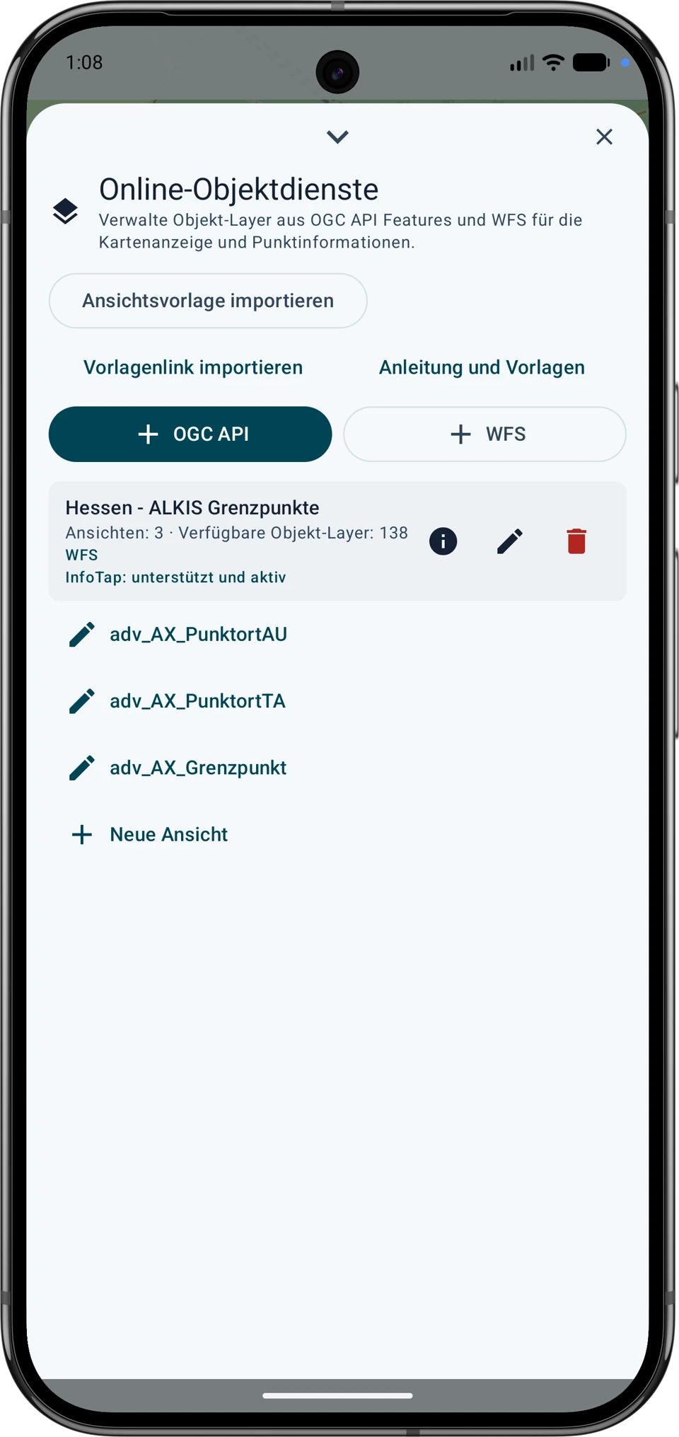
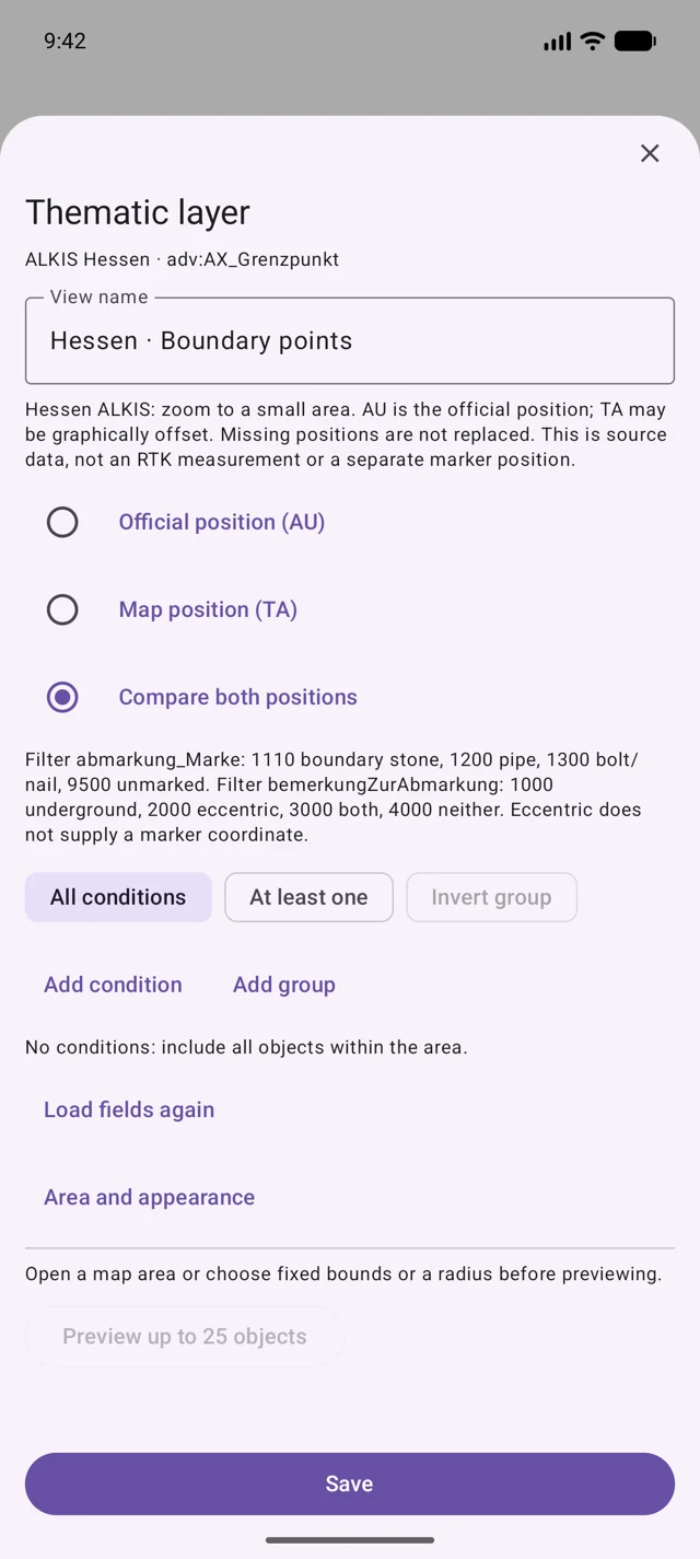
Zoom closely into the desired locality: at most 0.02° north–south and 0.04° east–west. Preview, inspect attributes and partial-result notices. Save the view and enable it in a map slot. Open a result and choose the desired position as a target or work item. If no results appear, reduce the area or remove filters; limited results are not a complete inventory.
Provider coordinates confirm neither a physical boundary mark on the ground nor a legally binding boundary. Your own RTK measurement and provider coordinates remain separate information; RTK does not retrospectively improve the dataset’s accuracy.
Source: Hessische Verwaltung für Bodenmanagement und Geoinformation. Check current access, licence, fees and download terms before use. The provider receives service requests and the map area. A saved view is not an offline copy; download a permitted extract beforehand.
Schematic TA examples: four stone markers (1110) and one plastic marker (1140). B01 to B05 are invented labels, not official point identifiers. No coordinates or real search locations are published here.
| Example point | Recorded marker |
|---|---|
| B01 · TA | 1110 · stone / boundary stone |
| B02 · TA | 1110 · stone / boundary stone |
| B03 · TA | 1140 · plastic marker |
| B04 · TA | 1110 · stone / boundary stone |
| B05 · TA | 1110 · stone / boundary stone |
Every listed record is TA, even though its coordinate-status field is 1000 and GST is 2000. Those attribute values do not change the position type into AU. Look up the same source object for a separate AU position; do not infer one if it is missing.
An empty TA/AU distance or NULL means no distance value was established in that extract. It does not mean zero offset. Closely spaced points may lie inside the same phone-position uncertainty area; match identifiers and the recorded marker rather than selecting the nearest symbol alone.
Data → Data Center → Import data → GPX (.gpx)
5. Export selected points as GPX waypoints
Keep the original point data alongside the GPX when marker, quality and provenance matter. A description containing an AU or TA label is descriptive text; GPX does not recreate the app’s service-based AU/TA comparison.
No points in QGIS: check the active layer, enabled categories, scale visibility and source-file location. A red warning may indicate a moved data file. An empty boundary-object table may also mean its positions have not been joined.
Empty or misplaced GPX: check the selected feature count, point geometry, waypoints layer and export CRS EPSG:4326. Reopen the saved file in QGIS before repeating the import.
A target that differs from the map: first compare identifier, TA/AU type, coordinate system and data dates. Imagery alignment, graphical position and current GNSS uncertainty are different possible causes; a mismatch alone is not evidence that the boundary marker moved.
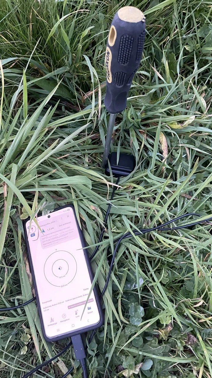
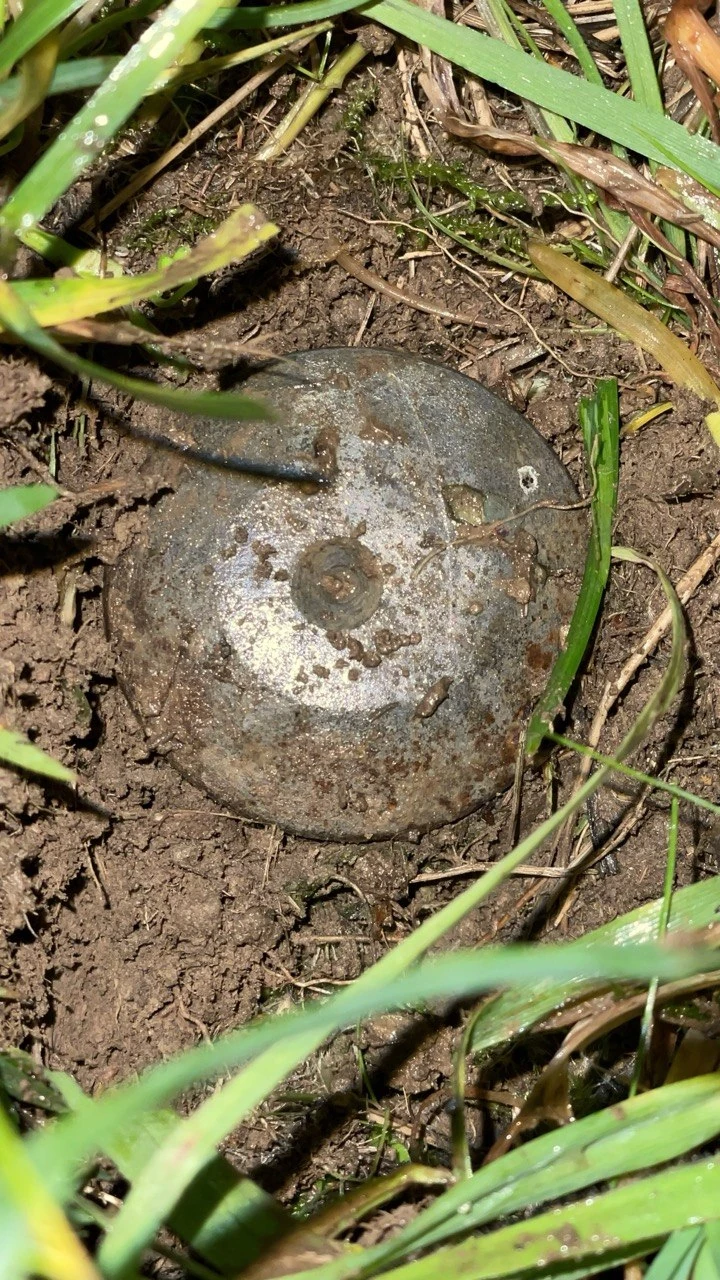
Photos from our field search: the RTK fine view, the smartphone in the meadow and the marking found in the grass.
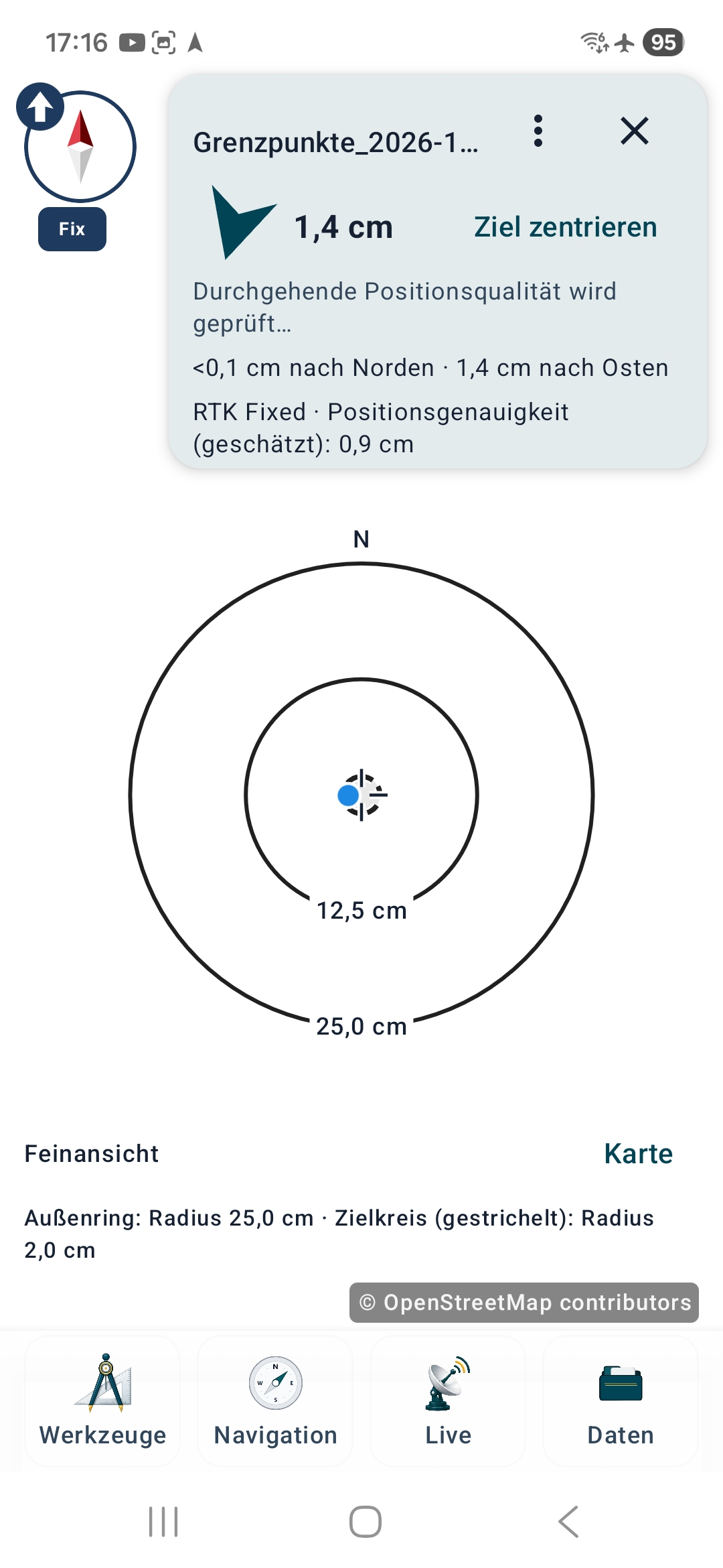
Target distance and estimated positioning accuracy describe different things. A small displayed distance does not make the ALKIS source coordinate more accurate.
This time it really was child's play: my daughter found the point in the meadow entirely on her own.
Use shared WFS and OGC API views by file, HTTPS link or QR link, without a built-in worldwide service list.
Display the meaning of codes and use them in filters, independently of country, language and provider.
Public examples with suitable data sources and reproducible MapTools queries.
Check your phone or RTK receiver at a known reference point: obtain official data, configure NTRIP, measure on the physical mark and compare the results.
The receiver used with MapTools: technical specifications, the included L1/L5 antenna, smartphone connection and our field experience.