
Feature layers in practice: trees, boundary points and monuments
Public examples with suitable data sources and reproducible MapTools queries.
Berlin: trees around 100 cm in diameter
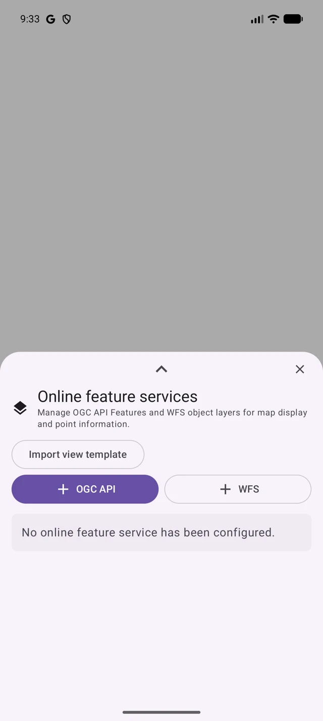
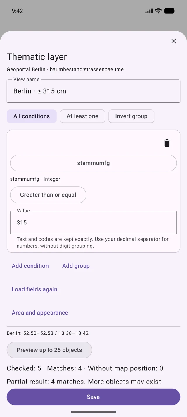
Import the tree template and configure baumbestand:strassenbaeume. The stammumfg ≥ 315 filter uses trunk circumference in centimetres: diameter = circumference / π. Choose a small Berlin area. Missing measurements do not pass this numeric filter; natural monuments belong to another dataset.
https://gdi.berlin.de/services/wfs/baumbestandFind large trees and natural monuments: Berlin step by step
Feature layers filter actual object data by their attributes. These examples are configured manually; MapTools has no built-in regional catalogue. Outside Berlin, you need a source covering your area.
Free includes one online feature service. Pro unlocks additional services and layers.
Add a source and choose a search area
- Long-press a map slot → Online map services → Object layers (OGC API / WFS) → WFS. Paste an address below, check the service, select the collection and save. Check source, licence and access. Then open New view beneath the service.
- First move the map to central Berlin: roughly 52.50–52.53° N, 13.38–13.42° E. Choose a small area. Preview without a filter first, then add the required condition. Save the view and enable it in the desired map slot.
Street trees with a trunk diameter of at least 100 cm
https://gdi.berlin.de/services/wfs/baumbestandSelect baumbestand:strassenbaeume. Add condition → field stammumfg → greater than or equal to → 315. This field contains trunk circumference in cm. Optionally add a second condition gattung equals Quercus and select All conditions to find oaks specifically.
Diameter and circumference differ: U = π × D. A 100 cm diameter means about 314.16 cm circumference; ≥ 315 is suitable for integer circumference values. A 100 cm circumference means only about 31.8 cm diameter. For your own data with diameter in cm, use ≥ 100 directly. Check measurement height, age and units; missing values are not zero.
Natural monuments: trees and erratic boulders
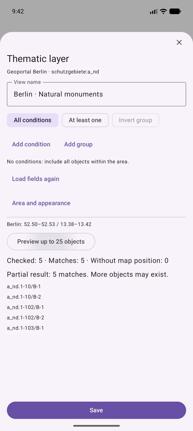
https://gdi.berlin.de/services/wfs/schutzgebieteAdd the second service below and select schutzgebiete:a_nd. Create a new view, preview without a filter first and save. This collection includes trees and boulders; one record may represent several points. Inspect attributes before using an object.
A natural monument is not necessarily a tree, and a street tree is not necessarily a natural monument. The views answer different questions. Empty results may also reflect the wrong area, missing values or a query limit.
These data cover Berlin and are not a complete survey of all trees. The preview displays a limited selection. Reduce the area and heed partial-result notices; do not infer a complete inventory from a few matches.
Add boundary stones and historic places
Configure suitable cadastral or heritage sources separately. Berlin’s tree services do not contain these topics. The heritage office’s map and database help locate sources. A WMS map image creates no filterable object points; historical filters need suitable date fields, not merely a mention of an era.
Provider coordinates confirm neither a physical boundary mark on the ground nor a legally binding boundary. Your own RTK measurement and provider coordinates remain separate information; RTK does not retrospectively improve the dataset’s accuracy.
Use results, save offline and share templates
Check previews and attributes, open results on the map and deliberately select the offered position as a target or work item. For offline use, save a permitted extract first; a saved view alone is not a data copy. Your own view templates can be imported and exported. Check the source, fields and usage rights when importing.
Sources, rights and availability
The examples use Geoportal Berlin’s tree and protected-area datasets; retrieved 12 October 2026. Check current metadata and licence terms through the source links. Access, fees, quotas, download and redistribution rights depend on the provider, which receives the request and map area. Public data grant no access or excavation rights; cadastral data do not replace an official boundary determination.
Berlin: monuments near Brandenburg Gate
The monument template uses the denkmale WFS and denkmale:denkmale layer. Find Brandenburg Gate or Pariser Platz on the map and enable the view. Available attributes are id, typ and link to the monument database; geometries are areas. This does not promise a name or construction-year filter.
https://gdi.berlin.de/services/wfs/denkmaleTiefenrother Höhe: understanding boundary points
Use the publicly documented Tiefenrother Höhe as a starting point. First check coverage: Hessen’s ALKIS service does not cover NRW areas. The boundary-stone template selects only 1110 and AU. For all points recorded as marked, use that selection in the boundary-point view. Official and map positions are not two surveyed stone positions.
Wilnsdorf · Tiefenrother Höhe · ALKIS · AU / TA
Worldwide: Acropolis, Statue of Liberty and Giza pyramids
UNESCO’s World Heritage dataset offers GeoJSON. The original export linked below contains entries 404, 307 and 86. Download the file and use file import to import it as a vector layer. This is neither a WFS address nor a view template.
UNESCO · GeoJSON · 404 / 307 / 86
Check the contents and destination in the import proposal, then enable the imported layer in the map slot. name_en contains the English provider name; date_inscribed is the World Heritage inscription year, not the construction year. Points are reference positions, not entrances or complete site boundaries. A file does not update like a live service.
Sources, rights and accuracy
The configuration files below contain our settings. Third-party data remain with their providers; check their licences, access and currency. UNESCO lists CC BY-SA 4.0 for its dataset. Your own RTK position does not automatically improve provider coordinates. Boundary points confirm neither a stone on the ground nor a legally binding boundary.
Examples
- Hessen · abmarkung_Marke = 1110 · AU · .mtfeature.json
https://www.arxsilex.de/app/maptools/downloads/feature-templates/hessen-boundary-stones.mtfeature.json - Berlin · stammumfg ≥ 315 cm · .mtfeature.json
https://www.arxsilex.de/app/maptools/downloads/feature-templates/berlin-large-street-trees.mtfeature.json - Berlin · denkmale:denkmale · .mtfeature.json
https://www.arxsilex.de/app/maptools/downloads/feature-templates/berlin-monuments.mtfeature.json