
OGC API Features
A modern OGC standard built around HTTP and JSON. MapTools discovers the landing page, conformance and collections, then requests bounded areas from the selected collections.
Online object services
Connect points, lines and polygons from standardized geodata services, control them per map slot and query attributes from several overlapping layers at one map position.
Overview
WMS and WMTS deliver rendered map images or tiles. OGC API Features and WFS deliver individual geospatial objects with geometry and attributes that MapTools can display and query.
A modern OGC standard built around HTTP and JSON. MapTools discovers the landing page, conformance and collections, then requests bounded areas from the selected collections.
Web Feature Service describes feature types through GetCapabilities and returns objects through GetFeature. MapTools supports WFS 1.1.0 and 2.0.0 with GeoJSON and GML 3.1/3.2.
These services remain the right choice for finished raster maps. WMS GetFeatureInfo can provide additional point information but does not replace a complete object layer.
The service, its data, availability, language, licence and possible fees are provided by the respective operator and are not automatically included with MapTools.
Setup
The service definition is managed globally. You then decide which selected layers are visible and queryable in each map slot.
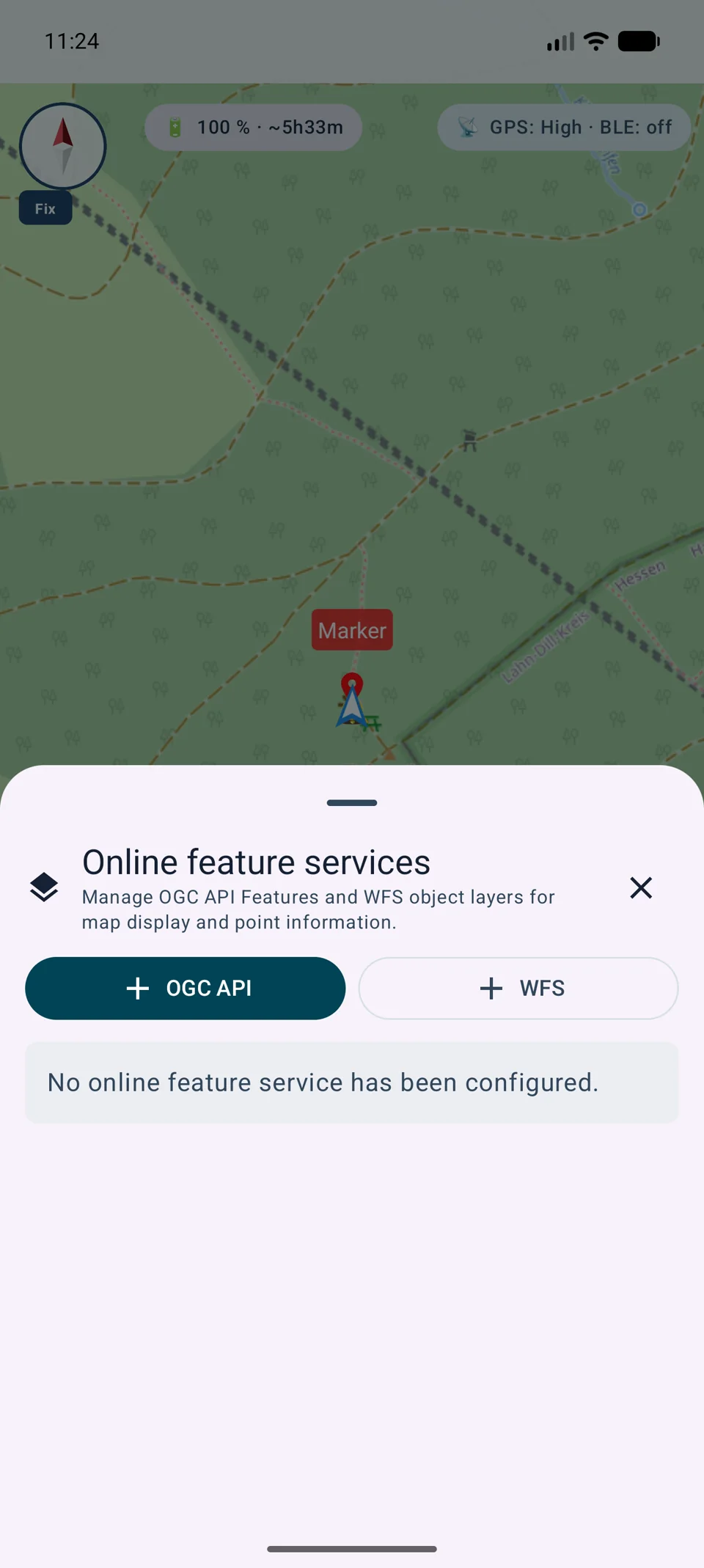
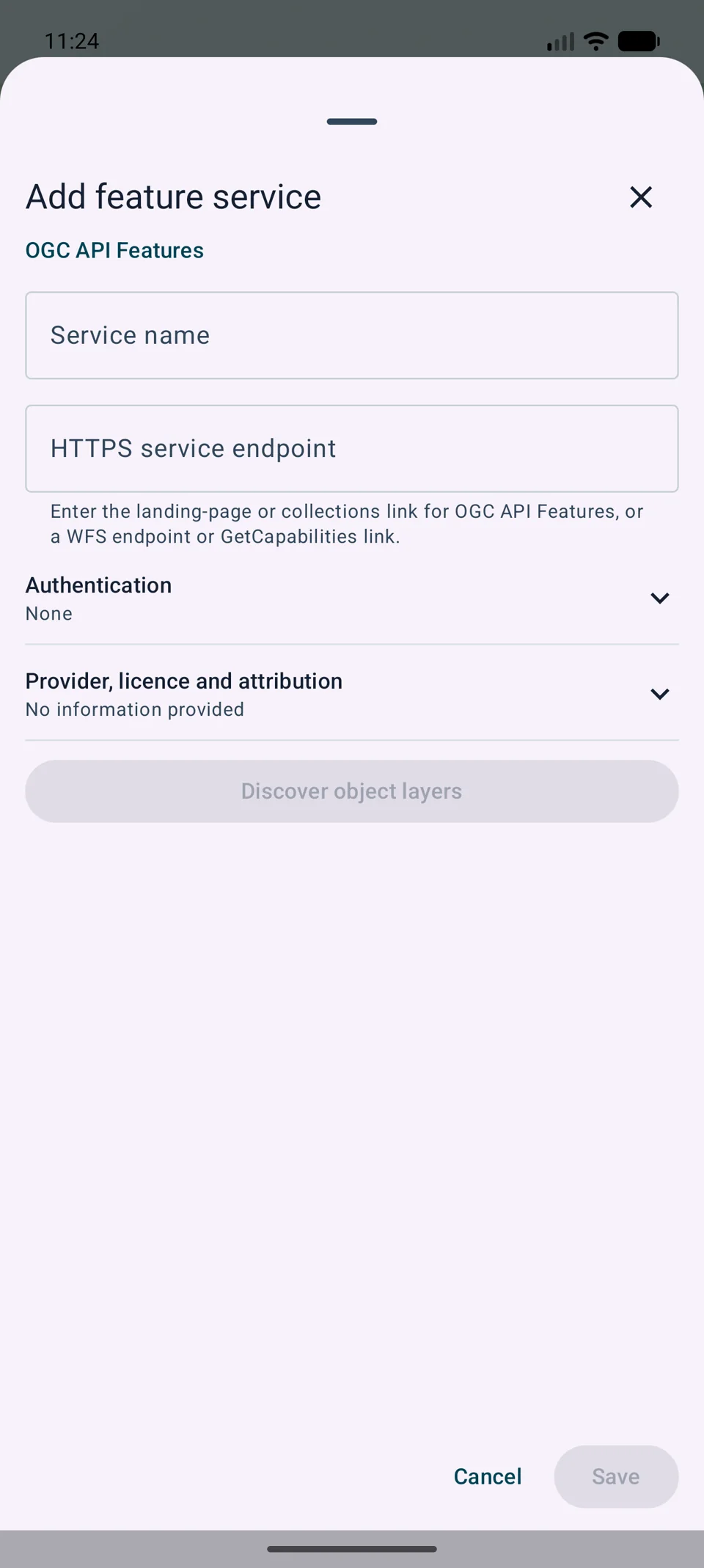
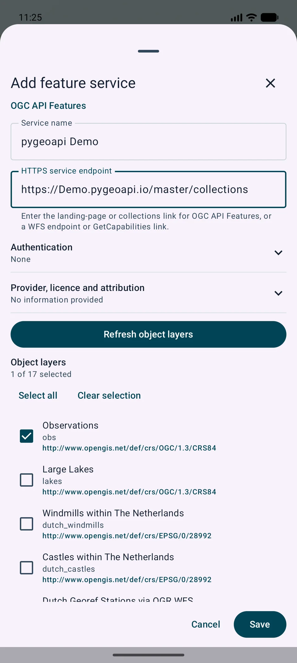
Map workflow
A service may provide many layers, and several services can overlap in one slot. MapTools keeps their results separate so that origin and status remain clear.
The service definition remains global, while visibility, drawing order, opacity and InfoTap participation are stored separately for each of the four map slots.
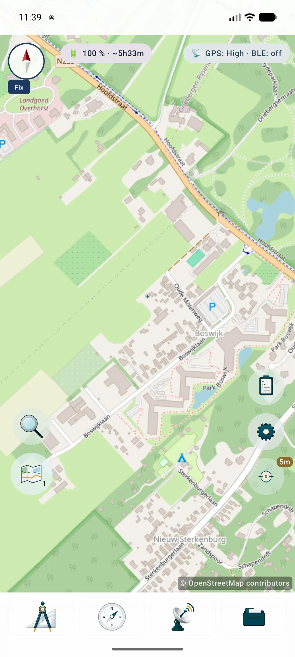
Enable information mode by long-pressing the GPS/info button, then tap the required map position.
While information mode is active, a short press on the GPS/info button queries the same active layers at the current position without moving the map or changing zoom.
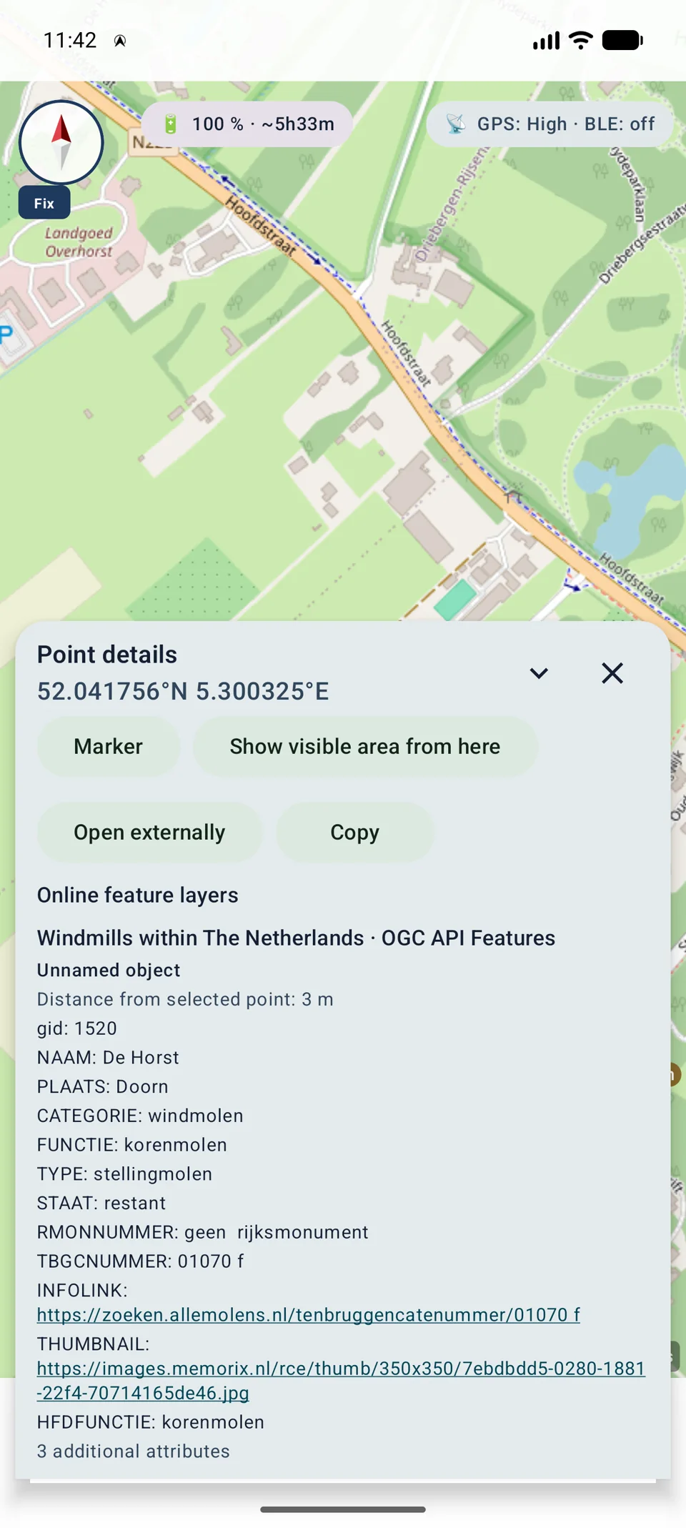
The point-details sheet groups matches by service and layer. Matches, empty results and errors from other layers remain separately visible.
Technical background
MapTools processes remote objects within explicit limits so that large or faulty services do not unnecessarily block map interaction.
Points, lines, polygons, multi-geometries and polygon interior rings are normalized and rendered through the central map engine.
Known CRS values are transformed through the central CRS engine. Unknown or contradictory CRS values are rejected rather than guessed from plausible-looking numbers.
The map loads spatially bounded data. Moving the view cancels obsolete requests; concurrency, response size and geometry complexity are limited.
Online object layers are currently rendered in VTM map slots. Other renderers are not silently presented as supported.
Practical test
The following public third-party demos are suitable for a functional test. Availability and content may change, and each provider’s terms apply. MapTools does not provide or operate these services or datasets.
Endpoint: demo.mapserver.org/cgi-bin/wfs
Feature type: ms:cities
Search term: Sydney
Endpoint: demo.ldproxy.net/strassen
Collection: abschnitteaeste
Search term: Abschnitt
Check online mode, explicit source selection and the possibly active 5 km filter. If the layer is reported as not supporting search, refresh the service. Public demo services may also be temporarily unavailable.
Security and limits
URLs, JSON and XML from third-party services are treated as untrusted. MapTools displays bounded passive content and does not execute supplied code.
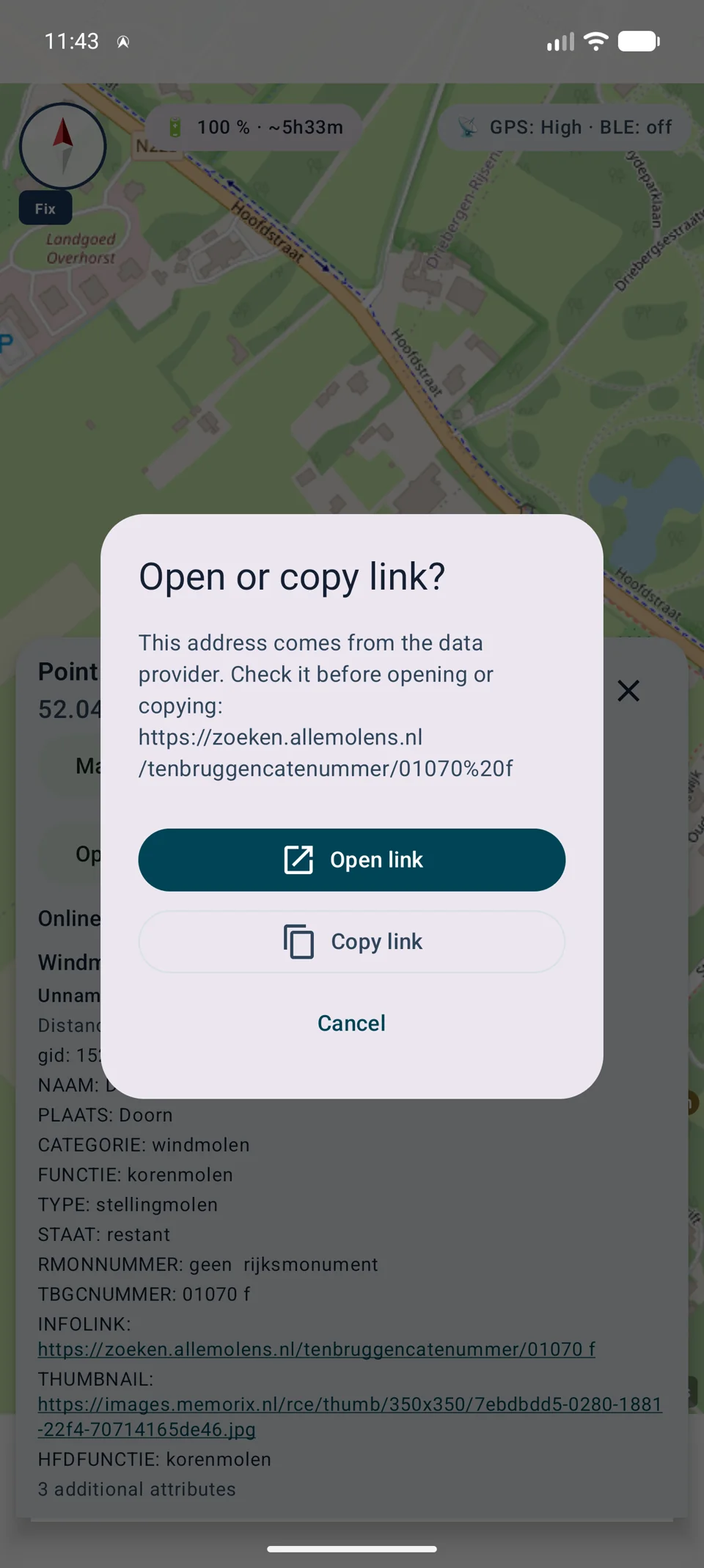
Complete HTTP(S) addresses are recognizable. Before opening or copying, MapTools shows the normalized destination; other schemes and embedded credentials remain inactive.
Passwords, API keys and tokens do not belong in the URL. They are stored encrypted and are not placed in project files or backups.
Links, labels, visible user names and source details can be backed up. Restored authenticated services stay disabled until the secret is entered again.
MapTools uses only Queryables and CQL2 or DescribeFeatureType and FES capabilities declared by the service. WFS-T, arbitrary raw filters and unsolicited complete downloads remain excluded.
Free supports one feature service with its selected layers. Pro supports additional services and layers. Provider accounts, quotas and data licences are not included in either edition.
InfoTap
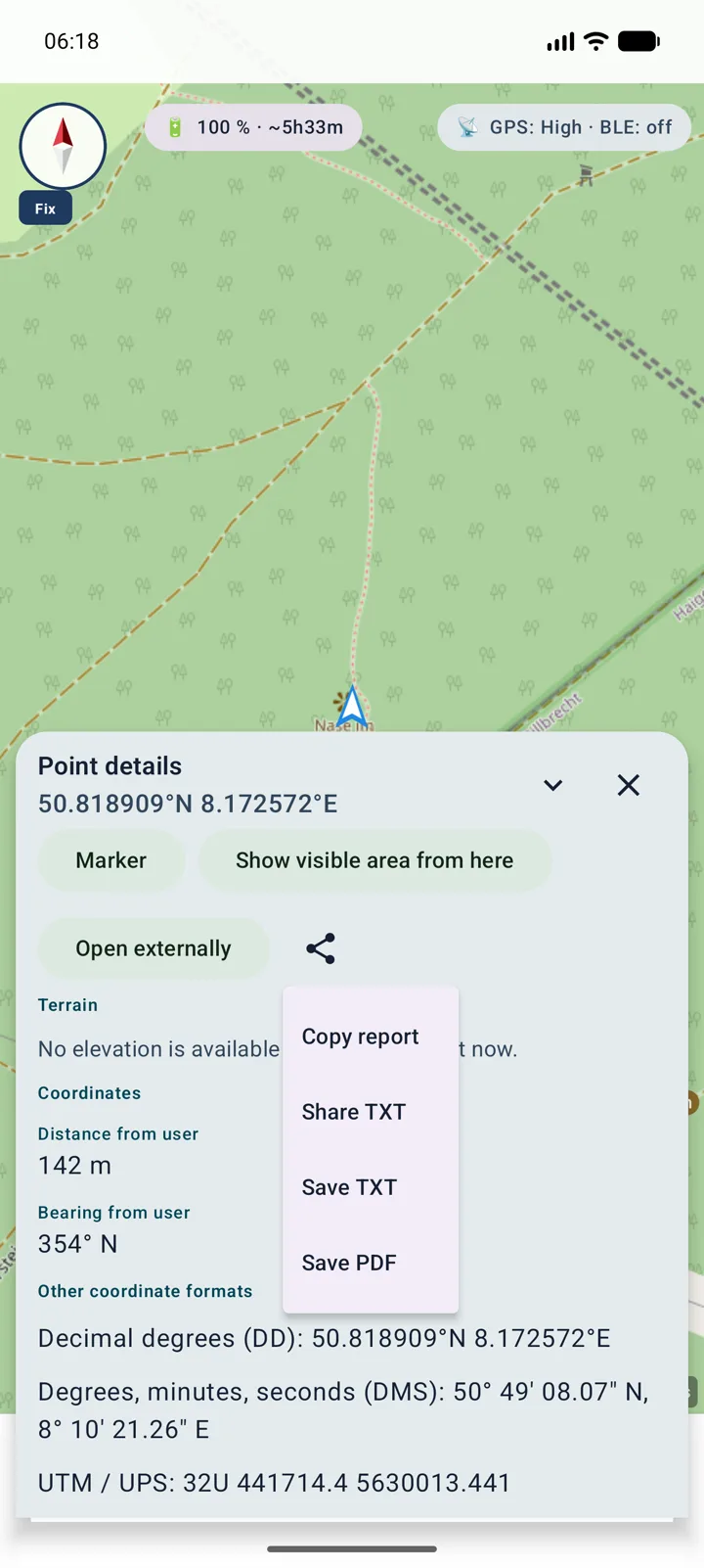
The point report combines information from the active map slot: coordinates and terrain, local Mapsforge data, WMS/WMTS FeatureInfo and OGC API Features or WFS hits when the source provides them.
TXT
TXT
TXT
Before export, MapTools sanitises control and bidirectional characters, limits oversized content and redacts recognisable passwords, tokens, API keys, cookies, Authorization values and sensitive URL parameters. Still review reports before sharing because unknown provider-specific field names cannot always be identified.
Detailed guides
A point report can combine local and remote sources without discarding successful results when only one service fails.
Use Retry source on the failed row. MapTools retains successful sections and repeats the request for the original point, map slot and source context.
Check network, server, coverage, CRS, layer, account and 401/403 credentials. Review reports before sharing and never expose tokens, cookies or API keys.
Current functionality
OGC API Tiles and Maps extend XYZ, TMS, WMTS and WMS as raster sources. WFS and OGC feature layers also work on Google maps. InfoTap clearly reports whether a source is actively supported, disabled, needs credentials or offers no feature query.