
USB GNSS and RTK with SAPOS
Connect an external receiver, feed it NTRIP corrections and save points with their measurement quality in MapTools.
Prepare the equipment
You need an Android device with USB host support, a data cable, sufficient power and a compatible NMEA receiver. LG290P-specific options apply only to that receiver. Place the antenna with an unobstructed view of the sky.
Connect the receiver
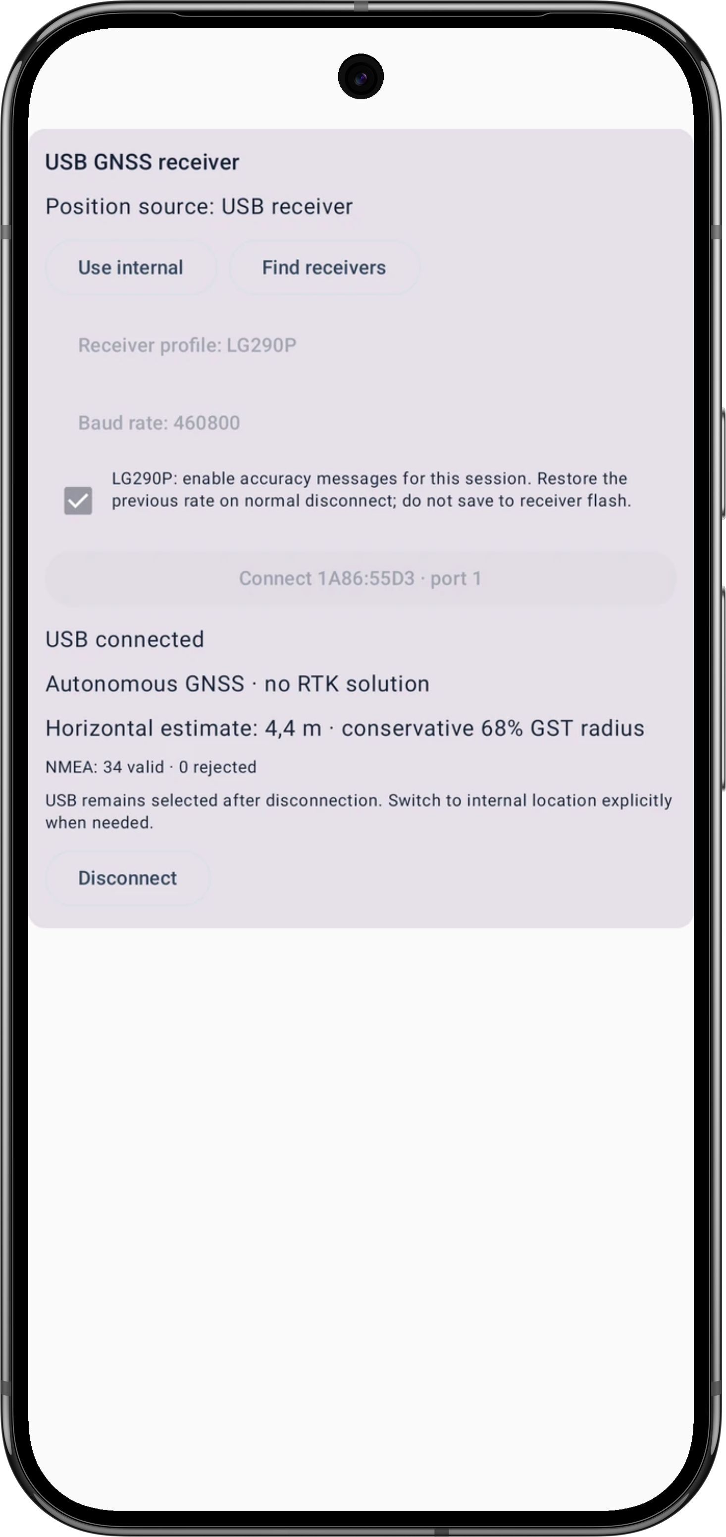
- Open Settings → Device and sensors → GNSS receiver → External GNSS receiver (USB). Find the receiver and select the receiver type and matching baud rate before connecting.
- For the LG290P, enable accuracy messages if required. Connect and approve Android USB access. Check that valid NMEA counts increase; a USB connection alone does not establish a position fix.
- Save frequently used settings as a receiver profile. Profiles stay on this device and are excluded from project backups and device transfers.
Start SAPOS or another NTRIP service
Open Settings → Device and sensors → GNSS receiver → NTRIP. Enter the provider's host, port, mountpoint and credentials. Check registration, coverage, licence and possible fees with the provider; access is not included with MapTools.
Choose TLS where supported. Unencrypted access needs explicit approval. VRS services need separate consent to send the current receiver position as GGA. Save, then start corrections; check both received and USB-written correction counters.
Understand fix and accuracy
Satellite count does not prove a valid fix. Autonomous GNSS, RTK Float and RTK Fixed describe different receiver solutions. GST is an estimated uncertainty, not a verified position error. Missing accuracy must not be interpreted as zero.
Save an RTK point
When creating a marker, open Position averaging with USB selected. RTK point measurement requires Fixed and a qualifying window of at least five seconds and five epochs. Keep the antenna still, review the quality checks and save the result with its measurement record.
Handle an interruption
Connection, position fix, corrections and receiver recording have separate status indicators. Stop active corrections before editing their settings. Changing source or disconnecting may require confirmation to end corrections or recording; saved recordings remain available. After unplugging USB, explicitly select the internal source when you want to use the phone location.
Save GNSS recordings and export RINEX Back to the manual Privacy
Read the compact GPS and USB status
The small map status identifies the position source and its profile or positioning status. It is separate from the compass button labelled Fix, which controls map orientation.
- GPS · Standard
- Phone position with the Standard request profile. The profile name is not an accuracy rating.
- Warning
- A warning needs attention. Tap the status to read the actual cause; the triangle alone does not identify one particular fault.
- USB · Float
- The USB receiver reports RTK Float. The RTK position is not yet fixed. Wait for fresh RTK Fixed and the required quality checks before a qualified RTK point measurement.
- USB · RTK Fixed
- The USB receiver reports RTK Fixed. Also check freshness, correction status and reported uncertainty; Fixed alone is not an independent accuracy check.
Tap the compact status to expand its details. A long press opens GPS information. With USB selected, also inspect receiver and correction details when positions stop updating.
RTK in the field: measure, disconnect and repeat
Use the same clearly identified point for several separately saved measurements. Record the antenna setup and coordinate reference so you can interpret the comparison later.
- Prepare the target coordinate and a project. Keep the original target separate from your measured points; do not overwrite it with a new measurement.
- Connect the receiver and start the correction stream. Check fresh positions and RTK Fixed. Keep the antenna stable over the point and record the antenna height and reference point where known.
- Start the RTK point measurement. Hold still throughout the quality window, review the result and save the point with its measurement record and an unambiguous name.
- Save another measurement. To check recovery, unplug USB between measurements; if you interrupt an active measurement or receiver recording, inspect its interruption status instead of treating it as normally completed.
- Reconnect, confirm USB permission if requested and restart corrections if necessary. Wait for fresh RTK Fixed and a new qualified measurement window before saving the next point. USB remains selected after unplugging. To use the phone's location, explicitly select the internal position source.
- Compare the saved points and retain their records, photos and setup notes. For an independent repeat, reposition the antenna and wait until RTK Fixed is established again. Several readings from an unchanged setup test short-term repeatability.
Agreement between measurements describes repeatability. Absolute accuracy additionally needs an independently known, correctly identified reference point in a compatible coordinate reference system. A small receiver uncertainty or target distance alone does not establish it.
Our field comparison: two different kinds of evidence
At an identified official control point on 20 October 2026, two saved RTK results were about 2.02 cm and 1.57 cm from the unrounded official horizontal coordinates. This comparison used the documented source coordinates without a separate reference-frame or epoch transformation.
On 28 October 2026, two saved RTK points from the same antenna setup were 3.27 mm apart. Their small separation describes short-term repeatability, not 3 mm absolute accuracy. The identity of that day's mark as an official control point was uncertain, so it is not used as an additional absolute reference.
These observations describe the tested conditions. Antenna height and the complete reference-frame information were not recorded, so no confirmed vertical accuracy or general accuracy guarantee is derived from them.