
Find a point again with smartphone GPS
GPS target navigation with MapTools: find markers and coordinates, understand fine positioning and tolerance, compare positions and set up RTK when needed.
The images explain the controls using example positions. The displayed numbers do not demonstrate positioning accuracy achieved in the field.
What ordinary GPS can do
You can return to a saved observation point, POI or known coordinate using the phone's internal location. MapTools shows the direction and straight-line distance to the target. GPS is one of the satellite systems your device may use for GNSS positioning.
Finding the actual place depends on both your current position and the target coordinate. An imported coordinate or a point selected on aerial imagery is not automatically an accurate reference. Buildings, trees and reflective surfaces can affect positioning. To test accuracy, use a known, clearly identifiable physical mark.
1. Prepare the phone and position source
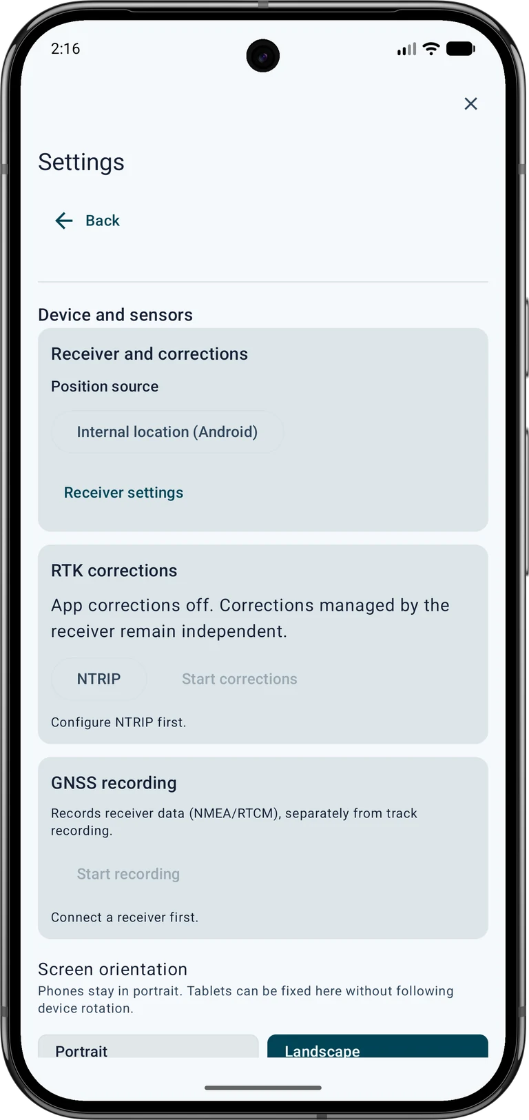
Enable Android location and grant MapTools precise location access. Open Settings → Device and sensors → GNSS receiver and select Internal location (Android) under Position source. This is especially important after using a USB receiver: disconnecting the cable alone does not switch the source.
Wait outdoors for a fresh position and check the GPS display. A GPS profile changes position requests but guarantees no particular accuracy. Prepare maps and target points before a trip without internet. Satellite positioning and an already stored map need no NTRIP account; online maps and internet correction streams need connectivity.
2. Choose a reliable target point
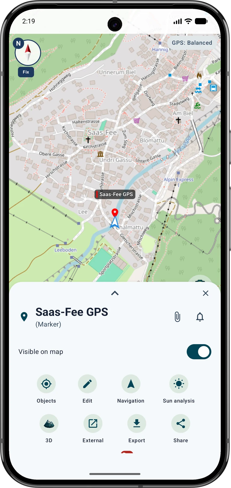
Open the appropriate project and select a saved marker or POI. Tap Navigation in its object details. Alternatively, open Navigation → Target and choose a map point. For entered coordinates, first save a named marker, then start navigation from its details. Check the name and location before setting off.
For coordinates from a survey document, match the format, axis order, units and reference system. Keep the original reference coordinate. Create a separate measured point later for comparison. The reference-point guide demonstrates the complete process using control point 5215 420 00.
3. Approach using direction and distance
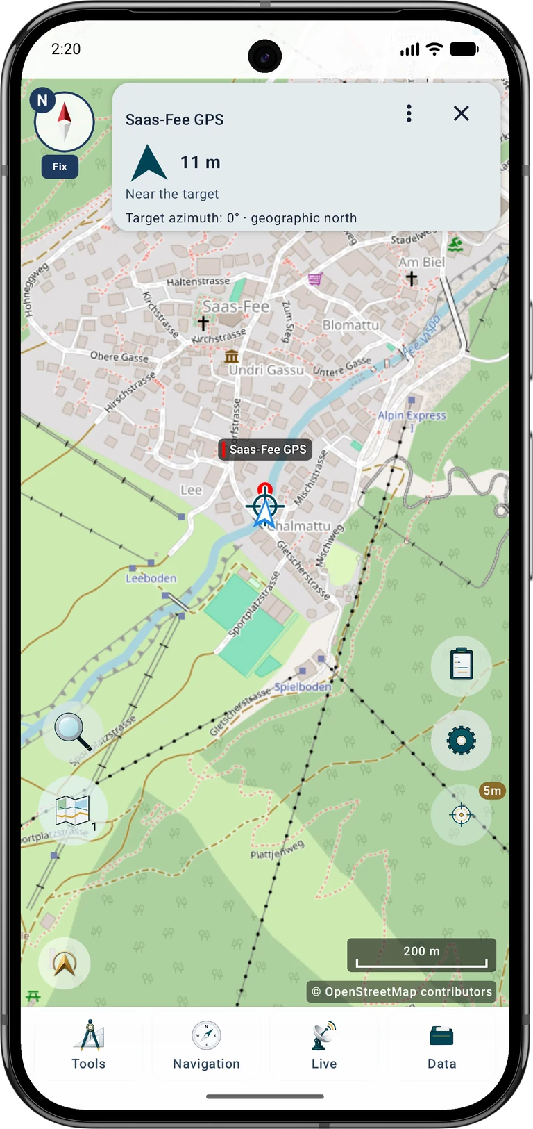
Start in Standard mode. Watch the distance and direction arrow, walk a short way and check again. Guidance shows the direct connection to the target; it does not calculate a walkable route around fences, water or other obstacles.
Pause near the target and compare the map, surroundings and position estimate. A jumping dot does not mean you should chase every jump. If direction is unclear, check the compass and how you hold the phone. North up keeps orientation understandable when no reliable compass heading is available.
4. Use fine positioning
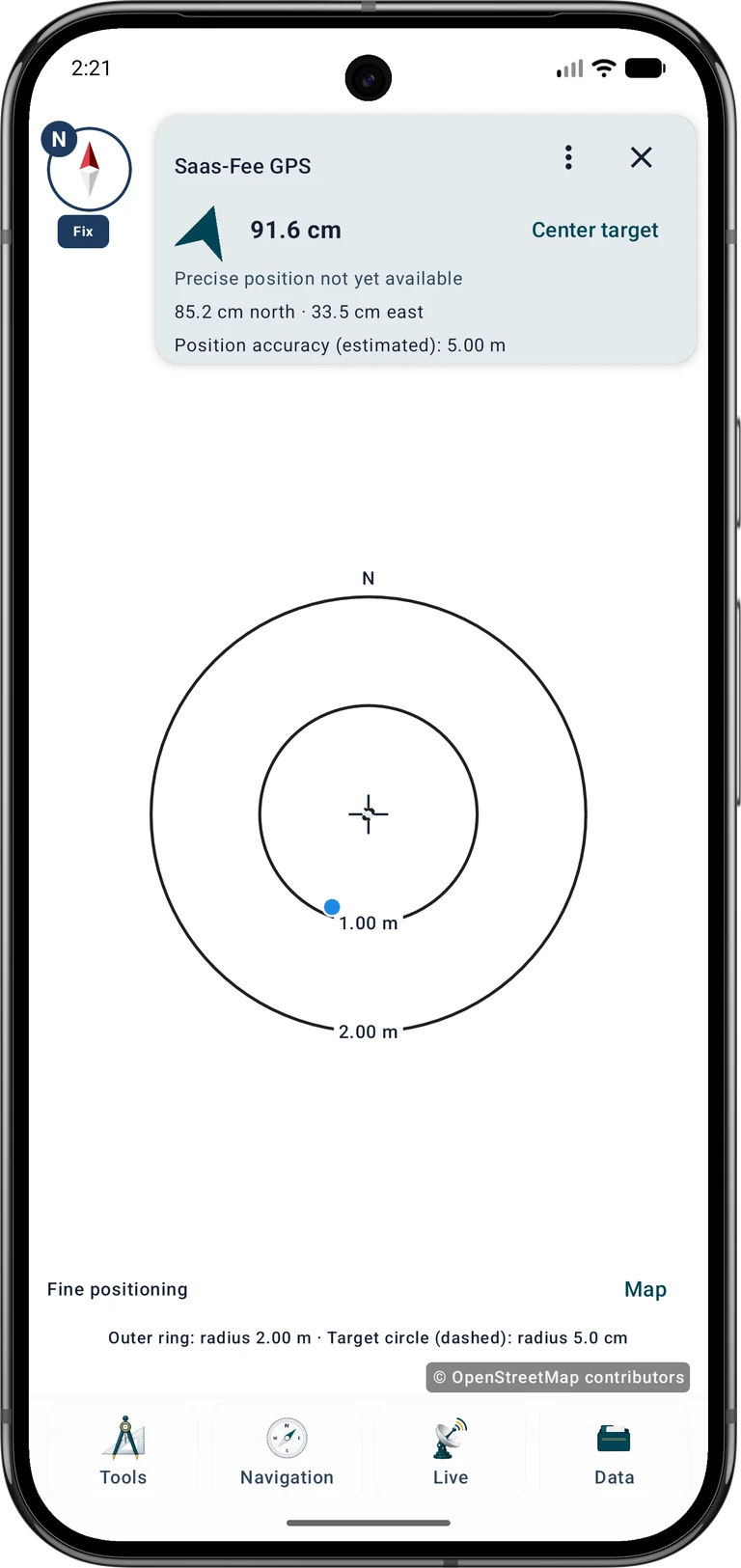
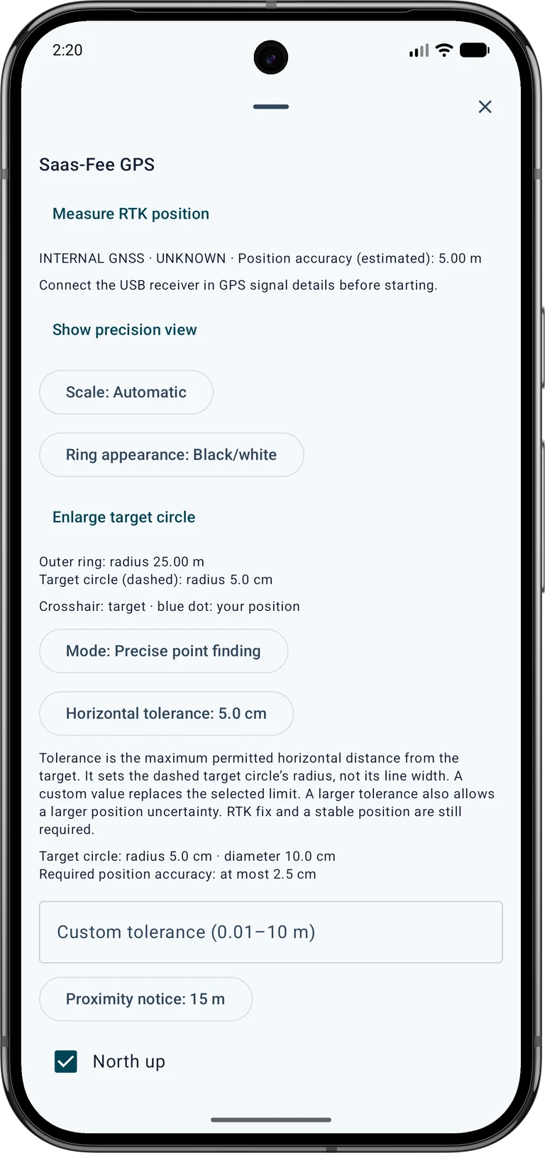
Open the target card's three-dot menu and select Precise point finding under Mode. Use Center target to restore the guided view. The crosshair marks the target and the blue dot your current position. North/south and east/west values describe movement from your position towards the target.
In guided precision mode, fine positioning appears automatically within 2 m of the target; beyond 3 m the map returns. Magnification follows distance and tolerance, with manual scale selection also available. It does not improve the position measurement. You can use this view with smartphone GPS, while the absence of RTK qualification remains visible.
Target navigation options → Mode: Precise point finding → Show precision view
5. Distinguish distance, accuracy and tolerance
Example: a target distance of 0.4 m with estimated position accuracy of 4 m does not mean you reached the physical spot within 40 cm. Distance is calculated between two coordinates; the current position and possibly the target are uncertain. Accuracy is an estimate, not a guaranteed maximum error.
Horizontal tolerance sets the permitted horizontal distance for qualified target evaluation. The outer ring describes only the visible scale. At a tolerance of 5 cm, the dashed target circle has a radius of 5 cm and a diameter of 10 cm. The ring's line width does not represent tolerance.
6. Adjust the target circle and appearance
In Target navigation options, adjust tolerance, a custom limit, scale, north-up orientation, proximity notices and optional signals. Custom tolerance (0.01–10 m) replaces the selected tolerance. A larger tolerance also permits a larger estimated horizontal uncertainty during RTK evaluation; it does not improve the receiver or replace RTK Fixed and a stable position.
Use Ring appearance to choose contrast suited to the map background. Enlarge target circle helps make the correctly scaled target circle visible. A very small circle may shrink to just a few pixels with a large outer radius. The close button dismisses the options while navigation continues.
7. Save a comparison position
To document the place you found, save the current position as a new marker. Give the reference and measured points different names and record the date, conditions and source. Do not move the original target marker to the current GPS position if you want to compare them later.
Use Average position to collect several fresh positions for a marker while stationary. This Pro feature is separate from a recorded RTK point measurement. Averaging can reduce scatter but does not reliably remove systematic offsets caused by poor reception. Repeat the comparison later or from another approach direction; during a reference test, do not move simply to make the displayed distance zero.
8. When RTK is useful
For higher requirements, use a suitable external GNSS receiver with an appropriate antenna and, where needed, a correction service. Open Settings → Device and sensors → GNSS receiver, configure External GNSS receiver (USB) and NTRIP, and check the source, fix and current corrections. Hardware, registration, usage rights, mobile data and possible fees are separate requirements; they are not included with MapTools.
A positive precision evaluation requires RTK Fixed, fresh positions and corrections, and sufficient quality over several measurement epochs. The horizontal estimate must be no greater than half the horizontal tolerance. To save a result, start Measure RTK position; its measurement window is checked separately. Save a new measured marker or attach a report to the linked point while keeping its coordinate. Ordinary smartphone GPS does not produce a qualified RTK measurement report through this workflow.
Target navigation options → Measure RTK position
Common questions when finding a point
Use the following checks when the display does not match your expectations. A connection status, many satellites or a highly magnified map alone does not confirm suitable measurement quality.
For comparison with a physical mark, read the accuracy guide. It separates reference coordinate, measured position and actual deviation and covers both smartphone and RTK workflows.
Can I use fine positioning without RTK?
Yes. Direction, distance and the magnified target view also work with the phone’s built-in positioning. A positive qualified precision evaluation and RTK point measurement still require suitable RTK data. Use the standard mode for walking towards the target when appropriate.
Why does the blue dot jump or direction disappear?
Check for an open view of the sky, a fresh position and the estimated accuracy. Keep away from reflective facades and interfering magnets. Wait briefly, check the compass or use north up. If current data are missing, an old location does not replace a new measurement.
Does a 5 cm tolerance give my phone centimetre accuracy?
No. Tolerance is an evaluation limit and the target circle's radius. It does not change actual reception accuracy. Increasing tolerance does not remove the RTK and quality requirements either.
Why do the point and map disagree?
Check the position source, coordinate format and reference system, and where the target came from. Aerial imagery may be offset. Compare against a known mark and save the measured result separately rather than overwriting the reference coordinate.
9. Stop navigation or resume it later
Use Stop target navigation when finished. A proximity notice does not automatically remove or stop the target. After restarting the app, explicitly resume the saved target.
Keep the target and comparison points in the project to check them again later. Back up the project for continued work. Simple exchange formats do not necessarily retain all MapTools measurement reports; use the native project backup for that content.
Further guides and sources
The following guides link directly to complete workflows: RTK setup, testing at a known point, GPS/device settings and position averaging.
Android describes horizontal accuracy as a statistical estimate. GPS.gov explains the effects of blockage, reflections and receiver quality. These basics help interpret the display; your field measurement remains decisive.