
Check measurement accuracy
Check your phone or RTK receiver at a known reference point: obtain official data, configure NTRIP, measure on the physical mark and compare the results.
Keep NMEA diagnostics or create RINEX observation files locally for later processing, while preserving the original receiver recording.
Settings → Device and sensors → GNSS receiver → GNSS recording
Connect the receiver and open GNSS recording. Enter a point name and known antenna metadata. Antenna height is the vertical distance from the measured point to the antenna reference point (ARP), not elevation above sea level. Leave unknown values blank.
NMEA alone cannot produce RINEX. For the LG290P, request its own RTCM observations and navigation data before connecting, then check that receiver observations arrive. Corrections received from SAPOS are not your antenna's raw observations.
Start recording and stop it normally when finished. Check the completion status. Each recording is limited to 512 MiB of USB input. An interrupted recording should be checked before processing.
Choose 3.02, 3.04, 3.05 or 2.11 from the dropdown. The default is 3.02, which omits NavIC. Versions 3.04 and 3.05 can include available NavIC observations. Version 2.11 exports GPS and GLONASS only and loses signal distinctions.
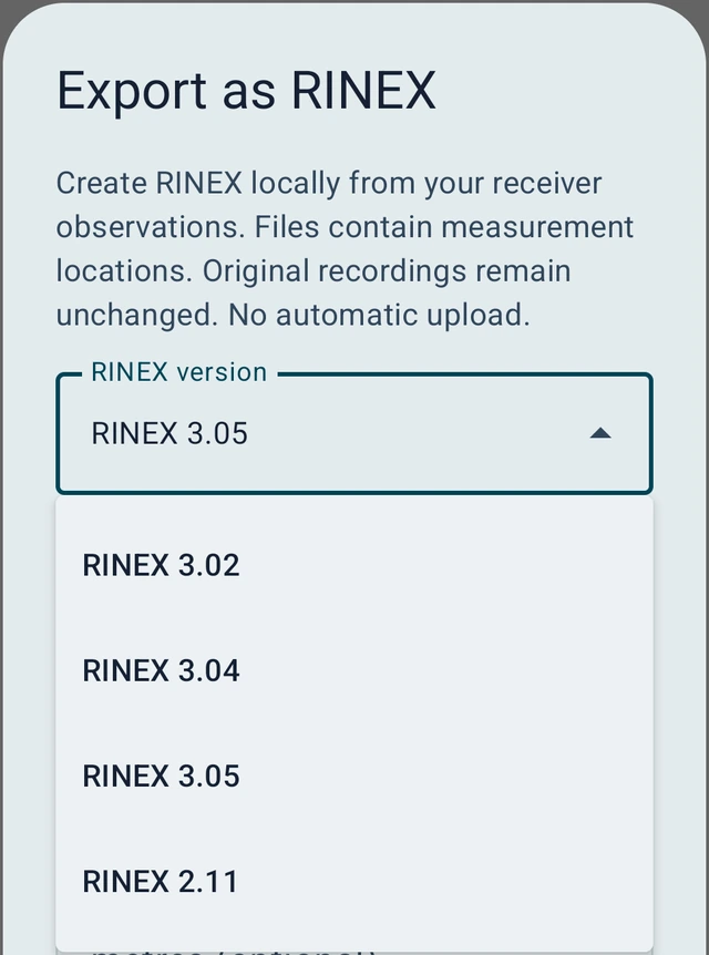
Open a completed recording with receiver observations and choose Export as RINEX. Select the version, check the point and antenna details, then create the files. Review epochs and warnings. Choose the format from the dropdown → Save → choose the storage location. Conversion is local, with no automatic upload.
The header includes an approximate position, known receiver firmware and the regular observation interval where available. Unknown antenna details remain marked; zero header values can be placeholders. Antenna height is not subtracted from raw observations. Unavailable extra GLONASS navigation fields in 3.05 use standard unknown values.
The GNSS recording ZIP contains manifest.json, receiver.usb, receiver.nmea and receiver.rtcm3. NMEA is included; the receiver RTCM file can be empty if no raw observations were output.
Observation ZIP: observations only. RINEX package: also navigation data and report. Complete package: also original NMEA, RTCM and USB files. The .rnx and .obs files contain identical observations; only the extension differs. For an observation-only upload, use the single file or observation ZIP accepted by the service. Navigation files are included when available.
*.rnx*.obsreceiver.rnxreceiver.rnx, receiver.nav / receiver.gnav, export-report.jsonreceiver.rnx, receiver.nav / receiver.gnav, export-report.json, source/manifest.json, source/receiver.usb, source/receiver.nmea, source/receiver.rtcm3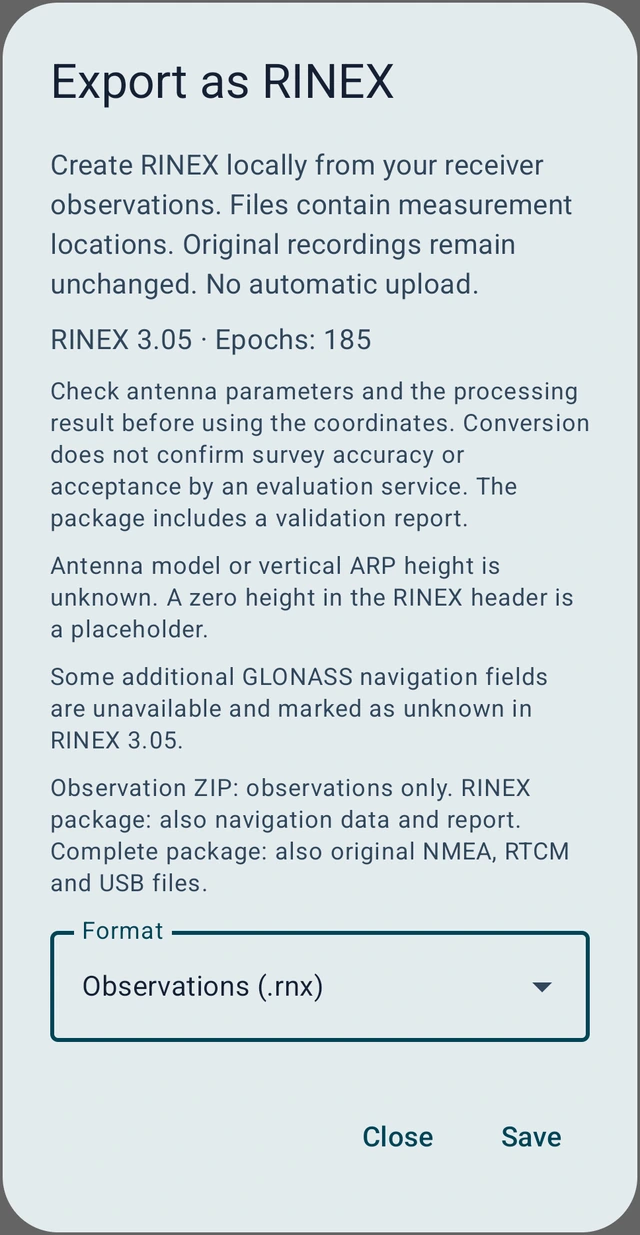
Check antenna model, ARP height, navigation data and the export report. RINEX 3.02 omits NavIC; missing navigation data can limit processing. A successful conversion does not confirm service acceptance or surveying accuracy. Ask the provider about required duration, formats, registration and fees before submitting.
Recordings are separate from project backups, so export them separately. Files contain measured positions. Keep originals and share only the required files with the intended recipient.
Check your phone or RTK receiver at a known reference point: obtain official data, configure NTRIP, measure on the physical mark and compare the results.