
XYZ and TMS
XYZ and TMS services deliver prepared raster tiles in a fixed tile scheme. They work well as a base map, aerial image or thematic background, but normally contain no directly queryable object attributes.
MapTools for your use case
Take maps and geodata into the field, inspect features on location and document new points, lines or areas in one mobile workflow.

Typical workflow
Prepare the required offline maps, local geodata and known online services before travelling to the site. Check coverage, coordinate reference systems, access rights and whether the planned workflow still works without a network.

Tools in the field
The essential tools form one clear mobile workflow and remain usable without a continuous data connection when maps and data have been prepared in advance.
Typical workflow
The workflow moves from a prepared data source through inspection at the feature to a traceable result for subsequent work.
Combine the basemap, overlays and project-specific sources in a map slot or preset and test them before leaving.
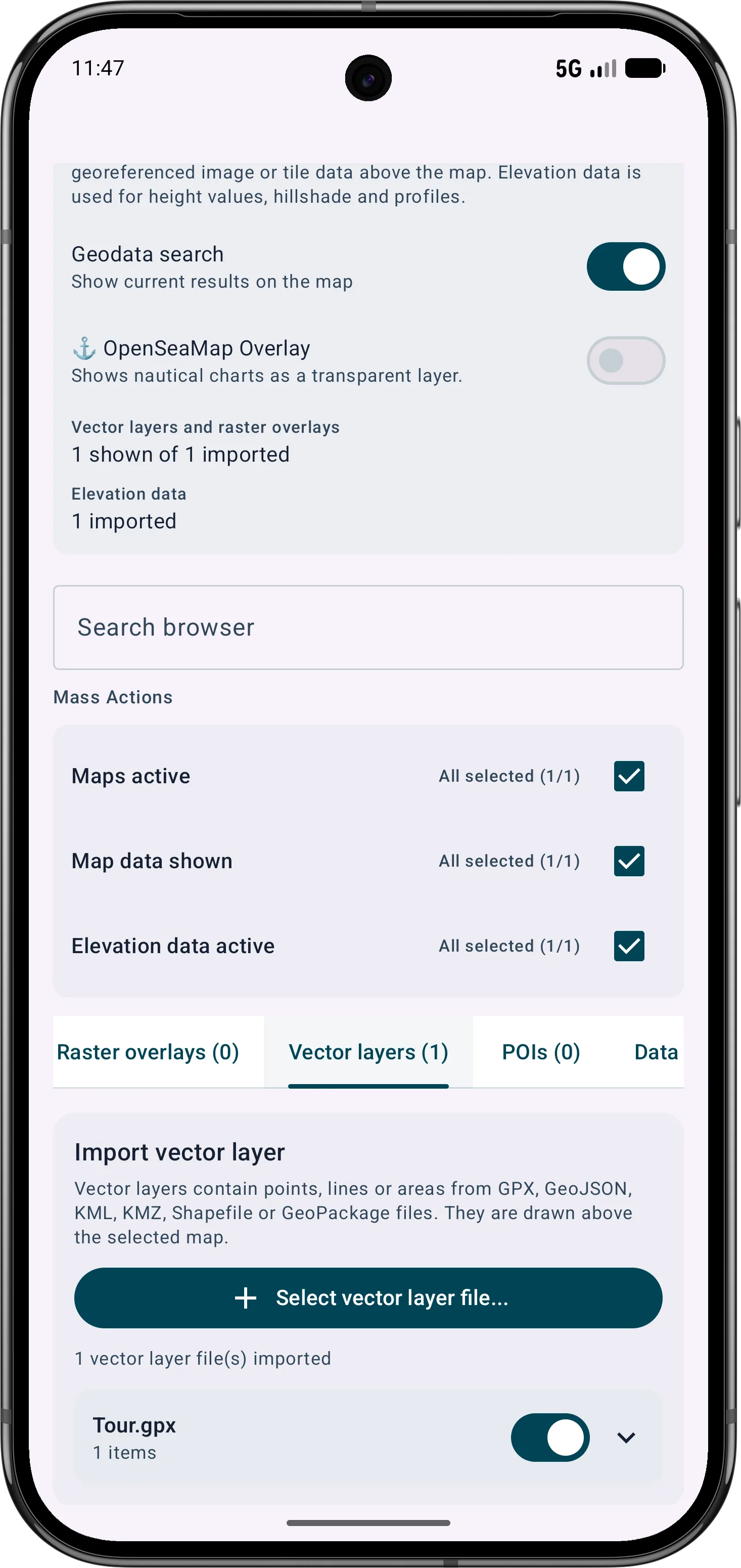
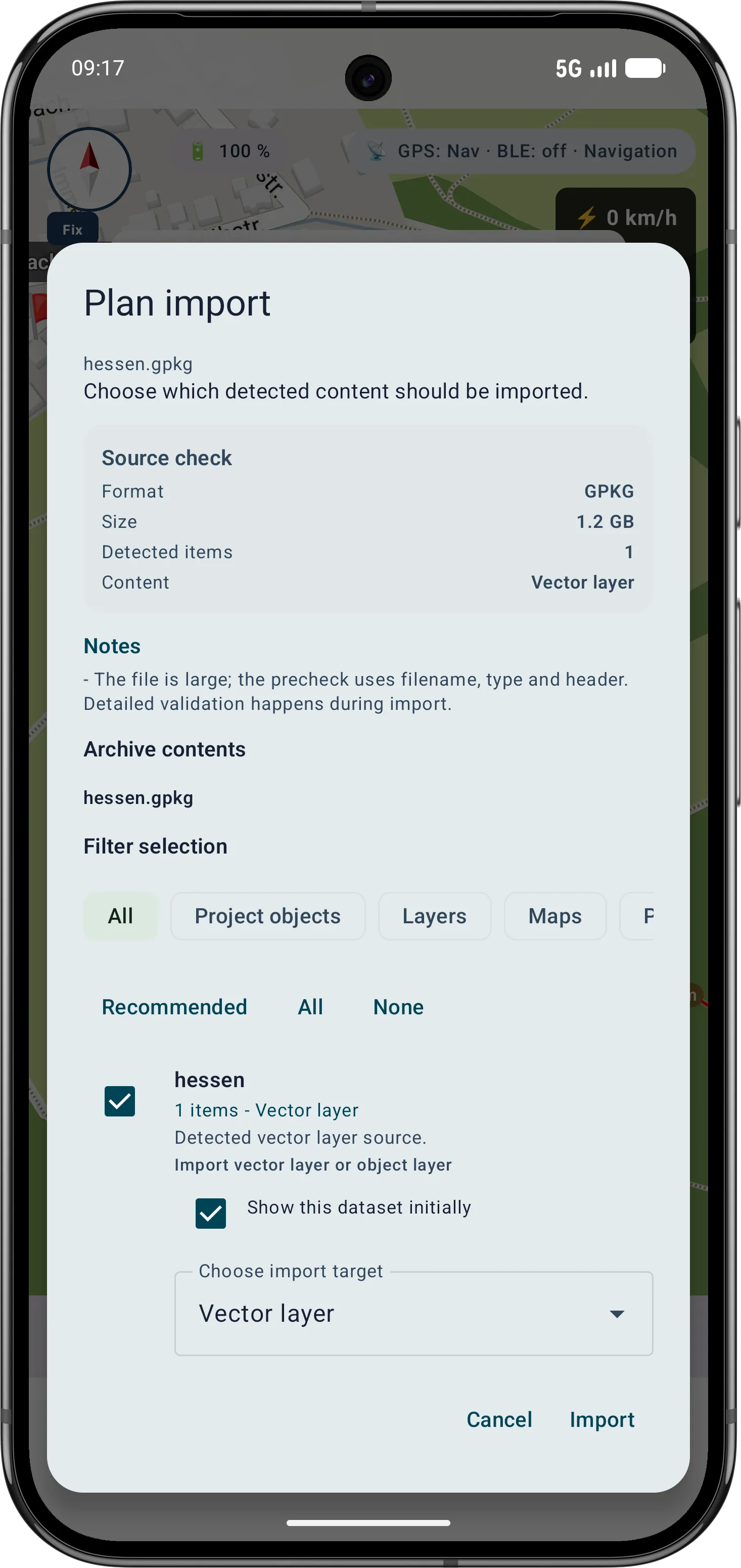
Map presets and slotsImport supported local files as the appropriate map, vector layer, raster overlay or project content; configure required online services separately.
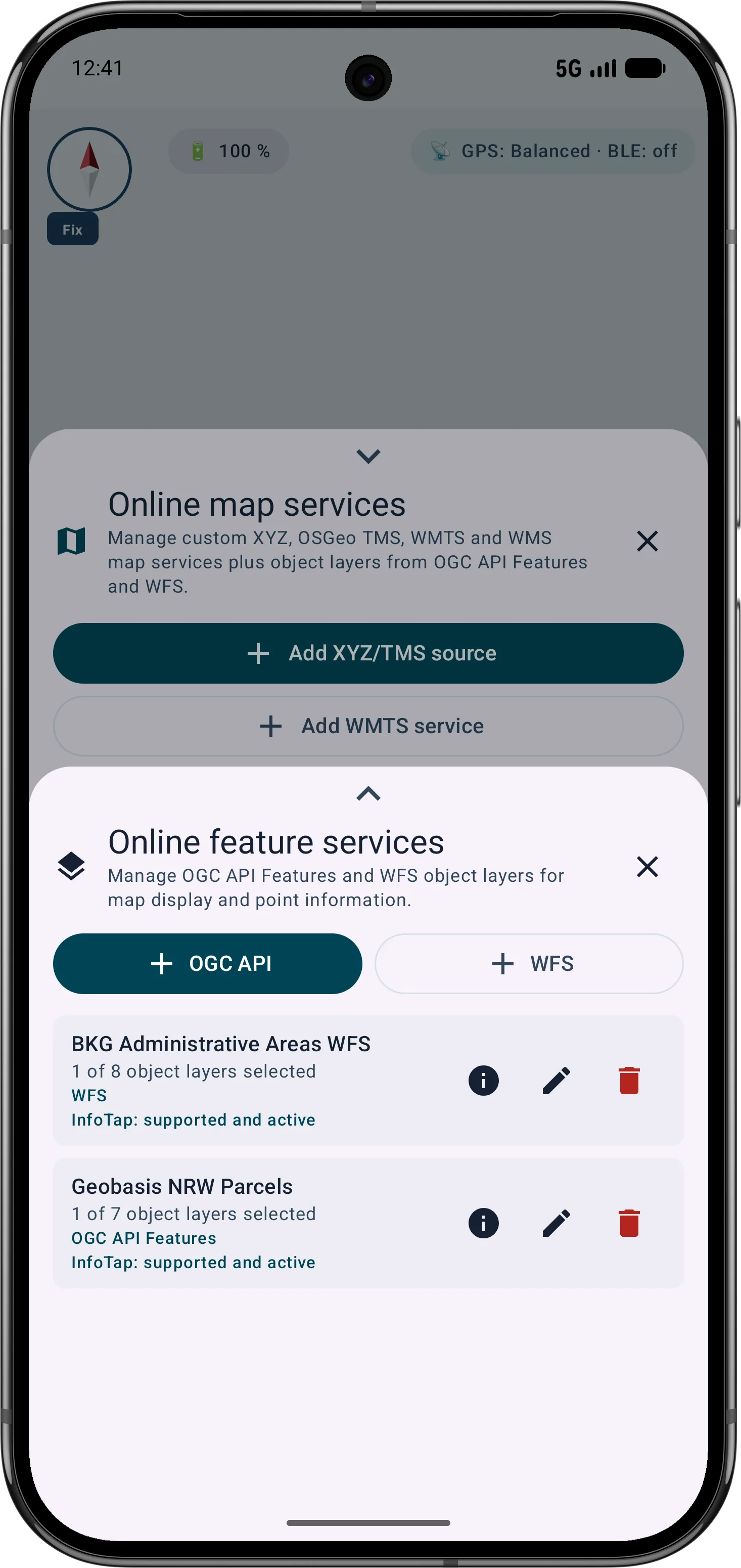
About geodata importCompare the map position with the real feature. Where suitable sources provide them, retrieve attributes and point information from OGC API Features, WFS or WMS with InfoTap.
Feature services and InfoTapAverage a GPS position over several readings where useful, review quality metrics and export supported project data for subsequent work.
Average a GPS positionTools in the field
MapTools helps compare a map finding with the situation on site. The origin and status of the information still matter: a rendered map image, a queryable feature and a GPS reading are different sources.

Understanding GIS services
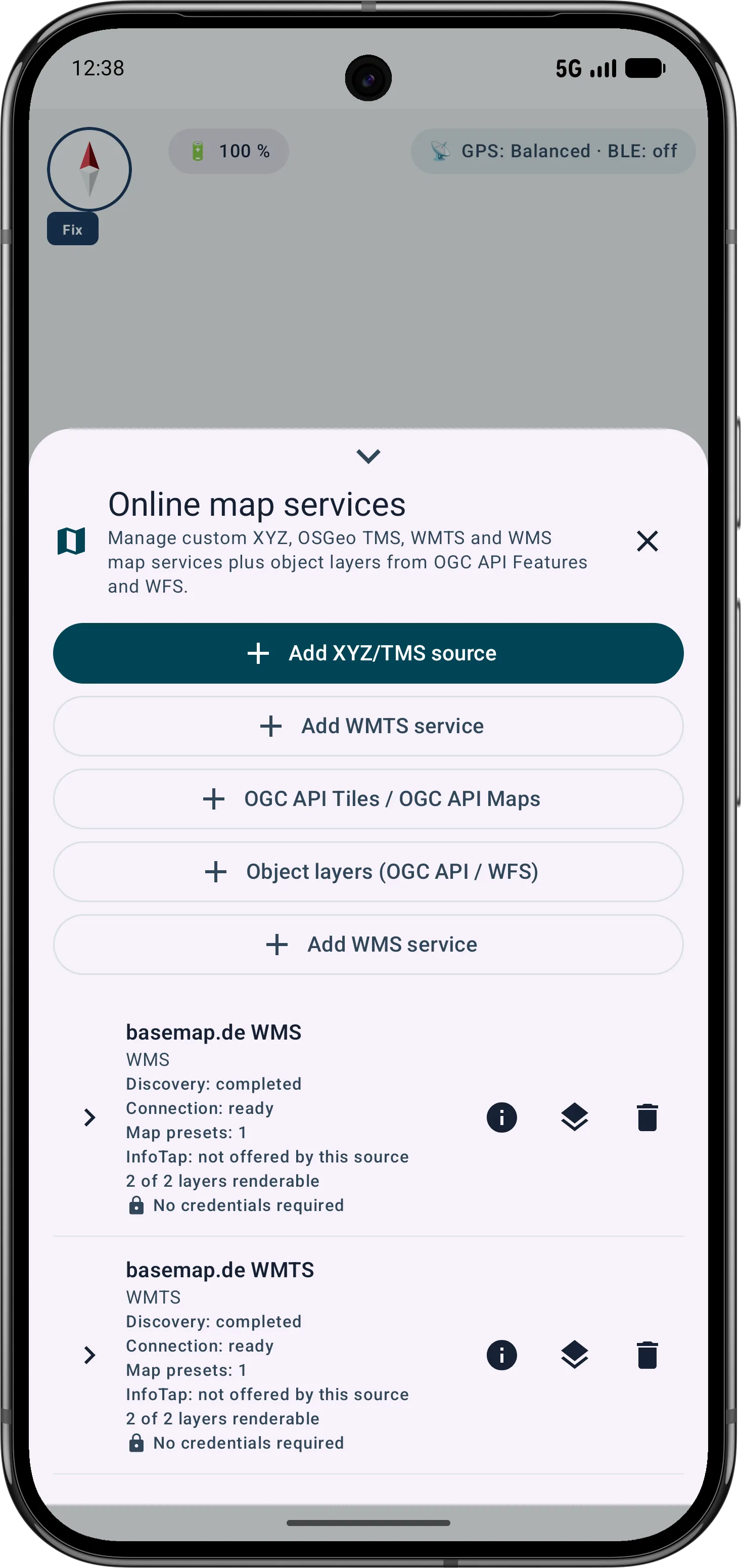
MapTools connects your own online services as map sources, raster overlays or queryable feature layers. The distinction matters: map images support visual comparison, while feature services provide individual geometries and attributes.
XYZ and TMS services deliver prepared raster tiles in a fixed tile scheme. They work well as a base map, aerial image or thematic background, but normally contain no directly queryable object attributes.
A WMS renders the requested map extent on the server. Selected layers, styles and transparent views can be combined above a base map. Point information is available only when the service provides suitable WMS GetFeatureInfo support.
A WMTS supplies prepared tiles from defined tile matrix sets and suits repeated panning and zooming. MapTools respects advertised layers, styles, coordinate systems and allowed dimensions such as a time value.
These services provide structured points, lines and polygons with attributes. MapTools renders selected collections or feature types in suitable VTM map slots and can query them through InfoTap and bounded geodata search. Access is read-only; WFS-T, server-side editing, full downloads and automatic offline synchronisation are not promised.
Combining layers in practice
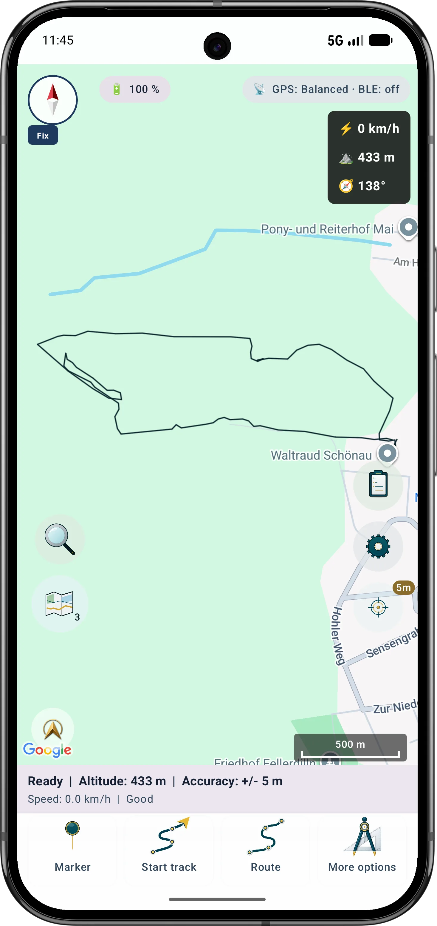
The four map slots are independent. Switching keeps the map position and work context while changing the base map and assigned layers, so sources do not have to be reconfigured repeatedly.
A short press on the map switcher opens the next configured slot. For example, slot 1 may hold an offline topographic map, slot 2 aerial imagery, slot 3 a WMS specialist layer and slot 4 OGC/WFS feature layers.
Base maps, raster overlays and suitable feature layers can be combined for each slot. Visibility, order and opacity support comparison; OGC API Features and WFS also keep InfoTap participation per slot.
Recurring combinations of map source, display, layers and terrain settings can be saved as a custom map preset and applied to the active slot. This creates prepared views for project checks, fieldwork or offline use.
Services and data come from their respective providers. Availability, registration, fees, quotas, licences and permitted offline use are not automatically included with MapTools.
Inside the app
The workflow moves from a prepared data source through inspection at the feature to a traceable result for subsequent work. MapTools connects your own online services as map sources, raster overlays or queryable feature layers. The distinction matters: map images support visual comparison, while feature services provide individual geometries and attributes.
Go deeper
Locally prepared data can remain available without mobile service. WMS, WMTS, OGC API Features and WFS normally require a reachable network connection. Registration, fees, quotas, licences and offline rights are set by the provider and are not automatically included with MapTools.
Important in the field
MapTools is a mobile field and data-exchange tool, not a full desktop GIS or an official surveying instrument. Accuracy, rights, fees and availability of external data depend on the device and provider.
FAQ
Yes, when a supported format has been imported locally and prepared for the intended map slot or project. The usable content and properties depend on the data type and import destination.
WMS and WMTS primarily deliver rendered map images or tiles. OGC API Features and WFS deliver individual geospatial features with geometry and attributes, so MapTools handles them as different source types.
MapTools can document points and other project geometries and average a GPS position over multiple readings. Quality metrics help assess the result but do not guarantee official accuracy.
No. MapTools is a mobile tool for map work, field inspection and data exchange. Complex GIS editing and official surveying still require the appropriate systems and procedures.
ArxSilex MapTools
Start with the quick guide or install MapTools on your Android device.
Help shape MapTools
What is missing from your typical workflow, what should work differently, or which information is missing from this page? Tell us about your workflow and the specific need. Your feedback helps us improve MapTools for real field use.