
App profile
Changes the arrangement of controls, but not maps, layers, projects or recorded data.
Search, map switching, object browser, settings, GPS/InfoTap and hiding map controls remain available in both profiles.

GPS · Online/offline maps · Geodata
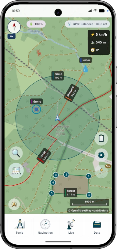
Outdoor map toolkit for GPS, online and offline maps, tracking, bearings, POI, areas, elevation data and drone Remote ID reception.
App profile
Both profiles contain the same MapTools functions. Compare how the controls will look on this device, then choose a starting layout.


Changes the arrangement of controls, but not maps, layers, projects or recorded data.
Search, map switching, object browser, settings, GPS/InfoTap and hiding map controls remain available in both profiles.
Map presets save the map source, map style, active layers, terrain, raster overlays, hillshade/contours, POI layer and map-object visibility. UI profile, coordinates, colors, icon favorites and menu order remain global settings.
Quick entry
Choose the entry point that matches your task. The detail pages then explain the complete workflow and available settings.
Overview
The areas work together: map sources, geospatial services, objects, navigation, terrain data and data exchange can be combined for the task at hand.
Map presets save the map source, map style, active layers, terrain, raster overlays, hillshade/contours, POI layer and map-object visibility. UI profile, coordinates, colors, icon favorites and menu order remain global settings. Global offline mode blocks every internet request initiated by MapTools, including custom WMS, WMTS, OGC, XYZ and WFS services and external web links. Android and other apps are not covered; with global mode off, Google and OpenStreetMap can be blocked separately. Linked data folders make local maps and data available app-wide or only in the current project.
Open guideWMS and WMTS provide map images and layers. OGC API Features and WFS provide points, lines, areas and attributes. InfoTap combines available coordinate, terrain, map and object information for a selected map point.
Open guideMarkers, POIs, routes, tracks, circles, areas, bearings and search grids are managed within projects. Object alarms monitor selected boundaries; .asmaps is used to exchange one editable project as a portable package.
GNSS status, GPS/RTK quality, compass, bearings, coordinates, track recording and route or target navigation work alongside elevation profiles, hillshade, contour lines and ViewRange based on local terrain data. Recording profiles control time or distance intervals and store pauses together with available GPS/RTK quality data.
Open guideSmart Import assigns maps, vector layers, POI, elevation and project data to a suitable destination. GPX, KML/KMZ, GeoJSON, ArcGIS JSON, CSV and other formats support exchange; .asmaps.backup backs up selected app areas with optional password protection.
Live groups, drone Remote ID reception, AR/LiveView, QR data exchange and position averaging extend map work. Availability and accuracy of sensor, radio and AR functions depend on the device and surroundings.
Open guideExamples by task
MapTools does not prescribe a fixed workflow. These examples show which areas work together for common tasks.
Prepare an offline map and elevation data, open a route, use the compass or target navigation, and record your track with time, pause and quality data.
Open guideCombine WMS, WMTS, OGC or WFS sources with local layers, inspect a point with InfoTap, and document markers or areas with position quality in the project.
Open guideCombine search grids, coverage, routes, object alarms and, where useful, live groups to keep completed and pending areas visible on the map.
Open guideAverage positions, check bearings and terrain information, export results in a suitable exchange format, and back up project and app data separately.
Open guideStart
Install ArxSilex MapTools, open the quickstart or check the supported import and export formats.
Current data
Tracks, markers, area points, bearings and ViewRange can include GPS/RTK quality data. Track recording also keeps timestamps, tour duration, pauses and GPS accuracy available in the info sheet.
Geodata search
MapTools searches imported POI data on the device and, when requested, searchable layers visible in the active map slot from OGC API Features or WFS. Online requests start only after deliberate submission. Results identify their source and layer and can be highlighted on the map. External services, data and licences are not included with MapTools; each provider determines availability, registration, fees and terms of use.