
MapTools for your use case
Astronomy and orientation at night
Check twilight, Sun, Moon and visible celestial objects for a selected place and time. Bearing lines on the map help compare their direction with your route and terrain.

Before departure
Check twilight and available daylight
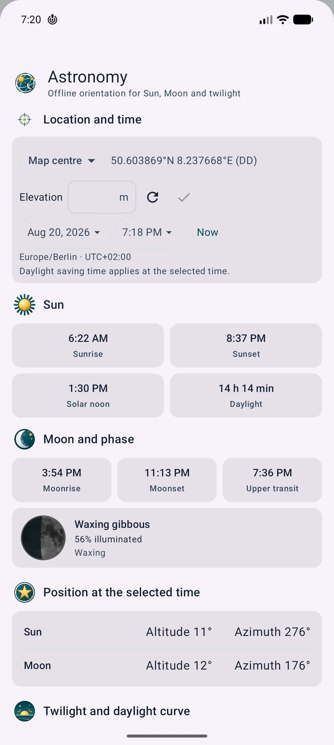
Choose place, date and time before setting out. MapTools calculates sunrise, sunset and twilight locally. Route analysis can also estimate which sections are likely to fall in daylight, twilight or darkness.

Tools in the field
What MapTools does for Astronomy & night orientation
The essential tools form one clear mobile workflow and remain usable without a continuous data connection when maps and data have been prepared in advance.
- Check local Sun, Moon and twilight times offline
- Review altitude, azimuth, events and visibility for selected planets and bright stars
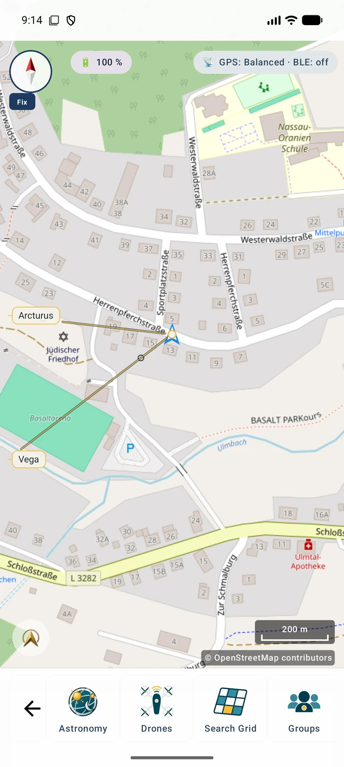
- Project up to five labelled celestial bearings onto the map and compare them with route and terrain
Typical workflow
From time and place to a map orientation aid
Astronomical values are calculated for a chosen location and time, then compared with map, route and the real horizon.
- 1Select place and time
Use current position, a map point or destination plus date and time.
Astronomy features - 2Review twilight and events
Check rises, sets, twilight, altitude and azimuth for relevant objects.
Times and visibility - 3Add objects to the map
Select up to five suitable objects and show their bearings from the chosen point.
Star-map layer - 4Compare route and terrain
Evaluate direction together with horizon, offline map and planned route.
From route selection to daylight guidance
On the trail
A star direction supports orientation – it does not locate you
A calculated azimuth indicates where a bright star or planet should appear. It becomes useful only when compared with mapped features, route, compass and visible horizon.
- Use only clearly identified objects at a plausible altitude
- Allow for cloud, obstruction, light pollution and compass error
- Continue to use GNSS, map and independent orientation for your position

Inside the app
Astronomical values and bearings in MapTools
The screenshots show the astronomy overview and the star-map layer with selected bearings.
Use realistically
Orientation aid, not position fixing
MapTools calculates astronomical directions for a known location. It does not determine your position from star observations or replace navigation training and safety equipment.
Important in the field
Understand the practical limits
Astronomy is a planning and orientation aid, not celestial position fixing and not a replacement for maps, compass, GNSS, safe trip planning or emergency preparation. Visibility also depends on weather, horizon, light pollution and terrain.
FAQ
Astronomy outdoors: common questions
Do the calculations work offline?
Yes. Astronomy calculations for place and time run locally. Maps and routes must be prepared locally before an offline trip.
Which objects are supported?
MapTools includes Sun, Moon, five planets, 17 bright stars and selected prominent constellations or star clusters. See the feature page for the current list.
Can I navigate using stars alone?
No. Bearings are an additional aid and do not replace position fixing, map, compass, GNSS or a safe route decision.
Can MapTools estimate daylight along a route?
Yes. Route periods can be estimated as day, twilight or night. Pace, breaks, weather, terrain and actual visibility remain your planning responsibility.
ArxSilex MapTools
Try MapTools for Astronomy & night orientation
Start with the quick guide or install MapTools on your Android device.
Help shape MapTools
Which feature would you still like to see?
What is missing from your typical workflow, what should work differently, or which information is missing from this page? Tell us about your workflow and the specific need. Your feedback helps us improve MapTools for real field use.