
Start recording
Choose a suitable recording mode and start the track after checking GPS. The compact tracking bar shows duration, distance, status and available quality information without unnecessarily covering the map.
ArxSilex MapTools
Record tracks, check elevation profiles, use terrain and export results.
From start to review
Recording runs independently of an opened route. Status, pauses and GPS quality remain visible so that the saved track can be reviewed later.
Choose a suitable recording mode and start the track after checking GPS. The compact tracking bar shows duration, distance, status and available quality information without unnecessarily covering the map.
Pausing stops the ongoing location request and is retained as separate track segments. The same recording can then be resumed, while route guidance may run in parallel.
After saving, review time, distance, segments and available elevation or quality data. If recording stopped too late, choose the last valid point on the map, in the point list or by time. A corrected copy is recommended; replacing the original requires an additional confirmation. Later photos, notes and audio remain in the project.
Track correction
Saved recordings can be cleaned up precisely without converting them into a planned route.
Under Clean recorded track → Remove points, select one inner raw point or a continuous section directly in the track view, with the range slider or from the complete point list. The preview shows the removed course and the new direct connection.
Network, passive and fused positions as well as isolated large outward-and-return jumps are offered as candidates. MapTools never removes them automatically; the user makes the decision.
Cleanup is saved only as a new corrected copy. The original, timestamps, recording events, activity boundaries, genuine segment gaps and media are retained. Older tracks without start/end markers are supported too; the general geometry editor remains reserved for planned routes.
Review and sharing
Create a readable map with relevant statistics from planned routes or recorded tracks, save it as PNG, and use it without requiring viewers to install an app.
Elapsed time, time excluding pauses, and explicit user pauses remain separate. Average speed and pace state their time basis; technical GPS gaps are not counted as pauses. A smoothed maximum speed suppresses isolated position jumps.
Summaries with maps and statistics, plus available route elevation profiles, are included in Free. Recorded-track elevation profiles and PNG export require Pro. Choose OSM with attribution or no background; Google and maps with unclear permissions are not exported. Separate elevation-profile PDFs remain available.
Routes show distance, estimated total and moving time, planned speed, breaks, and elevation. The time model is stated: slope adjustment for the hiking model, constant speed otherwise. Tracks show supported recording times; unknown times or pauses are not replaced with zero. Ending route navigation does not create a recorded track.
Choose the full track, trimmed ends, or data only. Trimming distance is adjustable; geometry, statistics, and elevation all refer to the remaining section. A short track never falls back to the full geometry. Additional slot contents stay off during trimming; the original is unchanged. Trimming does not guarantee anonymity.
Map left with data right, map above with data below, or two separate PNGs for map and data: output has no title block. A fine route line and an elevation profile with labelled axes and major/minor gridlines keep details readable. Statistics stay outside the map. Either image of the pair can also be exported on its own.
Move, zoom, and rotate the map inside a fixed frame; choose north-up or fit the route. Raster labels rotate too. Choose statistics, pace, date, profile, colour, line weight, and neutral/warm style; the last settings are remembered. Web: 2000 px; Large: 3000 px; map detail depends on the source. Save as selects a destination, or one folder for a pair. Supported slot content is optional; omissions are named.
Adaptive time forecast
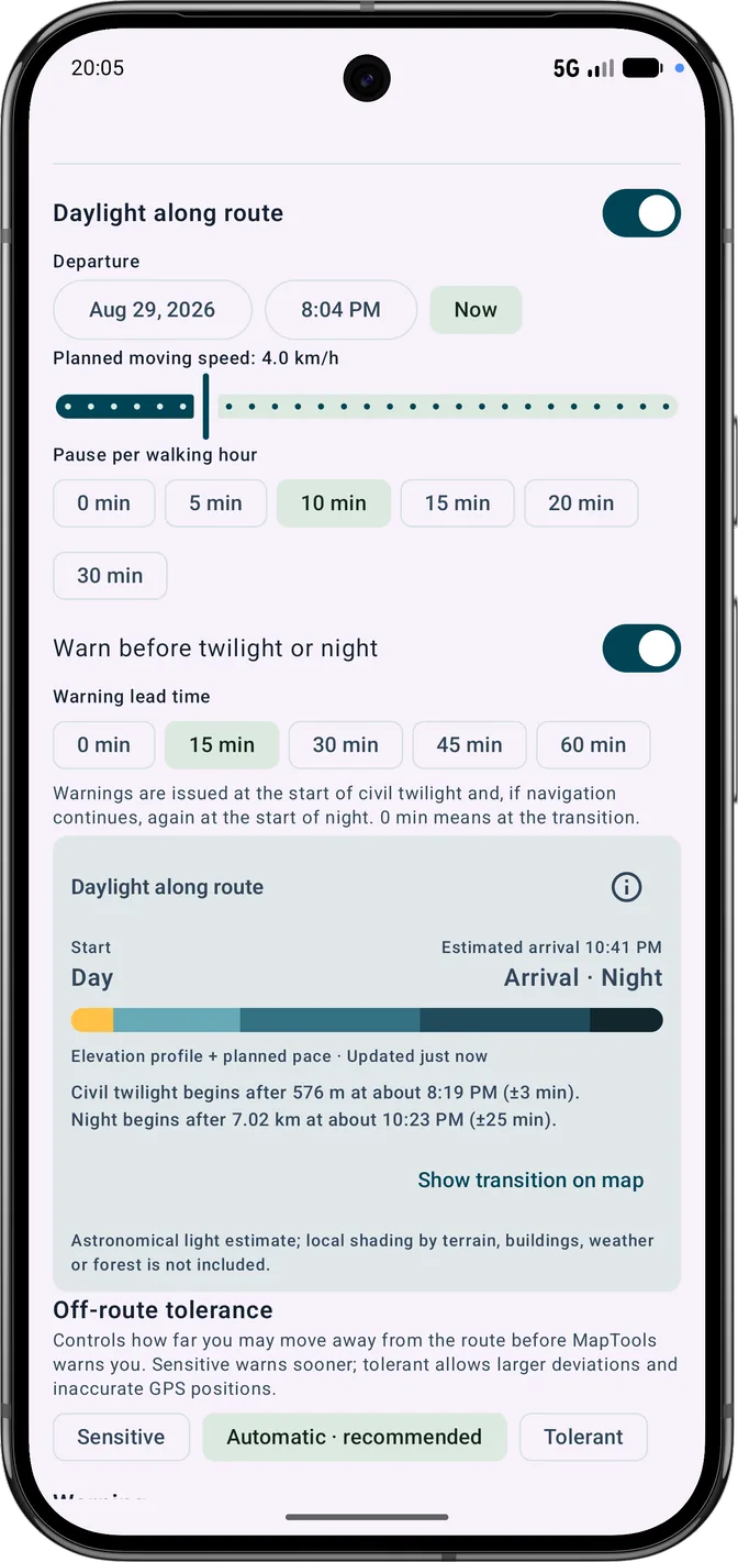
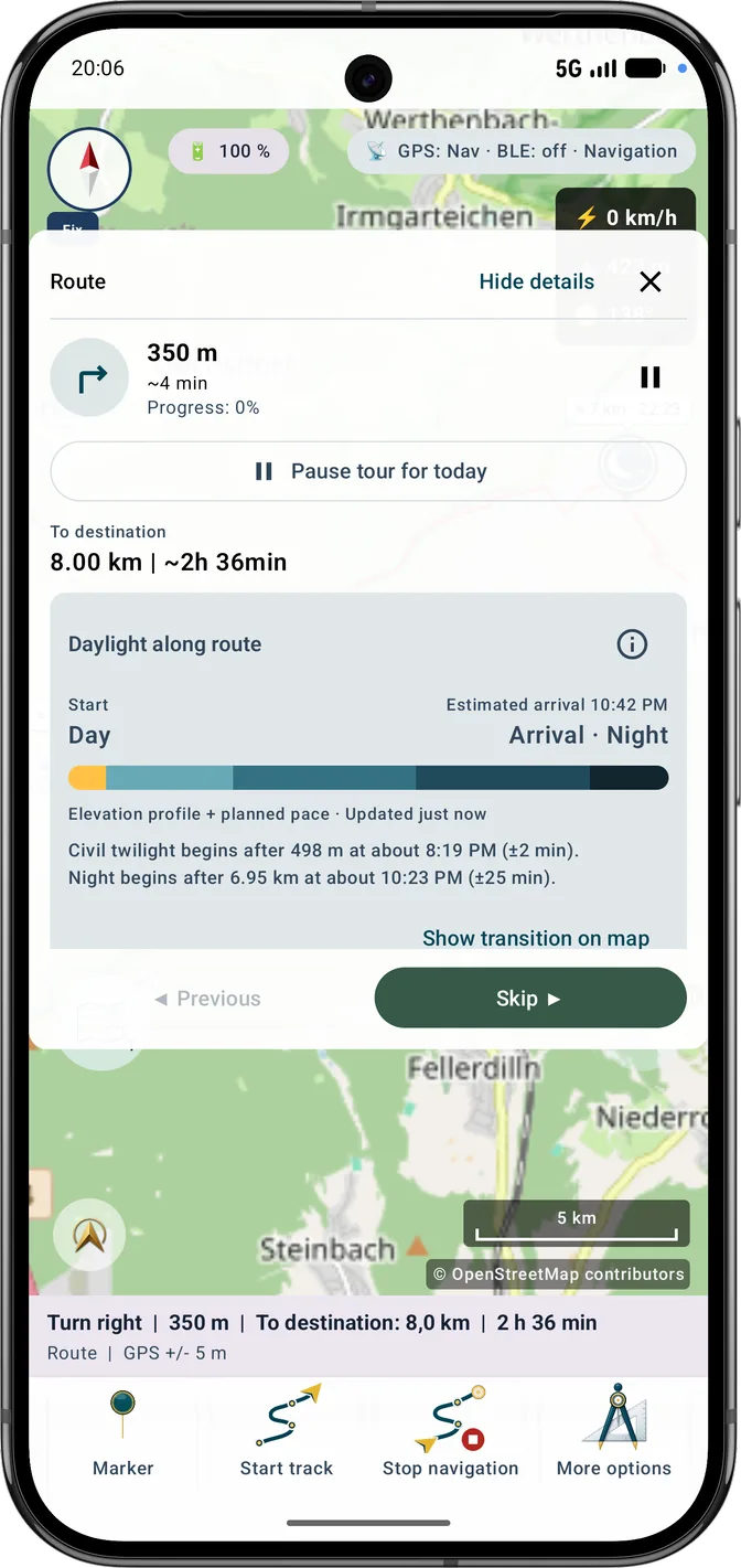
The app combines the route, planned pace, breaks and available elevation data into one timeline. During a hike, it can cautiously adapt that timeline to the pace actually achieved.
The first forecast uses the moving pace and breaks from route planning. In the Hiking profile, available elevations are applied by route segment; segments without elevation data keep the planned pace. The elevation profile is prepared once when the selected route starts and reused from cache throughout that navigation session.
After at least 5 minutes and 300 metres of reliable movement, the forecast can include personal pace. It uses the most recent 20 minutes or 2 kilometres. Stops, inaccurate GPS fixes and off-route sections are not learned.
A full forecast is normally recalculated about every 15 minutes or after a matching route distance. A clear pace change, a nearby light transition, changed settings or a longer pause can update it sooner. Warning checks are separate and do not trigger continuous full calculations.
The app shows the calculation basis, calibration status, update age and a ± planning margin. It is an orientation aid, not a guaranteed arrival time. Local shading by mountains, buildings, weather or forest is not modelled.
Read route light correctly
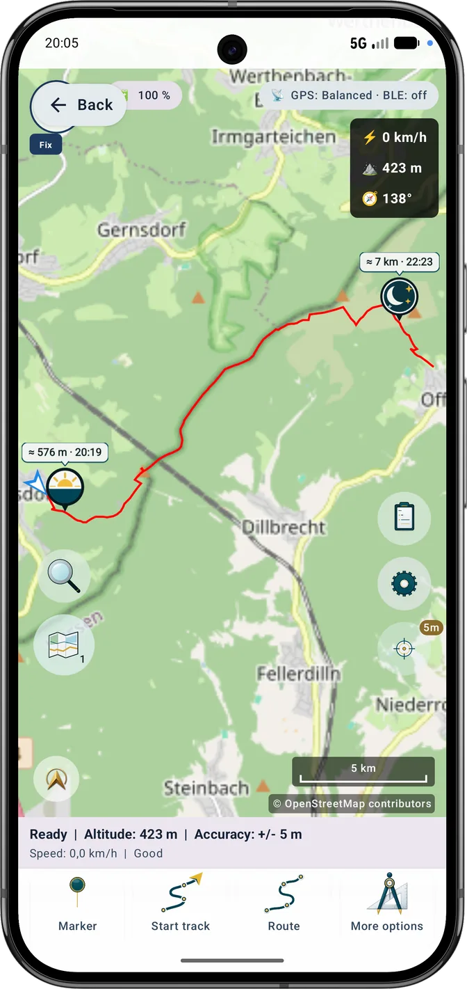
The marker in the screenshot belongs to the astronomical daylight forecast. Coloured sections from the optional terrain analysis separately show whether direct sunlight at each route location is blocked by the available elevation model.
“≈ 53.1 km · 07:14” gives the approximate route distance reached and local time. The upward arrow above the yellow horizon means brightening: civil twilight ends and daylight begins here. The pointer marks the location on the route. The symbol alone does not promise direct sunlight.
Gold means direct sunlight, blue-grey terrain shade, dark blue Sun below the horizon, and neutral grey unknown coverage. Distance, duration, source, grid spacing and coverage provide context for the approximation.
Active elevation data must cover the route and possible blocking terrain towards the Sun. Missing coverage stays unknown and is never reported as sunny. Up to 32 probes and a terrain range of up to 10 km per probe limit effort and precision; buildings, trees and forest are included only by a suitable DSM.
Route planning with daylight
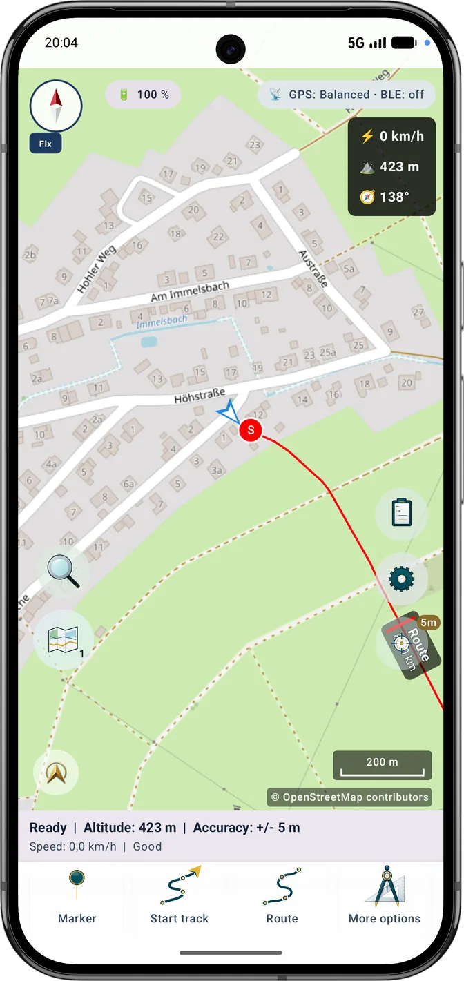
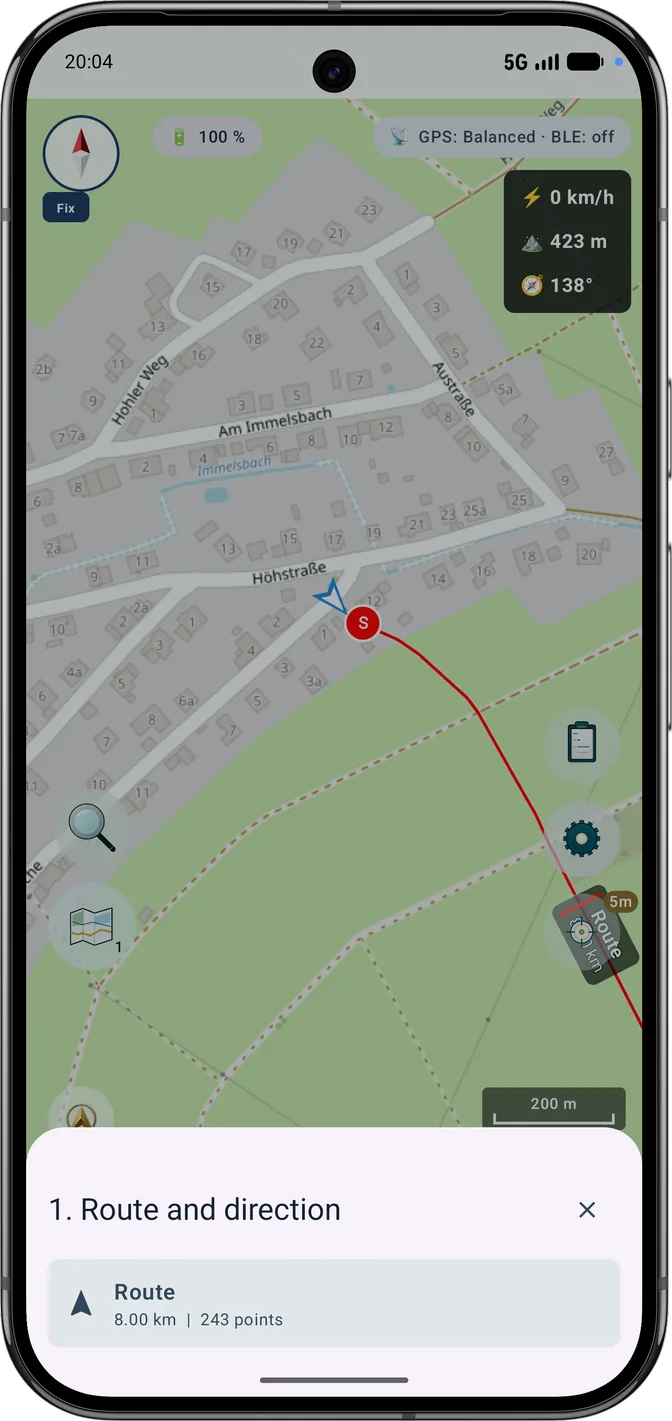
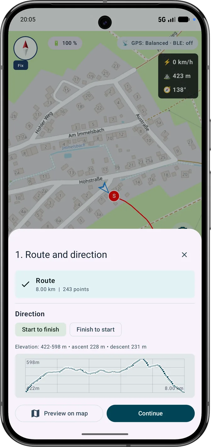
The six screenshots show the Hiking-profile workflow: open the Route action, select a route, review direction and elevation, adapt the forecast to pace and breaks, inspect transitions on the map, and start navigation.
Recording quality
Track recording separates map positioning from internal GNSS. Suspect fix sequences are checked within strict limits; confirmed reception gaps remain separate segments in display, statistics, navigation, GPX, KML, GeoJSON and CSV.
Live and final ascent/descent use the same distance- and segment-based profile filter. Unreliable heights and unresolved gaps do not create artificial elevation gain; the changing live figure is marked with ≈.