Compass
Compass with flexible sensor and view selection
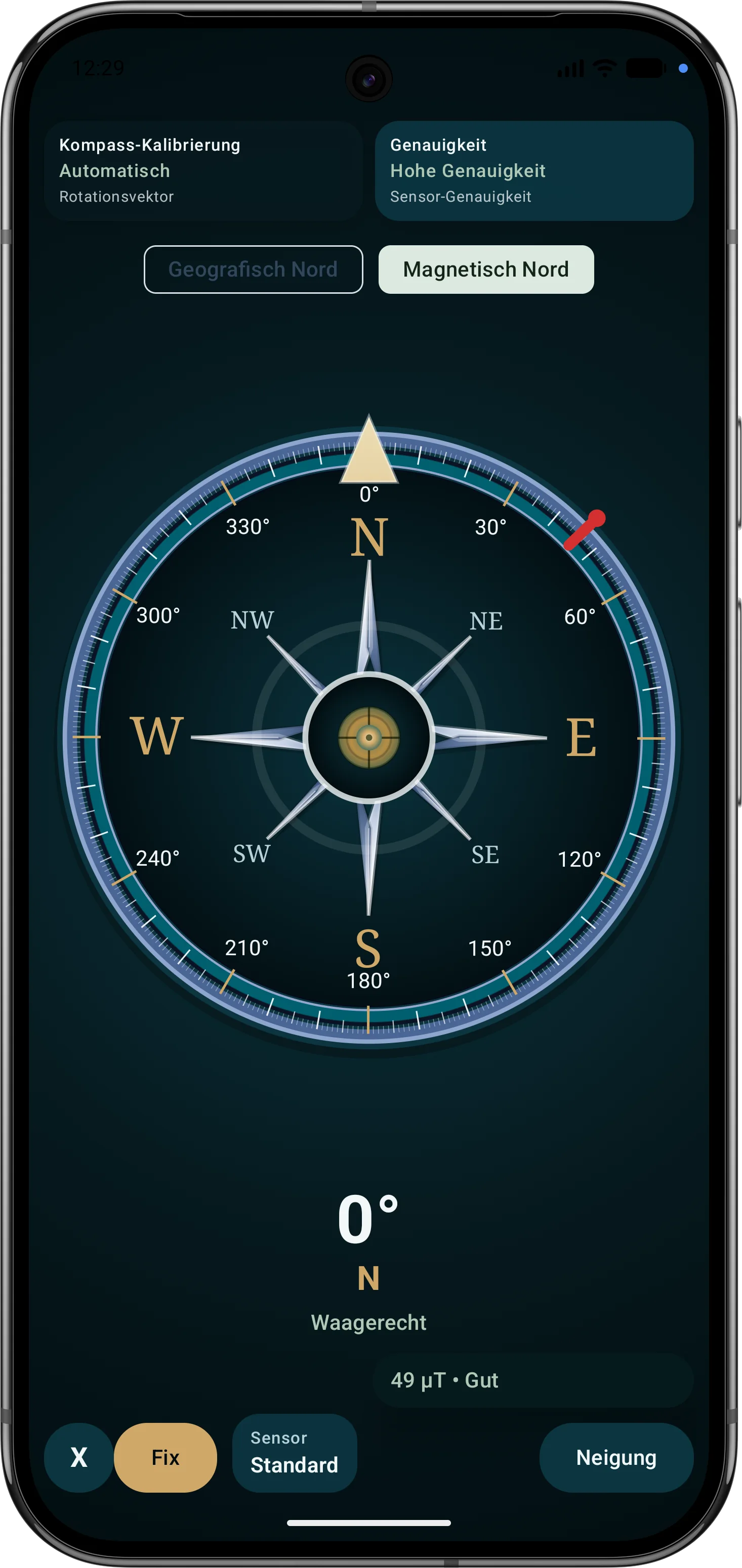
ArxSilex MapTools includes a practical outdoor compass for navigation, bearings, target alignment and map work. The app uses available motion sensors, magnetic field sensors and, while moving, also the GPS course to show the current viewing or movement direction as stably and transparently as possible.
More than north indication
The compass supports bearings to targets, alignment of map objects, work with routes and areas and visual orientation together with GPS position, map and LiveView.
Sensor sources
Depending on the device, fused Android sensor data, Rotation Vector, Geomagnetic Rotation Vector or a calculation from accelerometer and magnetic field sensor can be used. This keeps the compass usable on devices with different sensor hardware. The active source is shown in the display.
Auto, Horizontal and Vertical
In Auto mode, direction is not rigidly tied to one device edge. The app derives a practical viewing direction from the spatial posture of the smartphone, for example when it is slightly tilted in the hand, in a mount or on bicycle handlebars. Horizontal is suitable for use like a classic handheld compass; Vertical is suitable in front of the body, similar to a sighting or bearing direction over the display.
GPS course while moving
While moving, the app can additionally include the GPS movement course. This is useful when magnetic field sensors are disturbed by metal, vehicles, power lines, equipment or building structures. GPS course is weighted based on speed, course accuracy and sensor quality. When stationary, sensor orientation remains decisive; with sufficient movement, GPS additionally stabilizes the display.
Transparency and accuracy
The compass display shows sensor source, accuracy, magnetic field assessment and warnings for unfavorable device posture. This makes it visible whether the direction is based on high-quality sensor data, limited sensor data or additionally on GPS movement data. Achievable accuracy depends on the smartphone, sensor quality, calibration, magnetic environment, GPS reception and current movement.
For professional use
The compass is designed for demanding outdoor and field scenarios: terrain orientation, documentation of bearings, target indication, map work, route following and situational reference. Sensor decisions are made visible so the direction data basis remains understandable.
Important note
A smartphone compass does not replace operational training or required navigation tools. Magnetic field sensors can deviate due to environmental influences. For critical decisions, direction, position and target should always be checked with suitable additional means.