
MapTools for your use case
Offline hiking maps, route planning and GPS for mountain tours
Plan your route, take the right maps with you and keep distance, position and elevation in view even where mobile coverage is weak.

Typical workflow
When reception ends, the tour should already be prepared
Offline maps, the route and important waypoints should be on the Android device before setting off. MapTools brings these essentials into one map view, so hikers do not have to search through separate files or services on the trail.

Tools in the field
What MapTools does for Hiking, trekking & mountain tours
The essential tools form one clear mobile workflow and remain usable without a continuous data connection when maps and data have been prepared in advance.
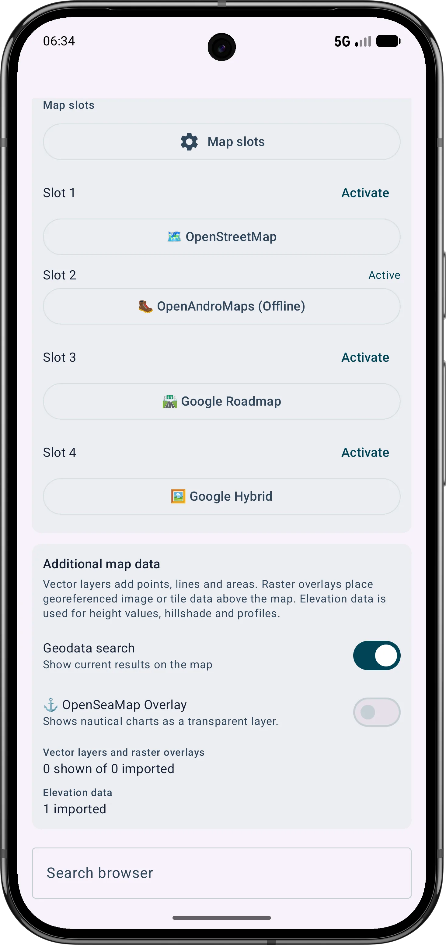
- Prepare offline maps and map presets for the planned region
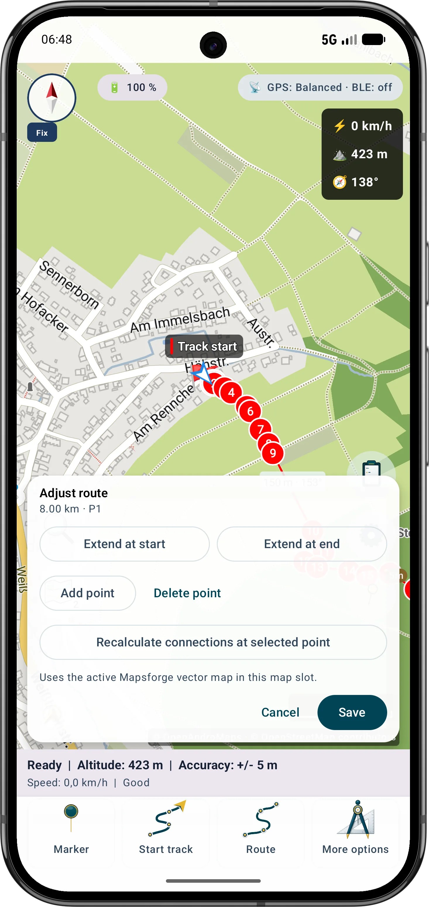
- Display and edit GPX routes and add waypoints
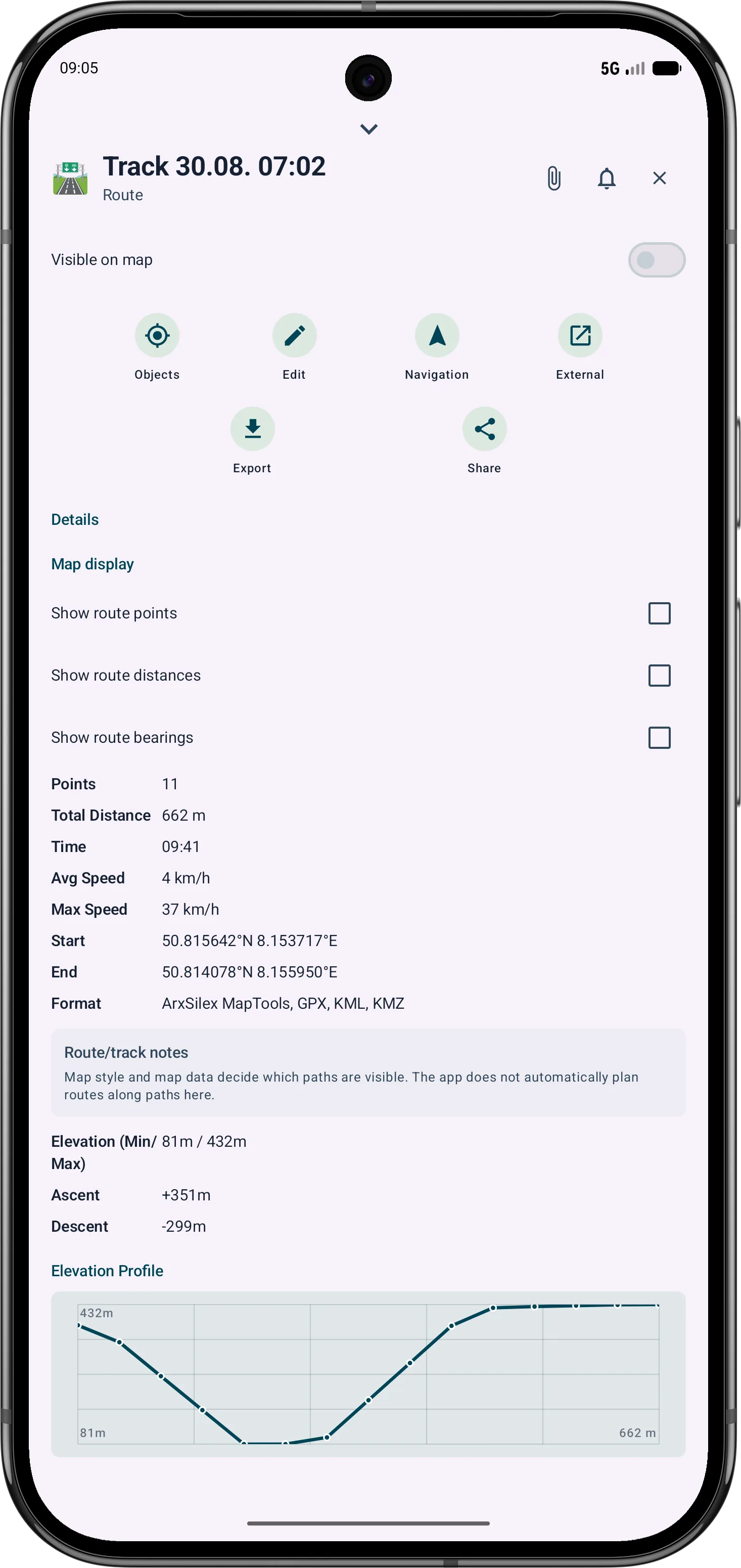
- Record tracks and review distance and elevation profiles
- Switch between online maps and prepared offline maps as needed
- Correct a track that was stopped too late using the map, point list or a time
Typical workflow
A typical hiking workflow in MapTools
The normal workflow starts at home or at the trailhead and ends with a track that can be reviewed.
- 1Prepare the map area
Download the required maps, profiles and other data before the tour and test them without a network connection. Switch between online maps and previously prepared offline maps as needed; online content that has not been loaded still requires a connection.
About offline data - 2Check or create the route
Import an existing GPX route or edit the route and its waypoints directly on the map.
Routes and tracks - 3Orient and record
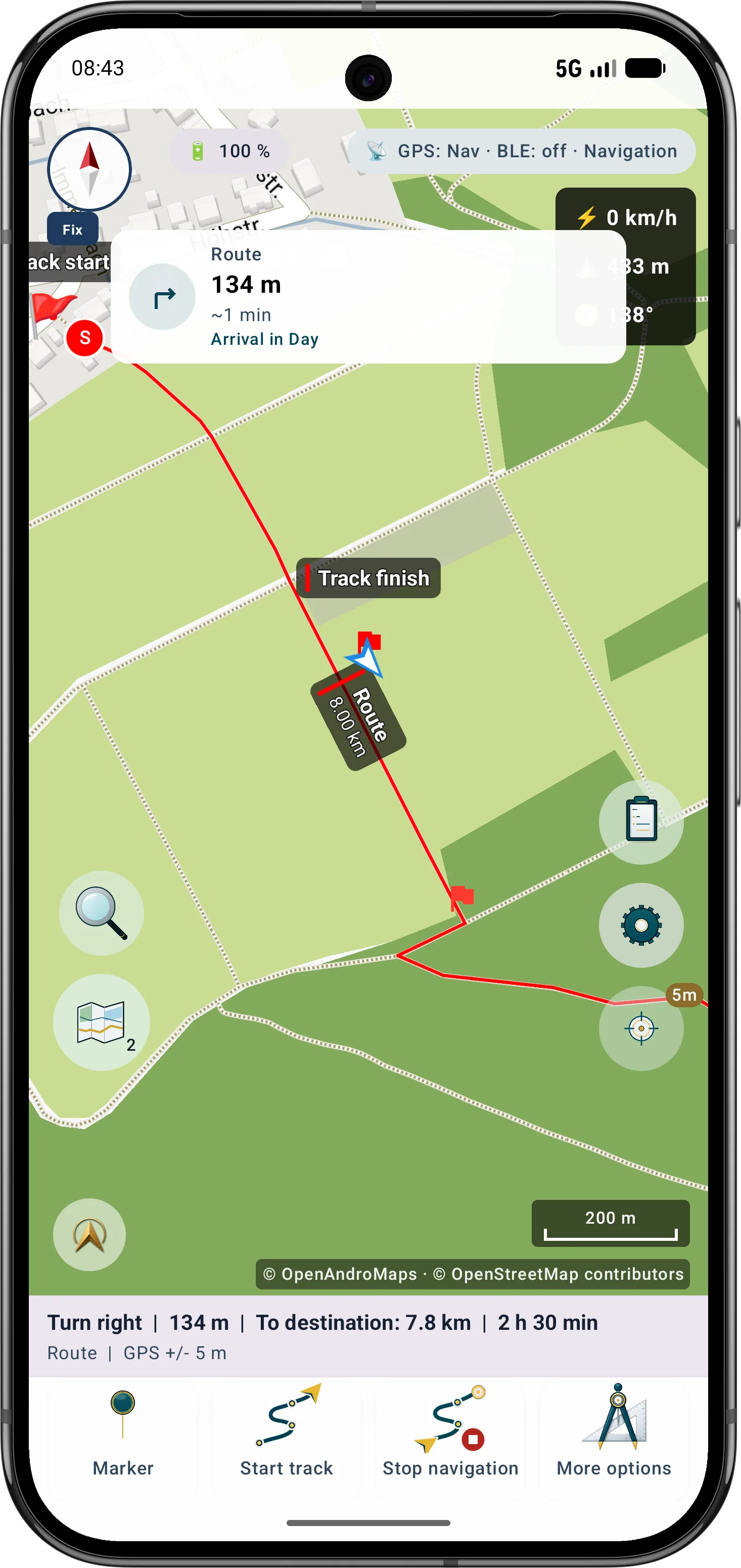
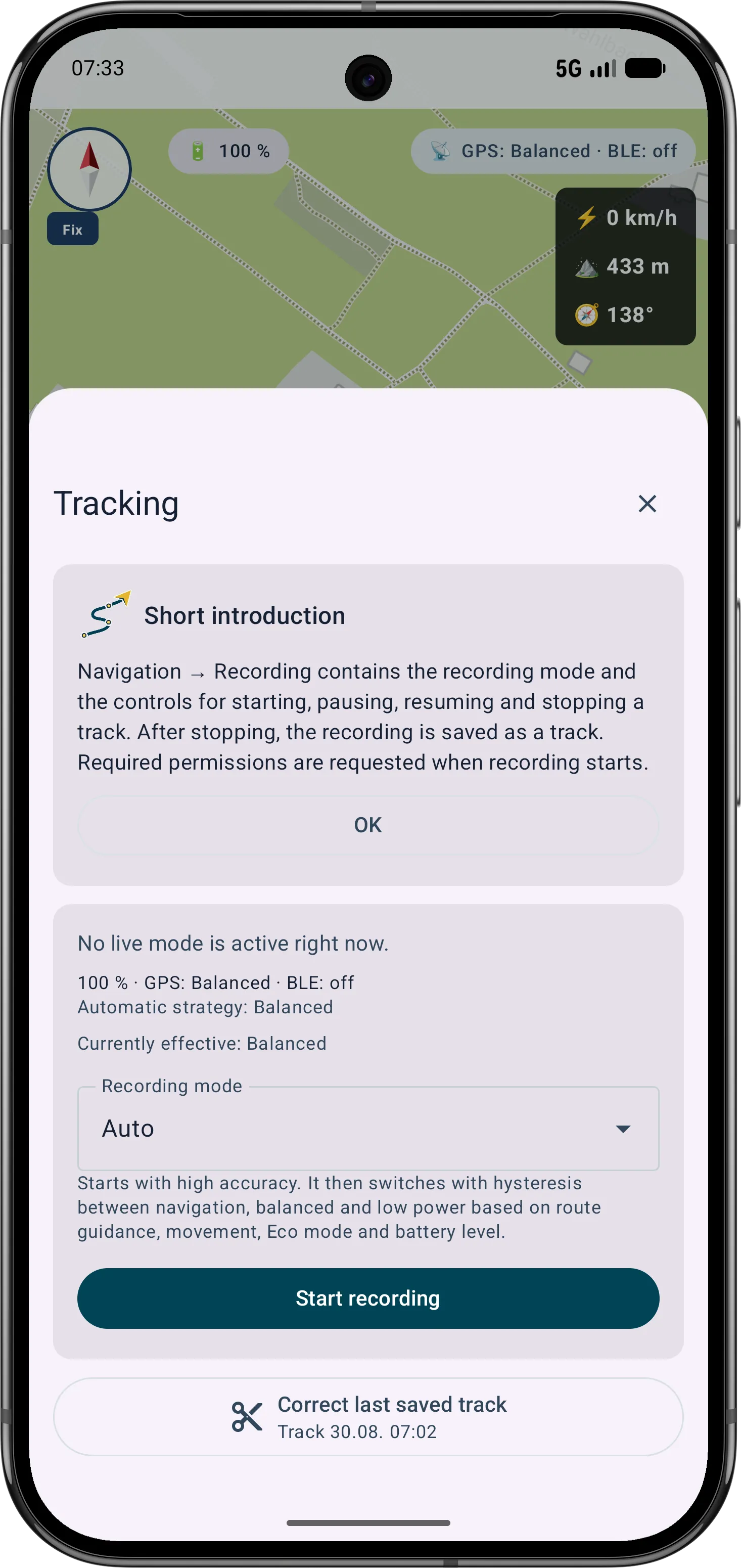
Compare your position with the route, follow it and record the path actually travelled as a track. The compact tracking bar shows recording status, while pauses and resumes remain traceable as segments.
Tracking and elevation - 4Review the tour
Check the track, distance, time and available elevation profile, then export the result if required. If recording stopped too late, choose the last valid point on the map, in the point list or by time and preferably save a corrected copy.
Tracking and elevation
Tools in the field
On the trail, a clear and traceable map view matters
MapTools displays the prepared route together with the current position and recorded track. This makes it easier to see whether the actual path still matches the plan without depending on a tour platform or a permanent internet connection.
- Review route, waypoints and current position together on the map
- Document the path actually travelled as a GPS track
- Review distance and elevation where suitable elevation data is available

Inside the app
Preparation and route directly in the app
The normal workflow starts at home or at the trailhead and ends with a track that can be reviewed. MapTools displays the prepared route together with the current position and recorded track. This makes it easier to see whether the actual path still matches the plan without depending on a tour platform or a permanent internet connection.
Go deeper
Optional: compare the route with daylight and twilight
The app combines the route, planned pace, breaks and available elevation data into one timeline. During a hike, it can cautiously adapt that timeline to the pace actually achieved.
Important in the field
Understand the practical limits
MapTools supports careful tour planning but does not replace local warnings, experience, suitable equipment or independent emergency preparation. GPS, compass and elevation readings depend on the device, surroundings and data source.
FAQ
Common questions about hiking with MapTools
Does MapTools work without mobile reception?
Yes, when the required maps and data have been prepared locally in advance. GPS can work without mobile service; online services and content that has not been downloaded still require a connection.
Can I import and edit an existing GPX route?
Supported routes and tracks can be imported, displayed on the map and edited with the route and track tools. Waypoints can be added to the workflow.
Can MapTools record my hike as a track?
MapTools can document the travelled path as a GPS track. Reliability and runtime also depend on location permission, Android power settings, GPS reception and the device.
How reliable are position, compass and elevation data?
They are orientation aids. Accuracy and availability depend on the device, sensors, terrain, reception and data source; they are not a safety or surveying guarantee.
ArxSilex MapTools
Try MapTools for Hiking, trekking & mountain tours
Start with the quick guide or install MapTools on your Android device.
Help shape MapTools
Which feature would you still like to see?
What is missing from your typical workflow, what should work differently, or which information is missing from this page? Tell us about your workflow and the specific need. Your feedback helps us improve MapTools for real field use.