MapTools for your use case

Import geocaches, solve coordinates and navigate directly

Import prepared geocache GPX files, inspect cache details and coordinates on the map, then start direct target navigation. Bearings, circles, intersections and GPS averaging support Mystery and Multi caches.

Mother and daughter solving a geocaching coordinate puzzle in the forest

Typical workflow

A coordinate puzzle starts with unambiguous source data

Transfer the listing clues deliberately into MapTools or import prepared GPX or LOC waypoints. Check the detected format, latitude and longitude, sign, hemisphere, units and any coordinate reference system before calculating further. MapTools itself does not load cache listings or synchronise logs.

Mother and daughter prepare a geocaching coordinate puzzle at a solid picnic table

Tools in the field

Geocaching tasks MapTools can actually support

The tools combine known coordinate and geometry clues visibly on one map. Solving the riddle and interpreting each clue remains the team's responsibility.

GPX import and target navigation

From geocache import to direct navigation

MapTools connects a locally supplied geocache file with the map, cache details and simple point navigation. It does not discover or synchronise listings itself.

Import Groundspeak GPX

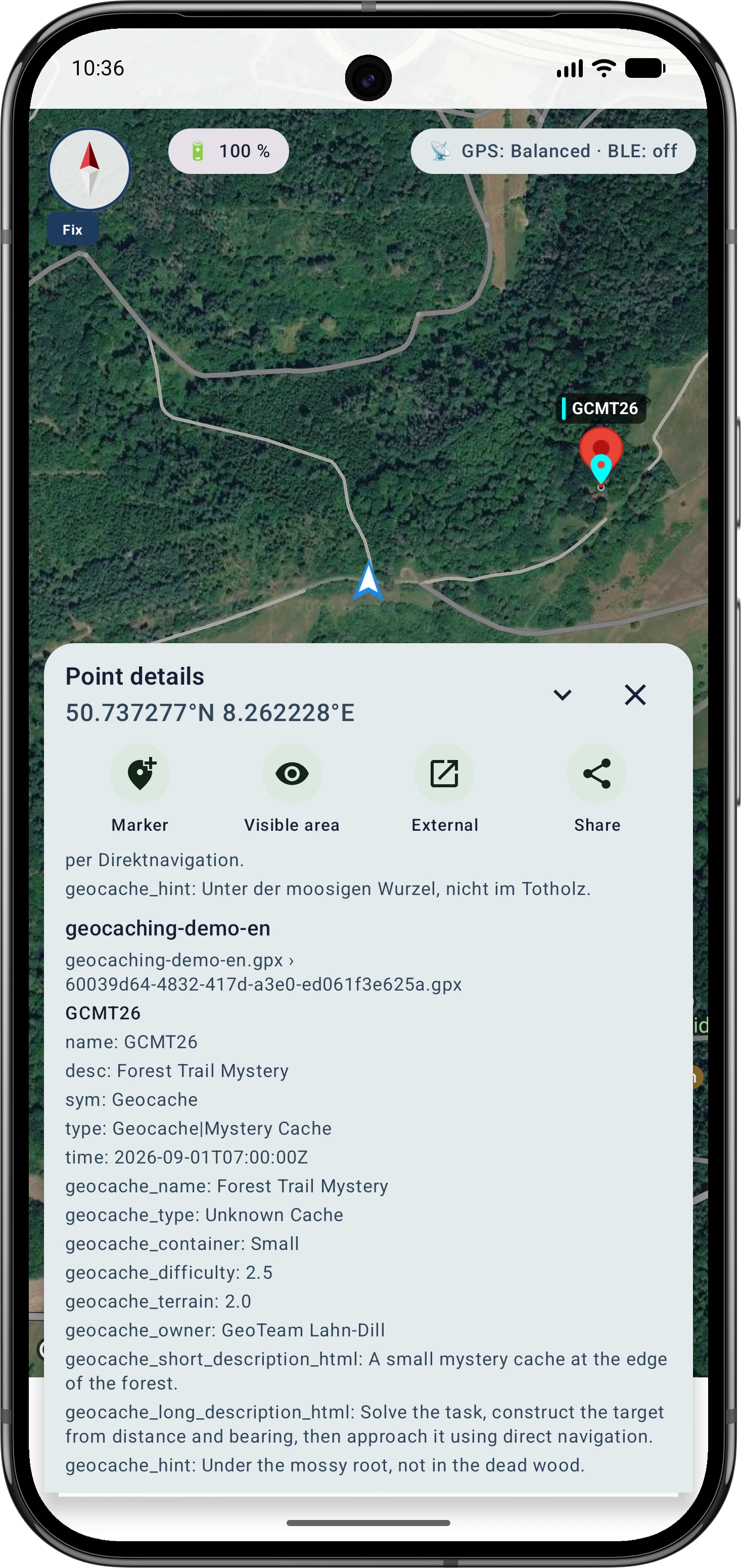
A cache is recognised as a dedicated marker. MapTools imports available core data such as cache code and name, type, difficulty, terrain, container size, owner, short and long descriptions and the stored hint. Recognised GPX child waypoints are imported as additional points.

Check the cache and coordinate

The imported point appears with a geocache marker on the map. Its details show the imported information and target coordinate. Scope and freshness depend entirely on the selected file.

Navigate directly to the point

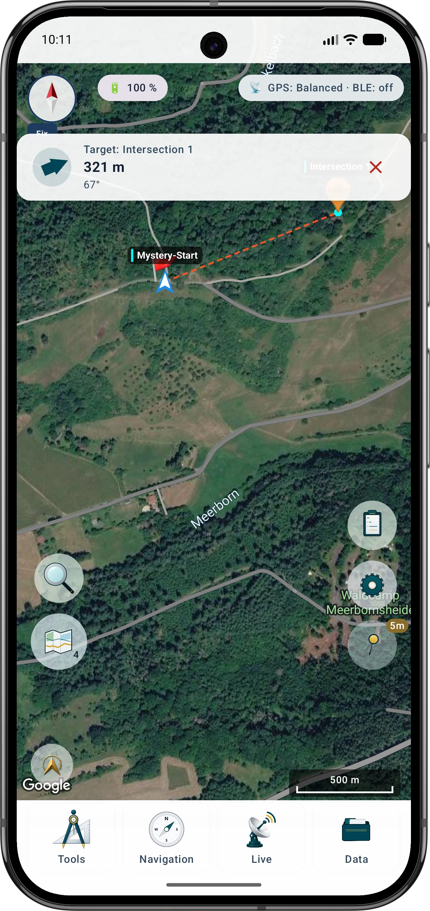
Set the cache marker as the target. Target navigation displays an arrow relative to device heading, the angle and remaining straight-line distance. It does not calculate a path or account for obstacles.

Current limit for images and links

MapTools currently does not display listing images from a geocache file. Images in HTML descriptions, embedded image data and images behind a URL are neither loaded automatically nor shown as cache images. Image and link viewing would therefore be a separate future feature request.

Typical workflow

A typical coordinate puzzle workflow in MapTools

This example represents a common projection from a start, distance and direction. Other Mystery or Multi-Caches may require additional calculations.

  1. 1
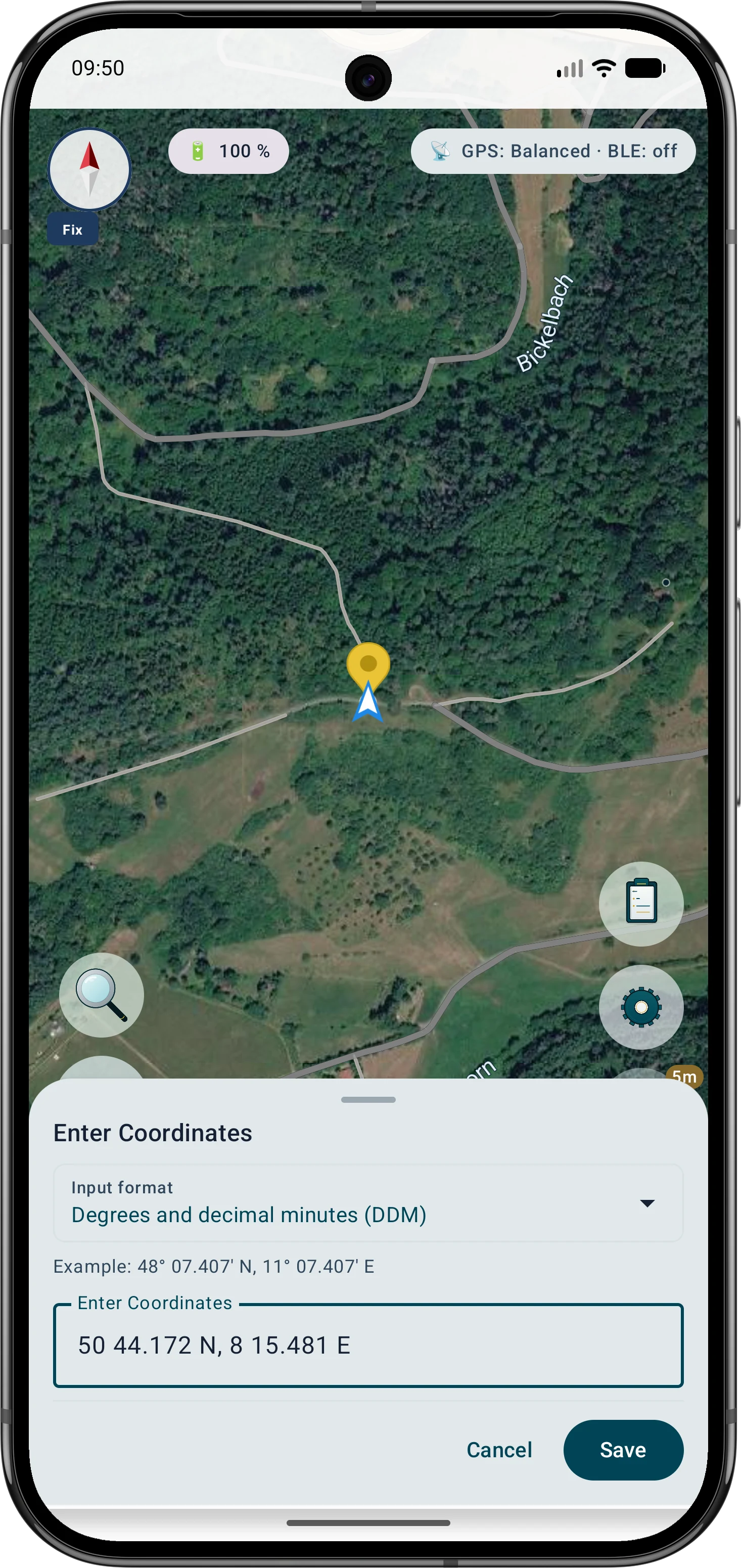
    Enter and verify the source coordinate

    Paste the coordinate, check the detected format and map position, then use it as a marker or tool point.

    Coordinate converter
  2. 2
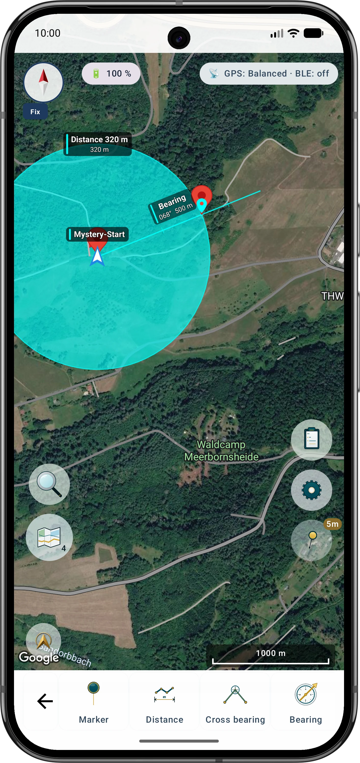
    Construct distance and direction

    At the start, create a circle with the stated distance and a bearing with the stated direction. Do not silently confuse true and magnetic north.

    Bearing and radius
  3. 3
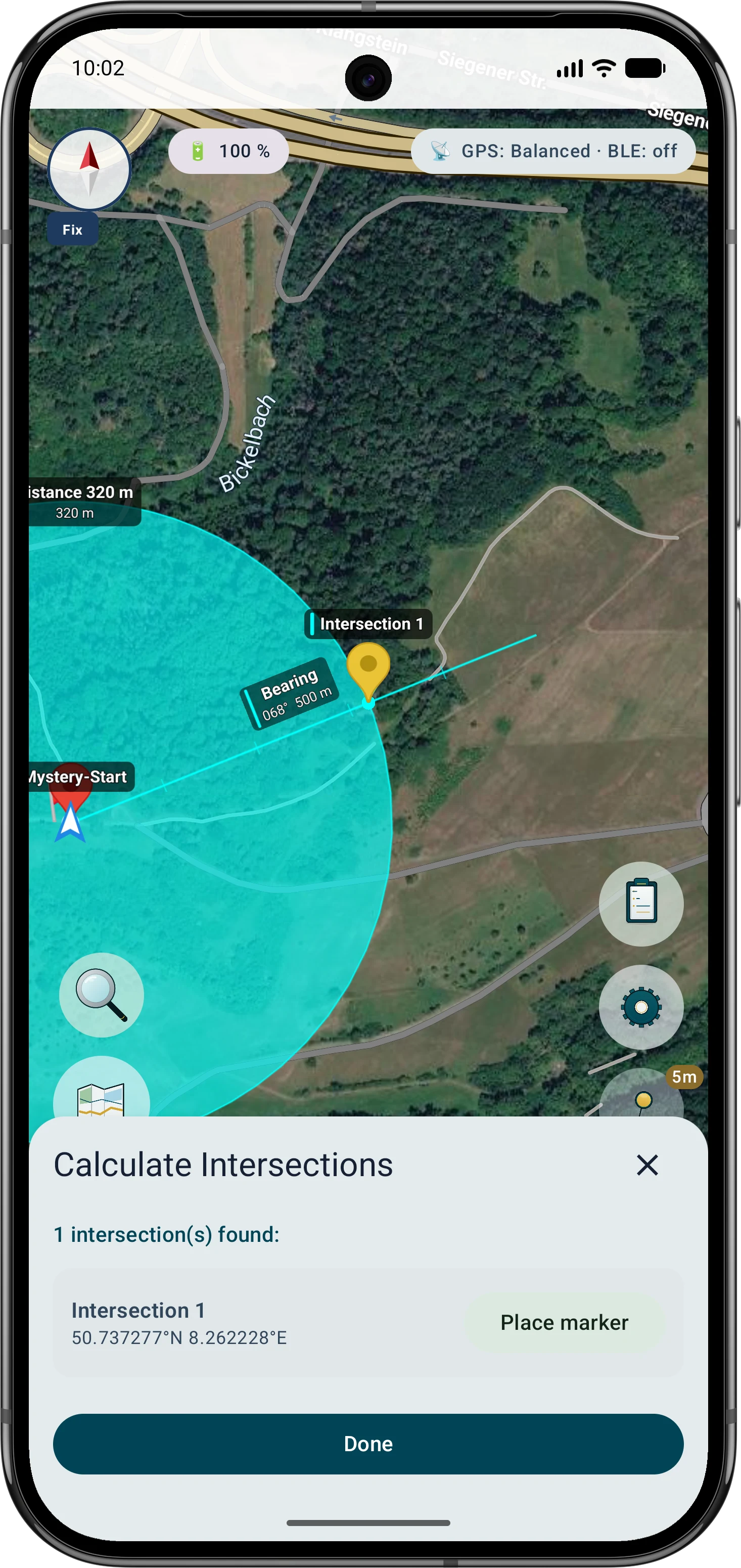
    Inspect and save the intersection

    Intersect circle and bearing, compare multiple results with the clue context and save the plausible candidate as a marker.

    Calculate intersections
  4. 4
    Navigate and interpret GPS

    Use the marker as a target. Stay still at the point, review measurement quality and compare a later second sample if needed.

    Target navigation with direction and distance

Tools in the field

At the calculated point, decimal places are not the deciding factor

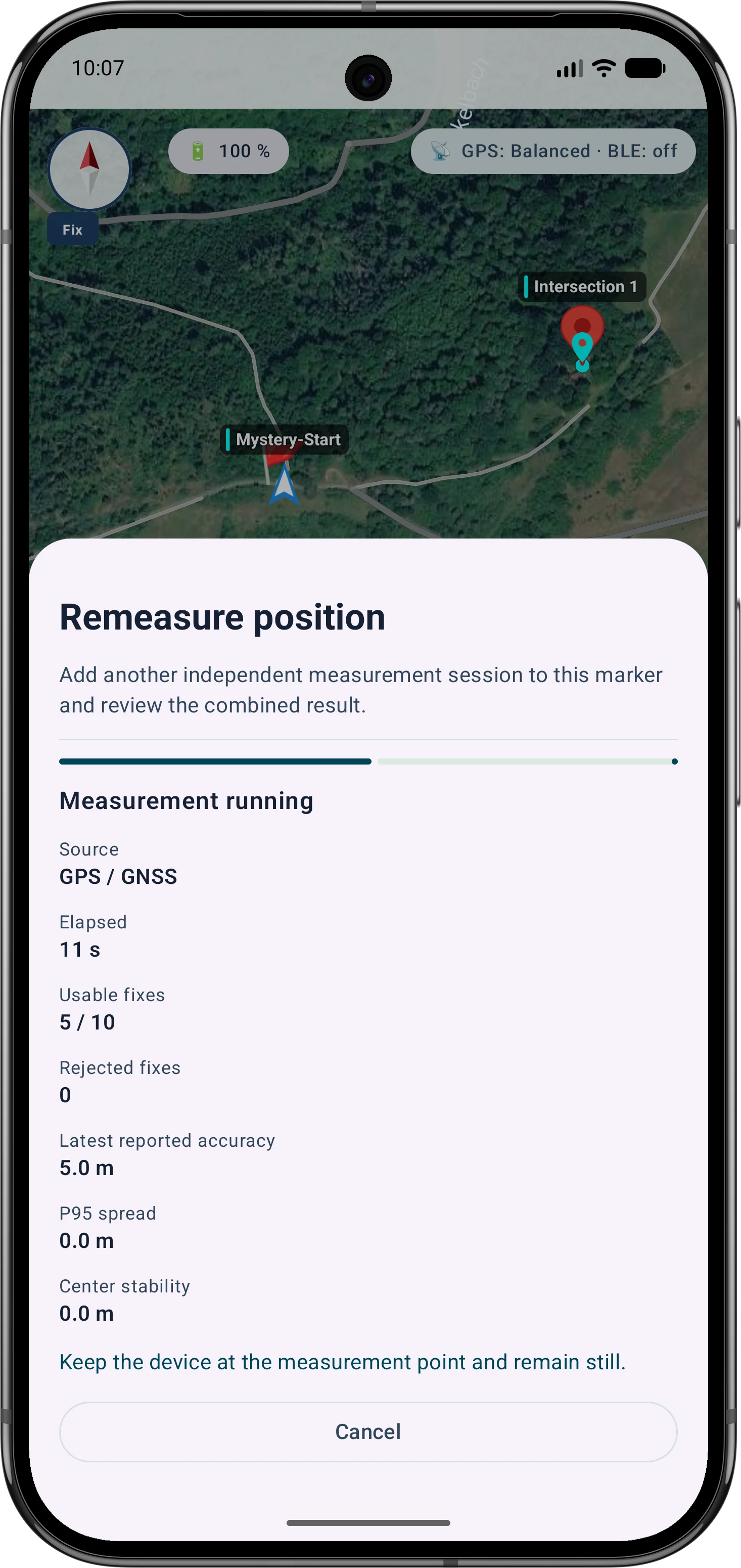
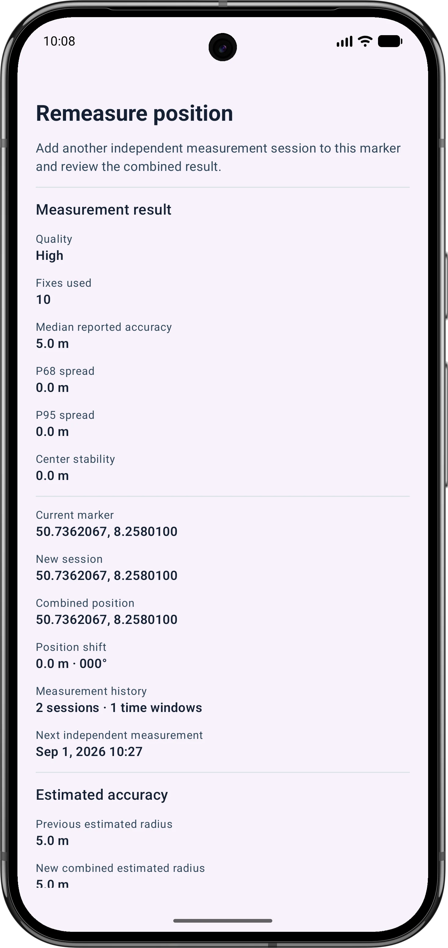
Under trees or beside rock faces and buildings, GPS fixes can wander. Stand still, give the receiver time and assess fix count, spread and quality. Averaging can reduce random scatter but cannot remove systematic error or inaccurate listing coordinates.

  • Measure with the clearest practical sky view and away from reflective surfaces
  • Review used fixes, P68, P95 and stability instead of only the coordinate
  • Repeat later or from a better reception situation when scatter remains conspicuous
Daughter holds the phone still for GPS averaging while the mother takes notes

Inside the app

Geometric clue and calculated target in the app

This example represents a common projection from a start, distance and direction. Other Mystery or Multi-Caches may require additional calculations. MapTools connects a locally supplied geocache file with the map, cache details and simple point navigation. It does not discover or synchronise listings itself. Under trees or beside rock faces and buildings, GPS fixes can wander. Stand still, give the receiver time and assess fix count, spread and quality. Averaging can reduce random scatter but cannot remove systematic error or inaccurate listing coordinates.

Enter and verify the source coordinate
Enter and verify the source coordinatePaste the coordinate, check the detected format and map position, then use it as a marker or tool point.Coordinate converter
Construct distance and direction
Construct distance and directionAt the start, create a circle with the stated distance and a bearing with the stated direction. Do not silently confuse true and magnetic north.Bearing and radius
Inspect and save the intersection
Inspect and save the intersectionIntersect circle and bearing, compare multiple results with the clue context and save the plausible candidate as a marker.Calculate intersections
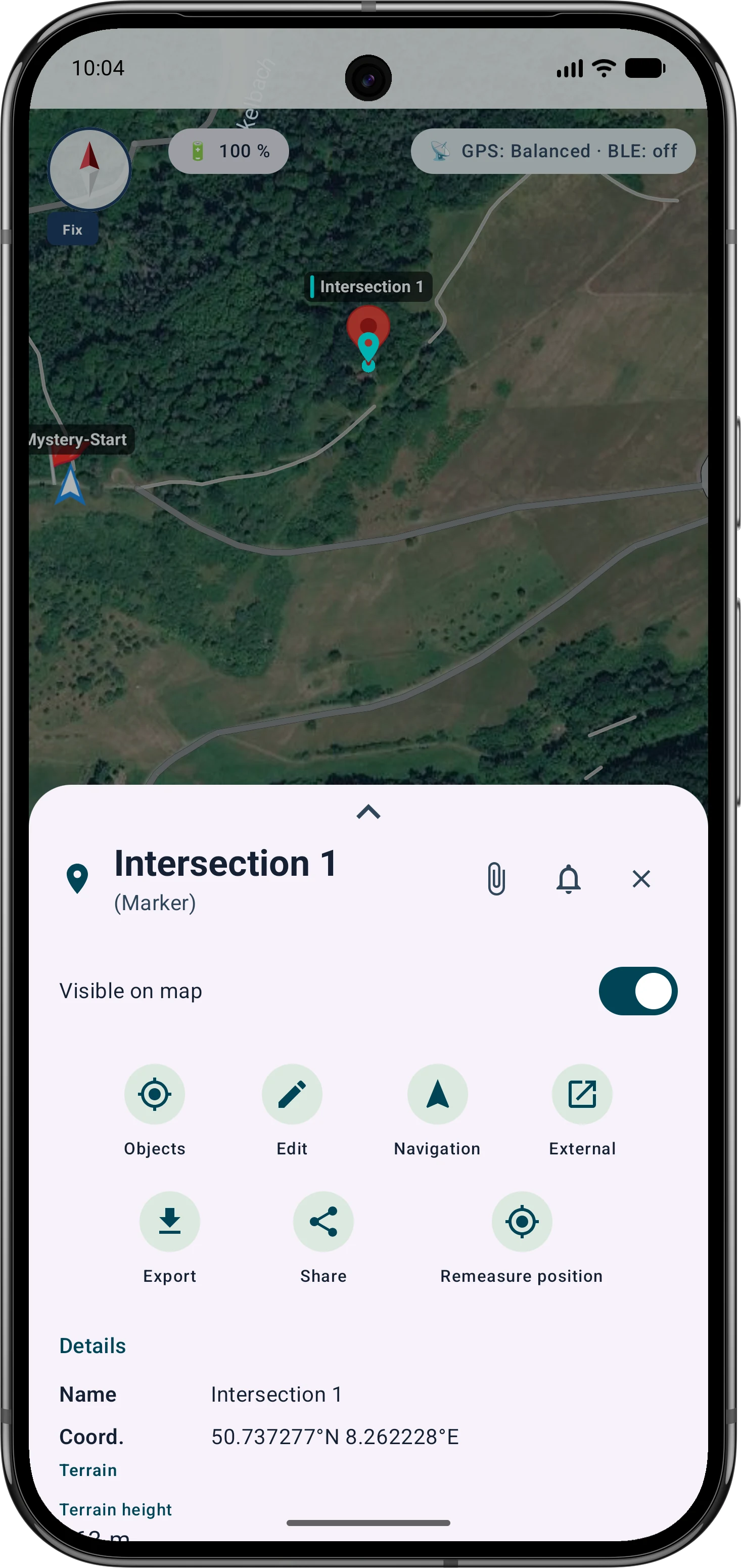
Target marker with verified coordinates
Target marker with verified coordinatesThe replacement will show the saved target in two or three coordinate formats without revealing a real cache.Coordinate converter
Average position
Average positionUse the marker as a target. Stay still at the point, review measurement quality and compare a later second sample if needed.Average position
At the calculated point, decimal places are not the deciding factor
At the calculated point, decimal places are not the deciding factorUnder trees or beside rock faces and buildings, GPS fixes can wander. Stand still, give the receiver time and assess fix count, spread and quality. Averaging can reduce random scatter but cannot remove systematic error or inaccurate listing coordinates.Average position
Navigate directly to the point
Navigate directly to the pointSet the cache marker as the target. Target navigation displays an arrow relative to device heading, the angle and remaining straight-line distance. It does not calculate a path or account for obstacles.Target navigation with direction and distance
Import Groundspeak GPX
Import Groundspeak GPXA cache is recognised as a dedicated marker. MapTools imports available core data such as cache code and name, type, difficulty, terrain, container size, owner, short and long descriptions and the stored hint. Recognised GPX child waypoints are imported as additional points.Import and supported formats

Go deeper

More decimals do not mean more accuracy

Conversion between DDM, DD, DMS or a grid only expresses the same point differently. It improves neither the source coordinate nor current GPS reception. First verify format, order, unit and map position, then assess measurement quality separately.

Avoid common input errors

Important in the field

Understand the practical limits

MapTools is a companion toolbox, not a geocaching platform with a cache database or log synchronisation. GPS accuracy and results depend on the device, reception, input data and selected coordinate system.

FAQ

Common questions about geocaching with MapTools

Which coordinate formats can I use for geocaching?

MapTools supports DD, DMS, DDM, UTM/UPS, MGRS/UPS, Plus Code, Maidenhead and Web Mercator plus selected projected CRSs. Format, axis order, zone, hemisphere and datum must be unambiguous.

How do I project a waypoint from distance and direction?

Create a circle for the distance and a bearing for the direction from the same start. Calculate their intersection, compare multiple candidates with the clue and save the appropriate point as a marker.

Can MapTools import GPX or LOC waypoints?

Yes. Groundspeak GPX can be imported as geocache markers. When present in the file, MapTools imports cache code and name, type, difficulty, terrain, container, owner, short and long descriptions and the hint; recognised child waypoints become additional points. GPX can also contain ordinary waypoints, routes and tracks. LOC remains a simpler waypoint format.

Why does the target wander in woodland?

Canopy, rock, buildings, device orientation and satellite geometry affect reception. Averaging exposes scatter and can reduce random error but does not guarantee the exact cache position.

Does MapTools solve Mystery Caches or sync listings and logs?

No. MapTools calculates coordinates and geometry you enter. It does not understand riddle text, load a cache database, or synchronise corrected coordinates and logs with a geocaching platform.

Are images from geocache files or linked listing images displayed?

Not currently. MapTools does not load images from HTML descriptions or image URLs as cache images and does not show embedded or supplied listing images in geocache details.

Can I navigate directly to an imported geocache?

Yes. Set the imported cache marker as the target. MapTools shows direction, angle and straight-line distance to the coordinate. This is direct point navigation without automatic path finding or obstacle checks.

ArxSilex MapTools

Try MapTools for Geocaching & coordinate puzzles

Start with the quick guide or install MapTools on your Android device.

Help shape MapTools

Which feature would you still like to see?

What is missing from your typical workflow, what should work differently, or which information is missing from this page? Tell us about your workflow and the specific need. Your feedback helps us improve MapTools for real field use.

Send feedback or a feature request