
MapTools for your use case
Discover old routes and traces with historical maps
Place a lawfully obtained, georeferenced historical map above a current base map. Compare old paths, former land use or remains such as charcoal hearths and ruins with today's terrain.

Before the hike
Check source, rights and georeferencing first
An old scan becomes a usable overlay only with a valid spatial reference. Use a lawful source, verify CRS and positional quality, and georeference a plain scan in GIS before importing. MapTools is intended for mobile use of the prepared result.

Tools in the field
What MapTools does for Hiking with historical maps
The essential tools form one clear mobile workflow and remain usable without a continuous data connection when maps and data have been prepared in advance.
- Import georeferenced raster data such as GeoTIFF, KML/KMZ or, depending on content, MBTiles and GeoPackage
- Place the historical layer over a current map, adjust opacity and prepare it for offline use
- Compare old paths, ruins, boundary stones or charcoal hearths and document your own markers or tracks
Typical workflow
From map source to field comparison
Clean preparation prevents a decorative old map from being mistaken for spatially reliable data.
- 1Check source and rights
Record file source, licence, scale, age and known accuracy.
Supported raster data - 2Import with georeferencing
Load GeoTIFF, KML/KMZ or a suitable raster container with the correct CRS.
Prepare offline data - 3Tune the map view
Combine historical layer, current base map and opacity in a suitable map preset.
Maps and presets - 4Document traces
Compare old routes or remains on site and mark observations only when useful.
Routes and tracks
Read traces
Find charcoal hearths and ruins in today's terrain
Historical maps can suggest former uses. A level platform with charcoal-rich soil, low wall remains or an abandoned path must still be interpreted carefully without disturbing the site.
- Compare a historical symbol with several visible terrain features
- Respect the site, remove nothing and follow protection and access rules
- Label your marker as an observation, not an official archaeological finding

Inside the app
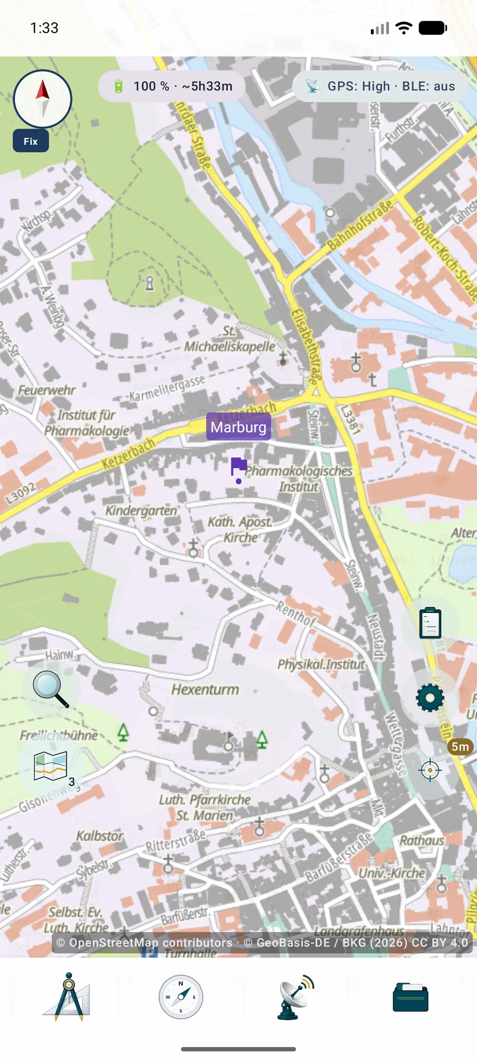
Historical map layer and opacity in MapTools
Clean preparation prevents a decorative old map from being mistaken for spatially reliable data. An old scan becomes a usable overlay only with a valid spatial reference. Use a lawful source, verify CRS and positional quality, and georeference a plain scan in GIS before importing. MapTools is intended for mobile use of the prepared result.
Important
A historical map is not current evidence of paths or boundaries
Paths may have vanished, boundaries changed and land may be closed. Use current maps, signs and local rules for navigation and access; the historical overlay is for comparison.
Important in the field
Understand the practical limits
MapTools does not include historical maps. Check source, georeferencing, coordinate reference system, usage rights and possible fees before import. Historical content may be inaccurate or obsolete and is not evidence of current paths, boundaries, access rights or safety.
FAQ
Historical maps: common questions
Are historical maps included with MapTools?
No. You obtain the data and check source rights, licence, fees, georeferencing and accuracy.
Can I use a plain scan directly?
Only if it is already spatially referenced in a supported format. A plain image scan must first be georeferenced and exported, for example in desktop GIS.
Does comparison work offline?
Yes, when historical layer, current base map and project data are prepared locally. Online services still require network and possibly credentials.
Does MapTools route along old paths?
No. An overlay displays map content. It does not verify that a historical path still exists, is passable or legal, and does not create automatic routing from it.
ArxSilex MapTools
Try MapTools for Hiking with historical maps
Start with the quick guide or install MapTools on your Android device.
Help shape MapTools
Which feature would you still like to see?
What is missing from your typical workflow, what should work differently, or which information is missing from this page? Tell us about your workflow and the specific need. Your feedback helps us improve MapTools for real field use.