
MapTools for your use case
Passively receive drone Remote ID on Android
Use a compatible Android device to passively receive broadcast Remote ID information nearby and place it in geographic context on the map.

Typical workflow
First check what the phone and radio path actually support
MapTools passively receives public Direct Remote ID broadcasts through paths available on the Android device. Before observing, check permissions and Bluetooth capabilities and, where supported, Wi-Fi NAN or Beacon reception. Android may throttle or reject active Wi-Fi scans, which also use more power.

Tools in the field
What MapTools does for Drones & Remote ID
The essential tools form one clear mobile workflow and remain usable without a continuous data connection when maps and data have been prepared in advance.
- Passively receive supported Bluetooth and Wi-Fi Broadcast Remote ID
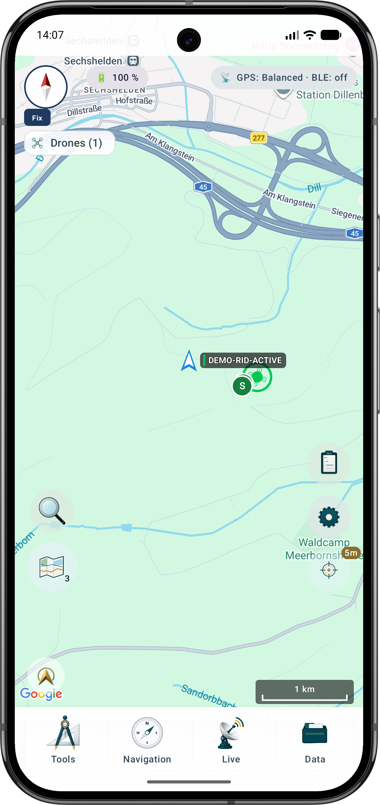
- Place drone and position information in geographic context
- Review received records locally and export them for documentation
Typical workflow
A typical Remote ID observation with MapTools
The workflow separates reception, interpretation and deliberate sharing. MapTools neither connects to nor controls a drone and can only show compatible signals received by the phone at that moment.
- 1Check reception capabilities
Enable Remote ID and verify which Bluetooth and Wi-Fi receiver paths the phone and Android version actually provide.
Reception and device limits - 2Check permissions and power
Grant required permissions, consider power saving and use active Wi-Fi scanning deliberately.
Understand permissions - 3Interpret monitor, map and details
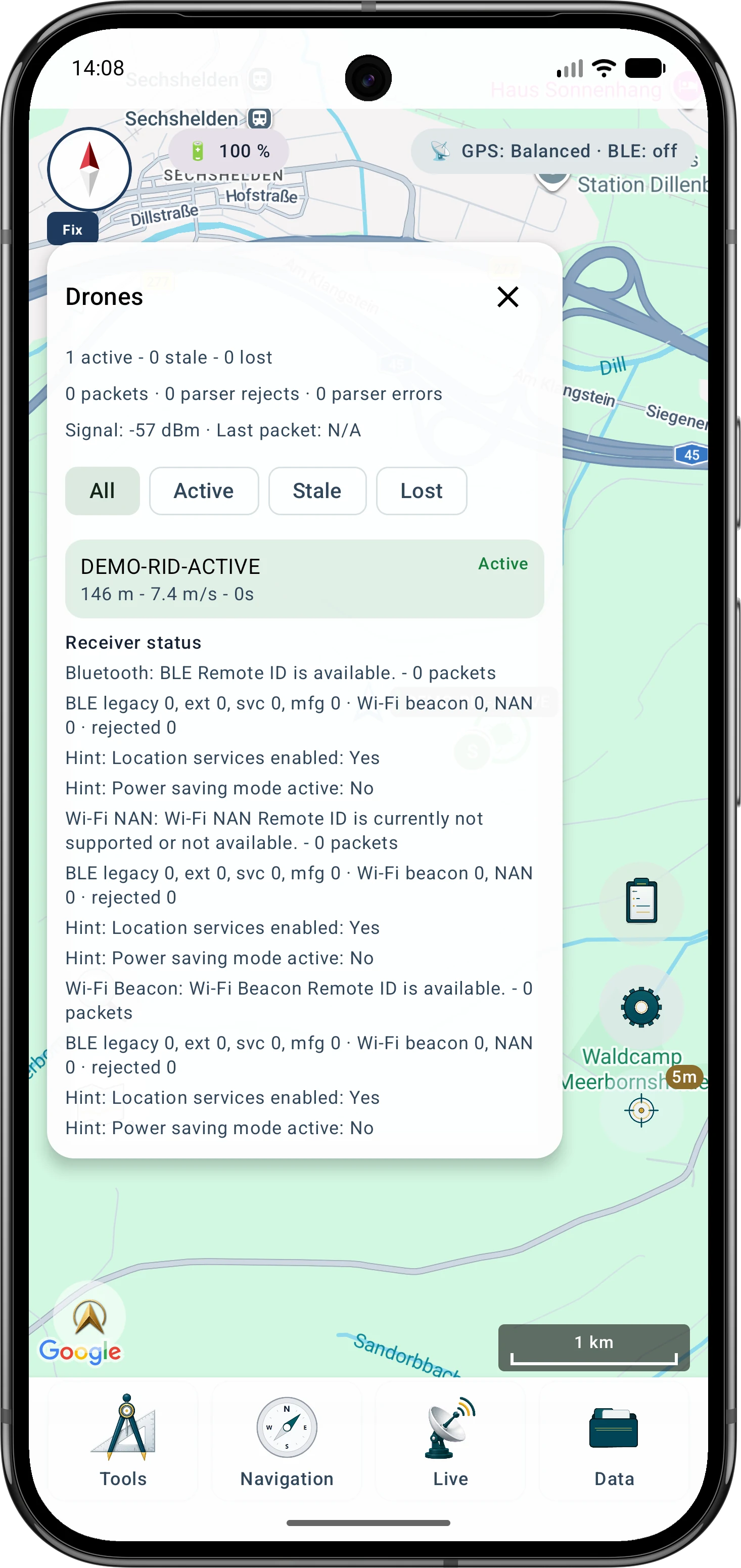
Filter active, stale or lost entries, inspect timestamps and receiver path, and compare reported map positions with the visible situation.
Remote ID monitor - 4Handle history and exports deliberately
Where history is available or enabled, review only needed records and export KML, GeoJSON or CSV intentionally. Avoid unnecessary sharing of identity or location data.
History and export
Tools in the field
Interpret received data before sharing it
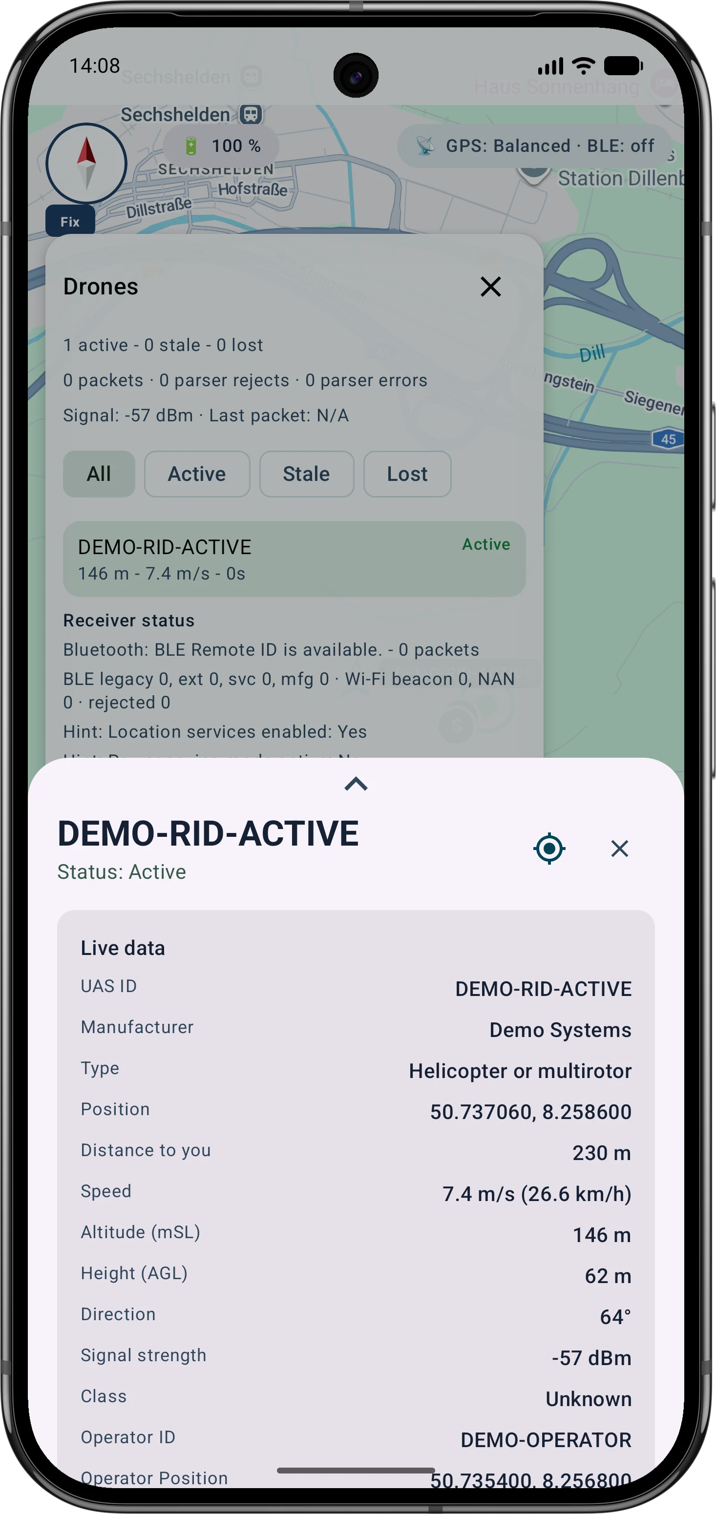
A received record shows what was broadcast and decoded by the phone; it is not an official finding. Check freshness, state, source and spatial plausibility. Operator or take-off positions appear only when they are actually broadcast.
- Consider timestamps and active, stale or lost state
- Do not confuse drone position with an optional operator or take-off position
- Share exports only with fictional or necessary identification data

Inside the app
Interpret monitor, map and details
The workflow separates reception, interpretation and deliberate sharing. MapTools neither connects to nor controls a drone and can only show compatible signals received by the phone at that moment. A received record shows what was broadcast and decoded by the phone; it is not an official finding. Check freshness, state, source and spatial plausibility. Operator or take-off positions appear only when they are actually broadcast.
Go deeper
Why an empty list is not an all-clear
No entry only means no compatible signal was received. The aircraft may not be broadcasting, may use another path, or reception may be affected by permissions, Android throttling, shielding, interference or device limitations. Visual observation and applicable procedures still matter.
Important in the field
Understand the practical limits
MapTools neither connects to nor controls a drone. Reception and range depend on Android version, hardware, permissions, signal, surroundings and broadcast protocol. No detection does not prove that no drone is present.
FAQ
Common questions about drone Remote ID in MapTools
Why is a visible drone not listed?
It must broadcast Direct Remote ID, the phone must support the path and Android must allow reception. Range, shielding, interference, permissions and scan throttling can prevent reception. An empty list does not prove that no drone is present.
Which data can MapTools show?
Only valid fields actually received, such as ID, drone position, height, speed, course, time, state, receiver path and signal strength. Operator or take-off positions appear only when broadcast.
Does reception require internet access?
Direct Remote ID reception and local processing do not require an ArxSilex cloud server. A background map must already be available offline or be loaded from its respective online service.
Can MapTools connect to or control a drone?
No. MapTools is a passive receiver for public broadcasts. It does not send control commands or establish a connection to the aircraft.
Is the display or export official evidence?
No. Display, history and export support local interpretation and documentation, but they are not an official finding, legal assessment or guarantee of completeness.
ArxSilex MapTools
Try MapTools for Drones & Remote ID
Start with the quick guide or install MapTools on your Android device.
Help shape MapTools
Which feature would you still like to see?
What is missing from your typical workflow, what should work differently, or which information is missing from this page? Tell us about your workflow and the specific need. Your feedback helps us improve MapTools for real field use.