功能

ArxSilex Map工具

在一个 Android 应用中整合地图、离线数据、地形、项目、导航和实时工具。

Terms

清楚区分地图、矢量图层和栅格叠加层

ArxSilex MapTools uses these terms deliberately. They make it clear whether a file is used as a base map, editable geometry, image overlay or elevation data source.

TermShort definitionExamples
MapsBase maps used as the main working view.OpenStreetMap, OpenAndroMaps, offline .map, MBTiles as a base map
Vector layersAdditional object, line or polygon data above the map. The content consists of points, lines or areas and can often be displayed or evaluated individually.GPX, KML, GeoJSON, Shapes, KML polygons, GeoJSON areas, GPX tracks as overlays
Raster overlaysGeoreferenced image or tile data above the map. They are placed as a finished image surface and are not interpreted as individual objects.GeoTIFF, MBTiles, image maps, aerial imagery, scanned maps, georeferenced plans
Elevation data / terrain数据来源 用于高程值和地形分析。它们并不是狭义上的可见地图,但会提供高度信息。HGT, DEM GeoTIFF, ASC, DTED
Map styleRendering rules for vector maps. The style defines colors, symbols, paths, POIs, contour lines and other map elements.OpenAndroMaps render theme, Elevate Theme
POI dataSearch and display data for places and points of interest.OpenAndroMaps .poi, custom POI files

Vector layers

矢量图层包含独立几何对象。它们适用于规划数据、边界、搜索区域、路线、轨迹以及导入的项目信息。

Raster overlays

栅格叠加层是覆盖在地图上方的成品图像面。它们适用于航拍图像、历史地图、扫描图或特殊地图视图。通常会调整透明度,使下方的底图仍然可见。

Show or use

地图、矢量图层和栅格叠加层可以显示在地图中。高程数据通常由工具使用,例如点高程、高程剖面、山体阴影、等高线和可视范围。

概览

ArxSilex Map工具 可以帮助你做什么

使用核心工具处理地图、地理数据、定位和现场文档。

地图与图层

  • 在线和离线地图
  • Mapsforge、MBTiles 和 GeoPackage
  • 来自 GeoTIFF、KML 或 KMZ 的栅格叠加层
  • 图层可见性和地图配置文件

地形与可视范围

  • HGT、DEM GeoTIFF、ASC 和 DTED
  • 点高程、剖面和气压计上下文
  • 山体阴影和等高线
  • 包含观察高度和地形采样的可视范围

数据中心与智能导入

  • 自动识别合适的导入目标
  • 分别管理地图、图层、POI、地形和主题
  • 检查离线状态、活动数据和导入历史
  • 根据内容检查 ZIP 包

渲染主题

  • 以 ZIP 导入 Mapsforge 样式
  • 检查兼容性和启用状态
  • 将配置文件与地图和主题组合
  • 遵守外部主题许可证

地图对象与项目

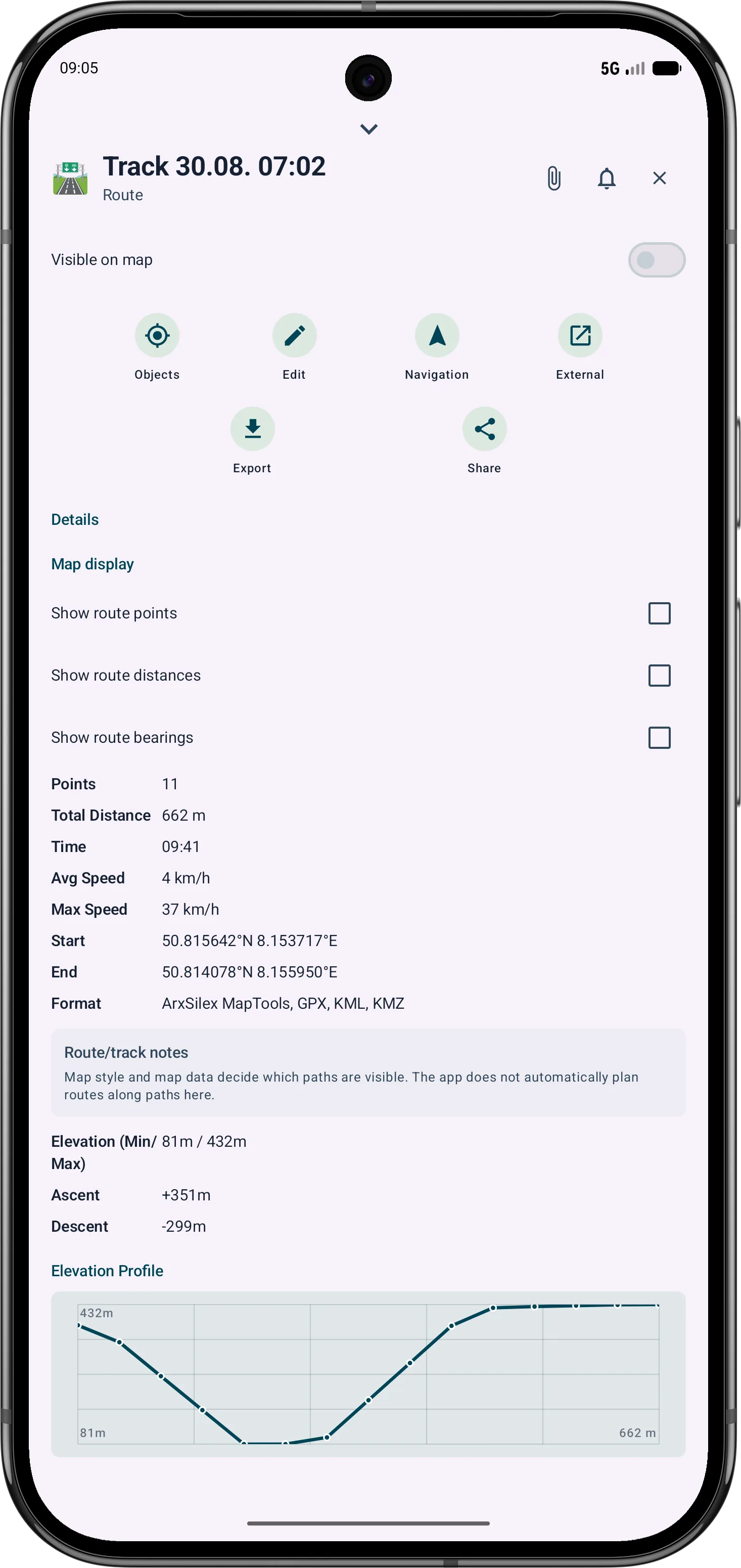
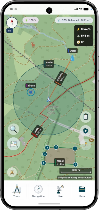
  • 标记、POI、路线、轨迹、圆和区域
  • 为区域和圆形区域计算立柱和围栏估算 (Pro)
  • 方位角、距离和交点
  • 项目浏览器和过滤器
  • .asmaps 用于备份和交换

搜索网格与覆盖范围

  • 将区域划分为搜索单元
  • 根据轨迹移动标记已访问单元
  • 动态宽度的覆盖条带
  • 适合系统化区域作业

实时功能

  • 附近的 BLE 群组
  • 实时中心和参与者状态
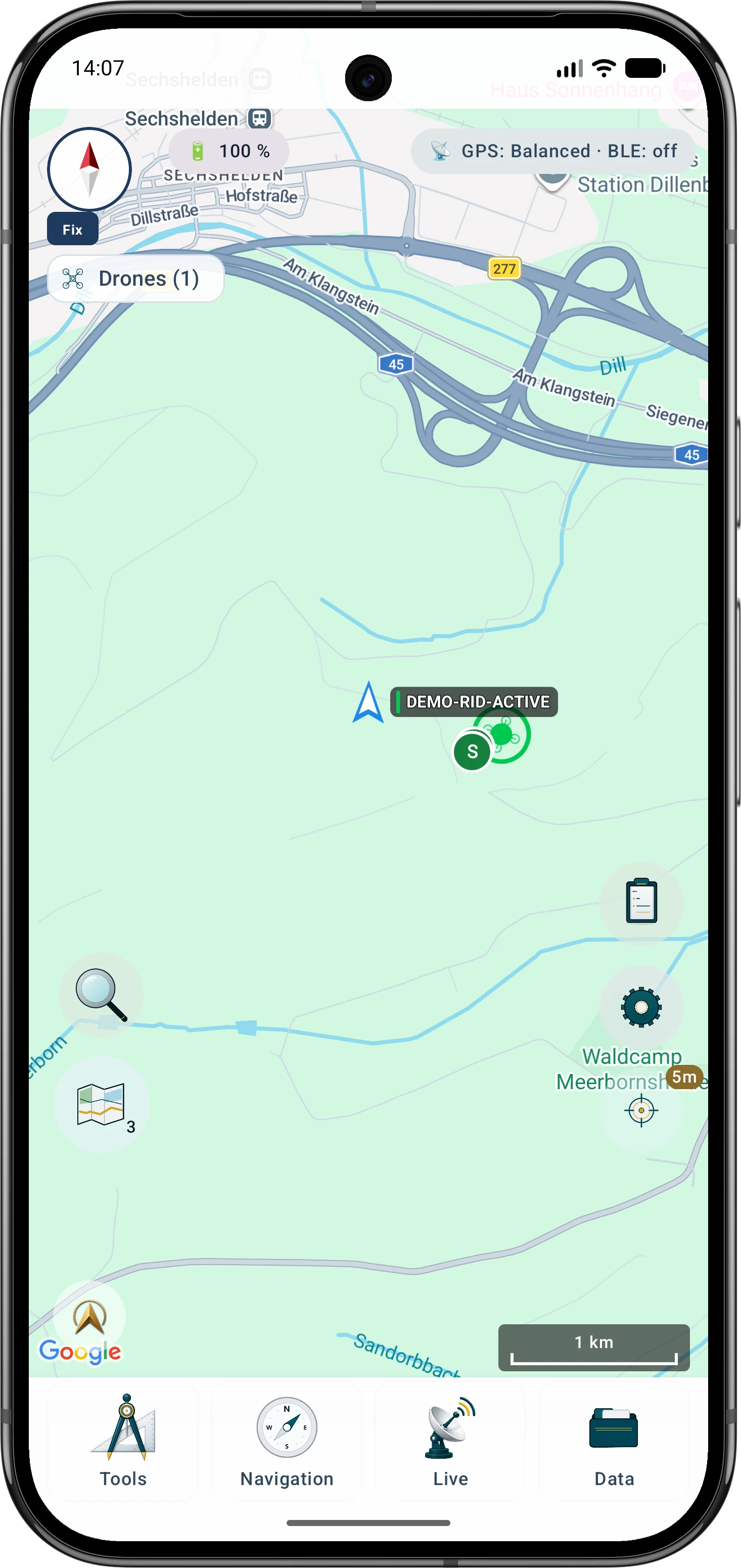
  • Remote ID 接收并可导出
  • 依赖设备和 Android 的测试功能

备份与恢复

  • 将应用备份创建为 .asmaps.bak 文件
  • 有选择地备份项目、设置、配置文件和本地数据
  • 可选密码加密
  • 可恢复为新项目、替换、合并或选择性导入

AR / LiveView

  • 相机视图中的方位角和目标
  • 将 POI、峰点、轨迹和搜索网格作为 AR 参考
  • 依赖传感器和 ARCore
  • 基础版和 Pro 的范围不同

详情

这些功能在实践中的作用

了解每个工具的用途以及可能需要的数据或设备功能。

功能用途上下文
可视范围使用可用高程数据计算从某一点可见的区域。需要合适的地形数据;结果取决于分辨率和覆盖范围。
山体阴影与等高线使地形形态更易读,并补充高程剖面和点高程。使用 HGT、DEM GeoTIFF、ASC 或 DTED。
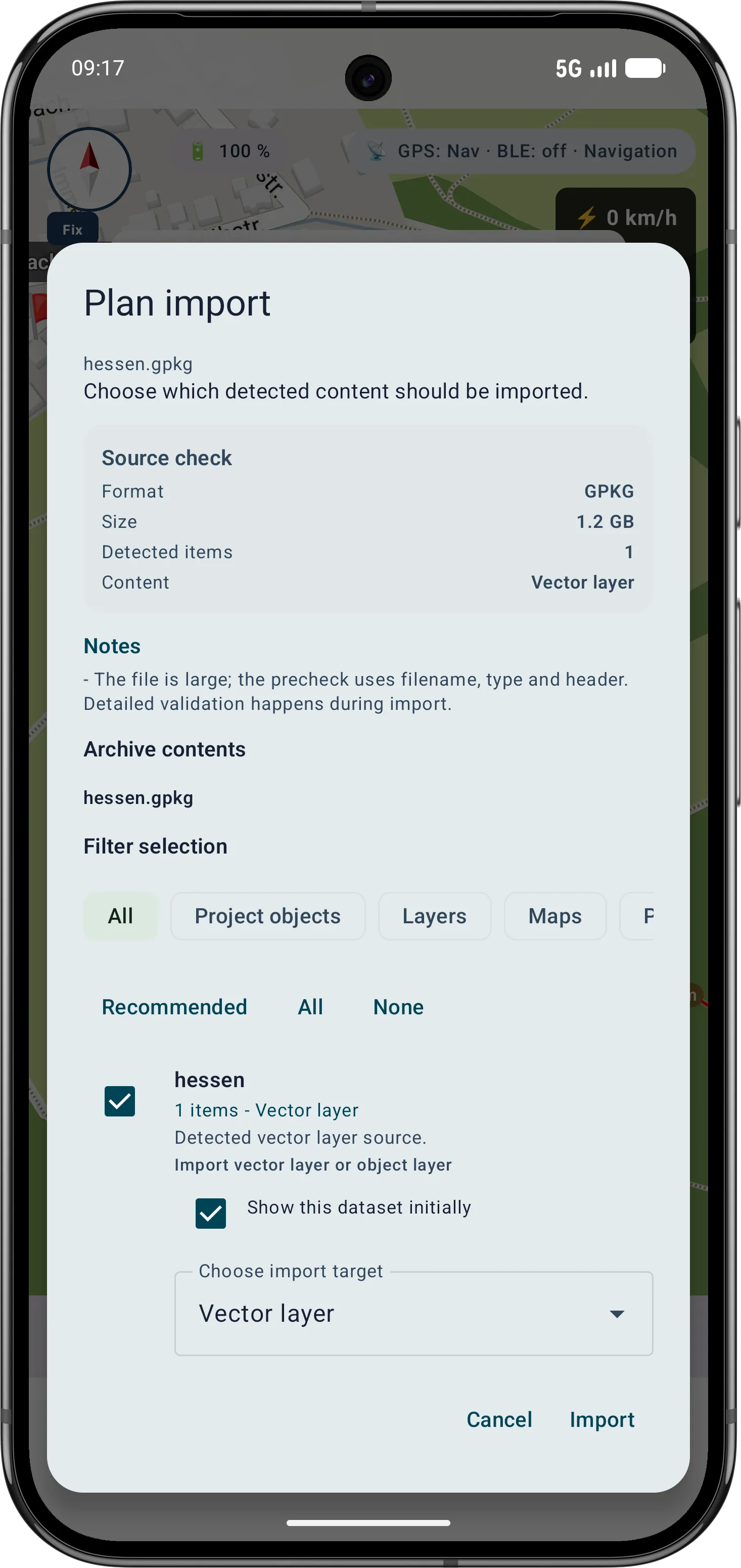
智能导入将文件分配到合适目标:项目、地图、地形、栅格叠加层、图层、POI、路线或轨迹。对于 ZIP 或 GeoPackage 等容器,内容本身很重要。
点详情地图点可提供道路、POI、地形、坐标和导入图层的上下文。详情级别取决于地图、标签和导入的数据。
Remote ID接收公开广播的 Remote ID 信号,并可导出历史记录。接收效果取决于地区、设备、无线电环境和权限。
BLE 群组无需应用自有服务器,即可在附近本地显示群组位置和状态。需要相应的 Bluetooth/Nearby 权限。
备份与恢复将选定的应用内容保存为 .asmaps.bak 文件,并由用户主动恢复。备份可包含项目、设置、配置文件、POI、群组和本地数据;可选择加密。
AR/LiveView在相机视图中显示目标、方位角、POI、峰点、轨迹或搜索网格。传感器质量和设备兼容性很关键。

GeoPackage

GeoPackage

GeoPackage 仍主要用于地图、瓦片容器和要素图层。地形功能请使用 HGT、DEM GeoTIFF、ASC 或 DTED。

??

Refine bearings, areas and routes more precisely

The current tools support more guided measurement and correction workflows so existing objects do not need to be recreated.

? Guided cross bearing for distance work

The app guides the selection of suitable bearings, circles or measurement objects, calculates intersections and can save the result as a marker.

更多详情

? Edit areas later

Polygon areas can be refined through their vertices. Side lengths, interior angles and distances help correct boundaries in the field.

更多详情

? Edit routes later

Route points and segments can be adjusted later. Bearing, distances and direction angles remain visible and understandable on the map.

更多详情

Intersection calculation from bearing and circle
Editing an area with vertices, angles and distances
Refining a route with bearing and distances

当前 Scope

New and expanded features

These capabilities are especially relevant in the current app version and are grouped here.

Guided cross bearing

Bearings, circles and measurement objects can be combined in a guided flow to determine intersections and distances.

Area editing

Polygon areas can be refined later through their vertices while side lengths, interior angles and distances stay visible.

Route editing

Route points and segments can be adjusted later with bearing, distances and direction angles.

指南针和方向作业

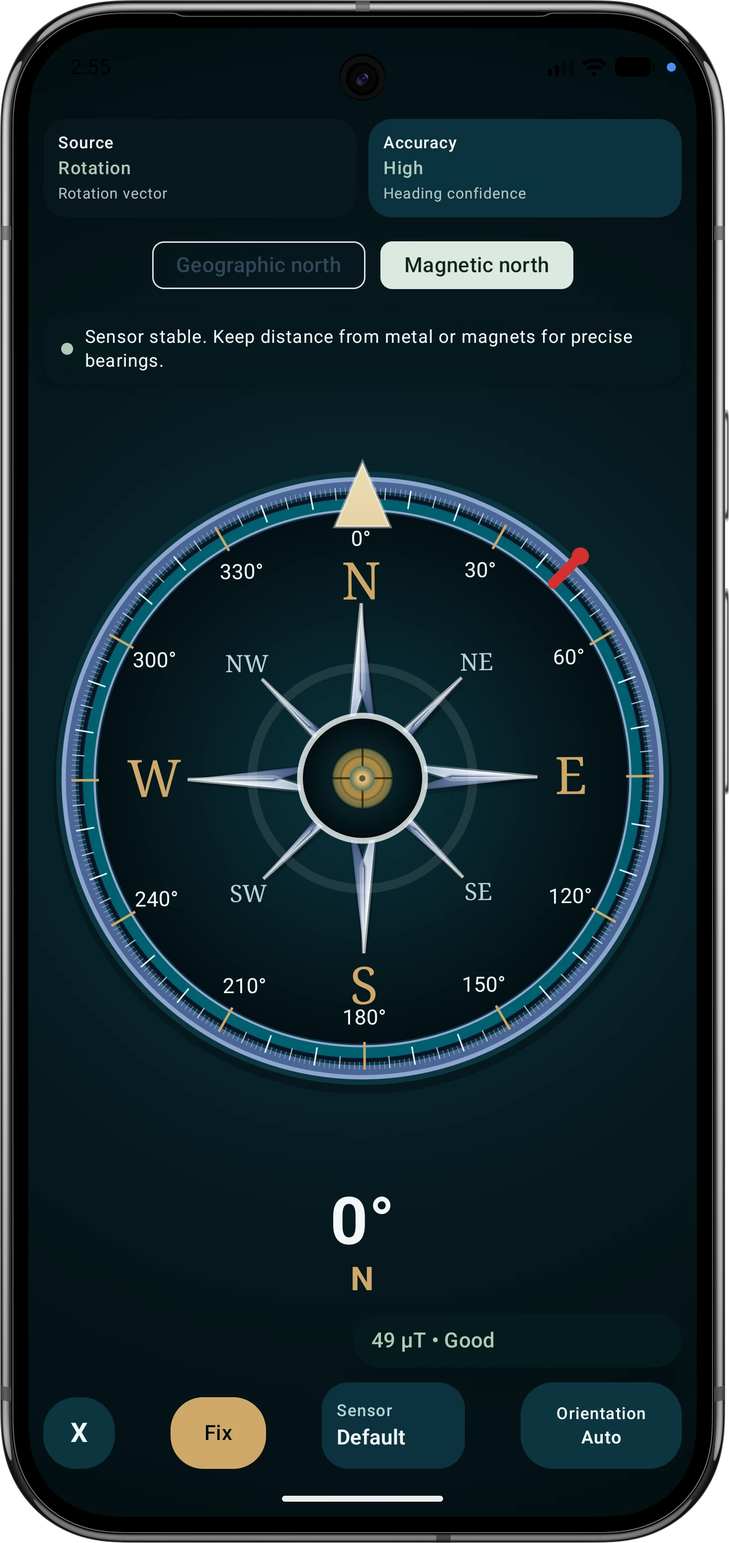
户外指南针支持导航、方位、目标对准和地图作业。传感器来源、磁场评估、视图模式以及移动时的 GPS 航向会透明显示。

Remote ID details

Drone reception shows BLE, Wi-Fi NAN, Wi-Fi Beacon, operator/system data, diagnostics and optional export where device and signal source support it.

自定义菜单布局

子菜单可以按常用工具排序,让野外作业中的重要功能更快找到。