 コンパスと修正地図の方向と固定方位方向。
 ツール
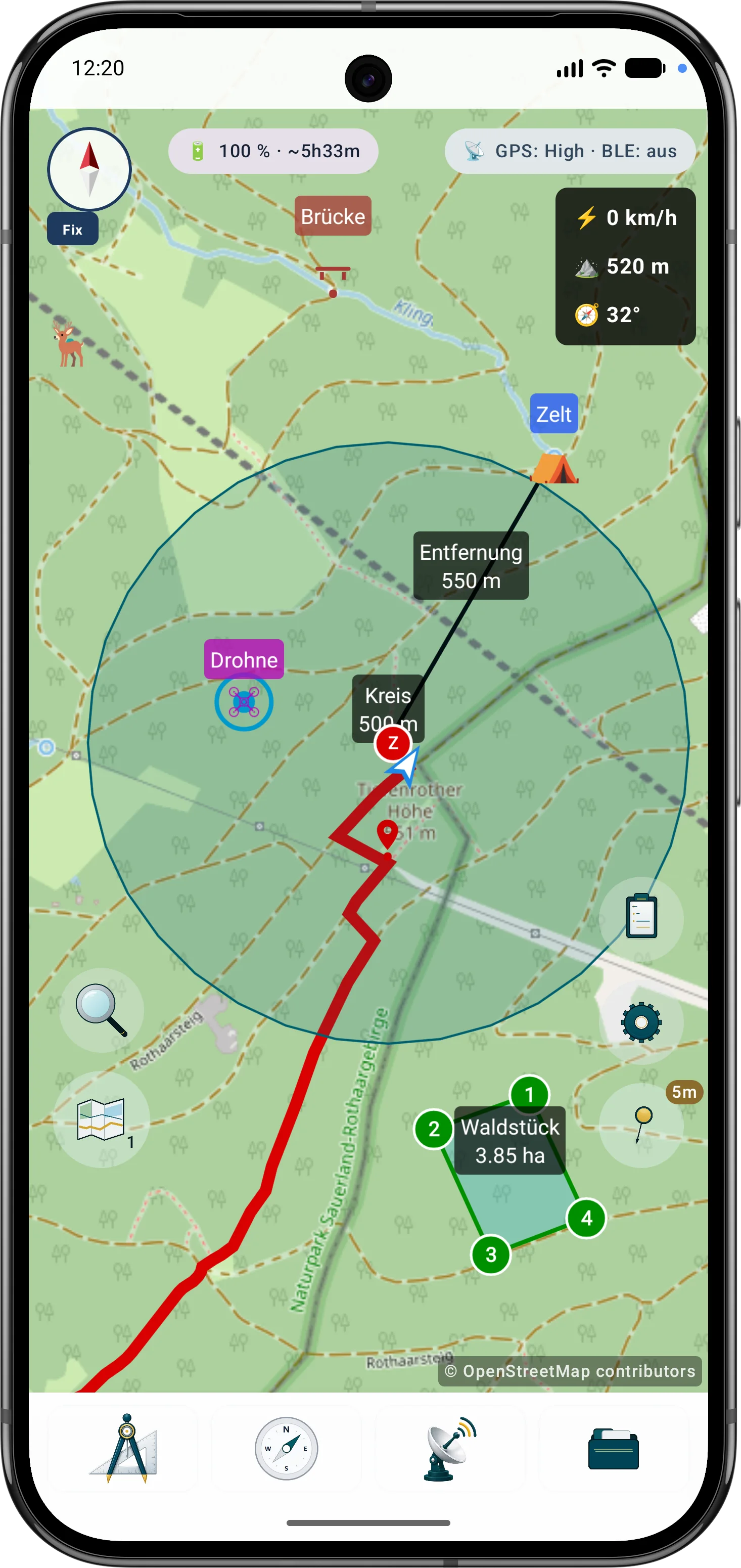
ツールバーは、ワークスペース上でマップ アクションを直接開始します。
- マーカーとドキュメントポイントを追加する
- 距離、方位、面積、円を作成する
- ルートポイントを設定し、視界範囲を計算する
- アクティブなツールをキャンセルしたり、入力を段階的に元に戻したりする
始める
標準画面、ツール、レイヤー、マップ、オブジェクト、検索、ライブ機能を簡単に紹介します。
インタフェース
標準画面では地図が作業領域になります。番号付きのマーカーは表示される操作部の近くにあり、凡例が各領域を説明します。詳細リンクだけが追加のマニュアルページを開きます。
画面領域
主要なコントロールはマップ ビューから直接利用できます。
ツールバーは、ワークスペース上でマップ アクションを直接開始します。
設定メニューは、動作、表示、および作業プロファイルをグループ化します。
どのマップ レイヤーとデータ レイヤーを表示するかを制御します。
マップ ブラウザは、デバイス上のマップ ソースとローカル データを管理します。
オブジェクト ブラウザには、現在のプロジェクトの内容が表示されます。
検索は座標入力と POI 検索を組み合わせます。プロジェクトオブジェクトはオブジェクトブラウザーにあります。
ライブ メニューには、実行中の機能とクイック アクションが表示されます。
最初のステップ
初めて使用する際の最も重要な手順。
オフラインデータ
通信圏外で使う場合は、地図、POI、標高モデル、オーバーレイを先に適切な提供元から入手し、ArxSilex MapTools に取り込みます。
ソーシャルメディア
ArxSilex をフォロー
ArxSilex MapTools のニュース、スクリーンショット、動画、短い更新情報は、これらの外部チャンネルでも確認できます。
これらのリンクは外部プラットフォームを開きます。各プラットフォームの内容とデータ処理については、それぞれの運営者が責任を負います。 プライバシー · 法的通知