
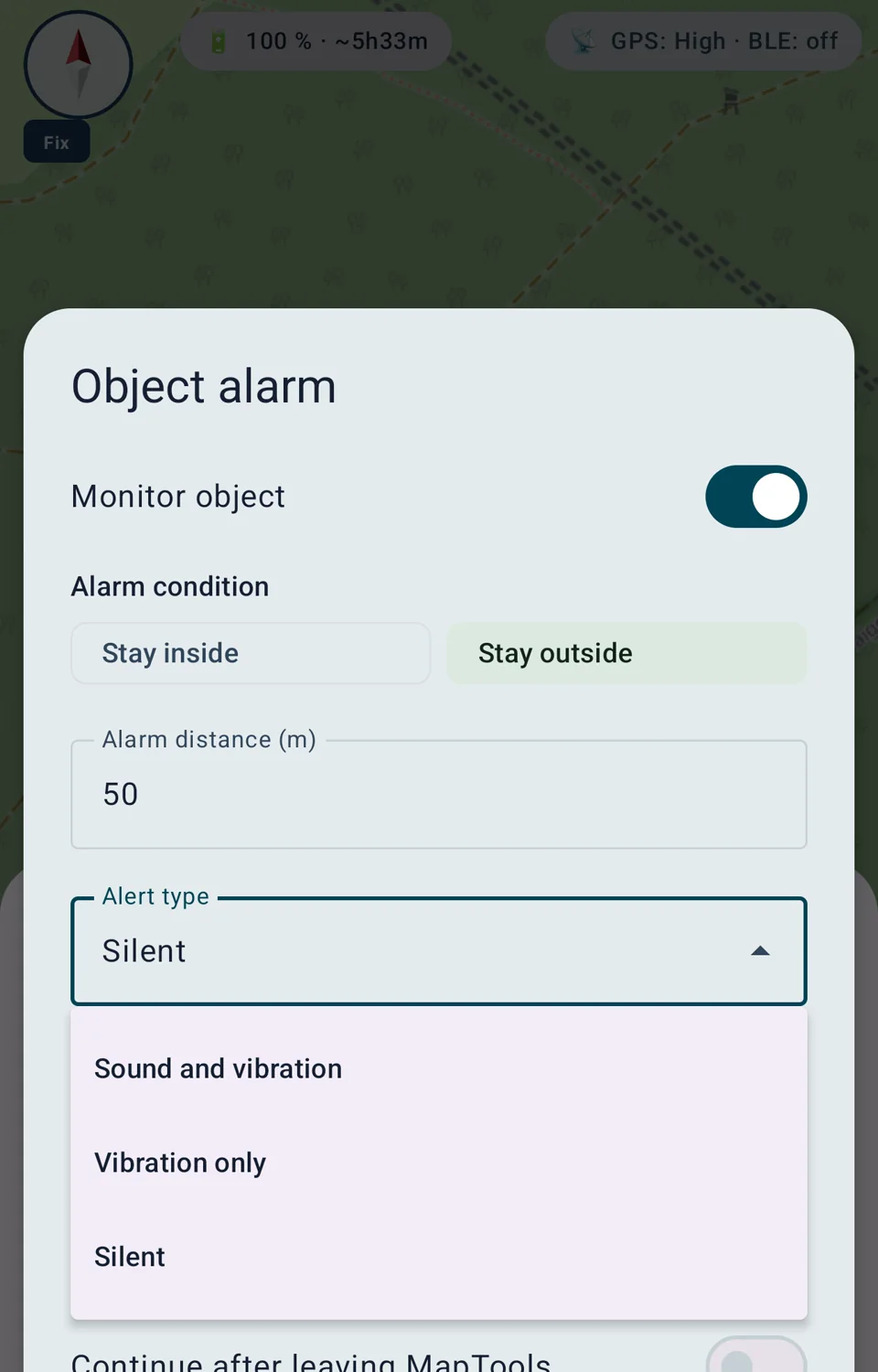
Stay inside
The alarm triggers when the confirmed position leaves the permitted area. This is useful for a designated area or a route corridor.
Area monitoring
Receive an alert when you leave or enter a defined area. MapTools accounts for object type, GPS accuracy and the limits of battery-efficient background monitoring.
Basic principle
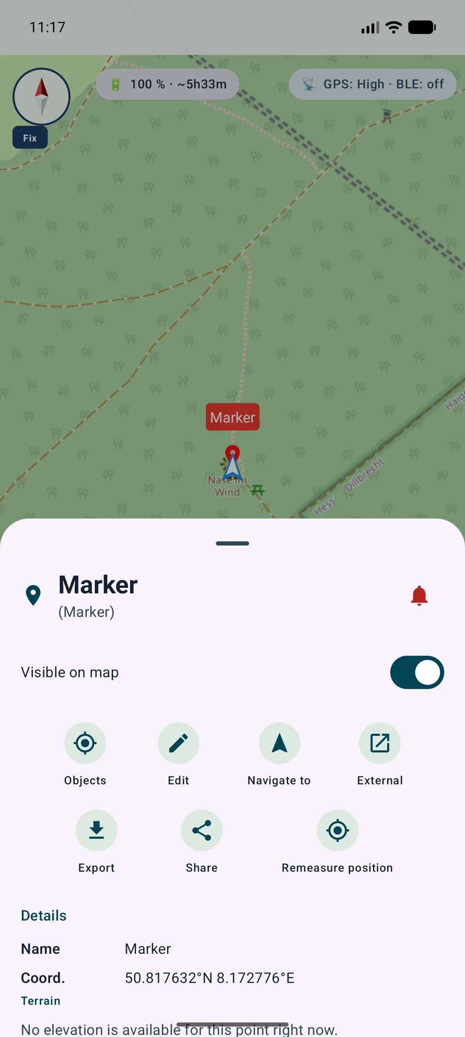
An object alarm links an existing project object to a spatial condition. A red bell indicates that its alarm is active.
The alarm triggers when the confirmed position leaves the permitted area. This is useful for a designated area or a route corridor.
The alarm triggers when the confirmed position enters the defined area. This can be used as an approach or exclusion zone.
Markers, circles, areas and routes can be monitored. Spatial evaluation follows the actual geometry of the object.
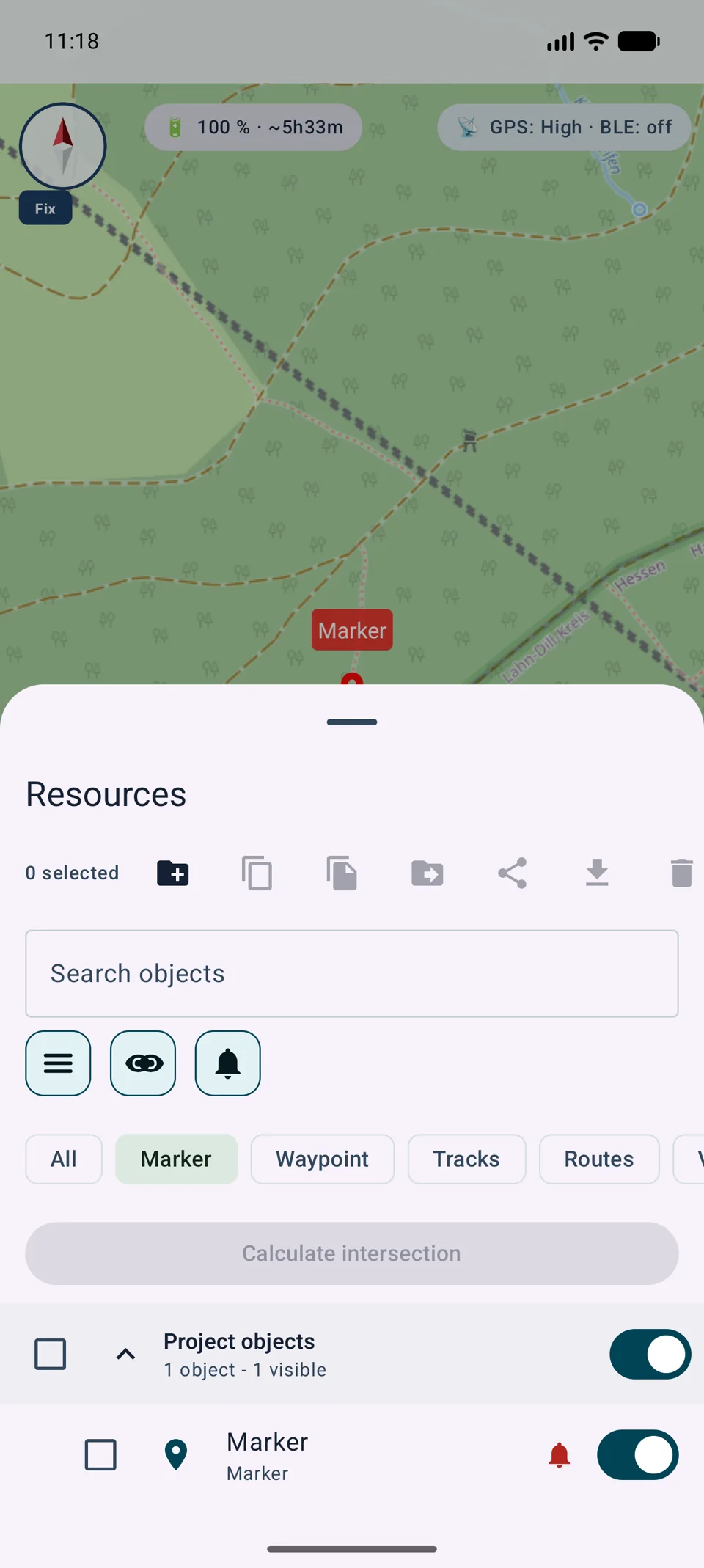
Active alarms use a red bell in the object information sheet, object browser and on the object in Google Maps and VTM.
Operation
Settings live directly on the object. This keeps the monitored geometry clear and makes the alarm easy to change or remove later.
Accuracy
One drifting GPS fix should not cause an unnecessary alarm. MapTools therefore combines geometry, reported accuracy and confirmation over time.
Distance is calculated from the marker position. The selected alarm radius defines the monitored area.
A circle uses its circular geometry; an area uses its polygon boundary and interior.
MapTools uses the nearest point on the complete route geometry. The selected distance forms a corridor along the route.
Fix age, GPS accuracy, several confirming fixes over at least eight seconds and hysteresis reduce false alarms near a drifting boundary.
Background
Full-geometry evaluation runs while the app is visible. Marker and circle alarms can additionally use Android system geofences after explicit background opt-in.
Markers, circles, areas and routes are evaluated through the shared location stream and their complete geometry.
After explicit permission, markers and circles can continue through Android system geofences. Areas and routes remain limited to the visible app.
Enabled system geofences can be registered again after a device restart. After Android Force stop, monitoring resumes only when MapTools is opened again.
System geofences save battery but are not second-accurate. Small radii, poor reception, Doze and manufacturer battery rules may delay an alert.
A smartphone alarm does not replace supervision, barriers, incident command or safety-critical navigation. Allow practical tolerance, particularly for radii below 100 metres.
Notification
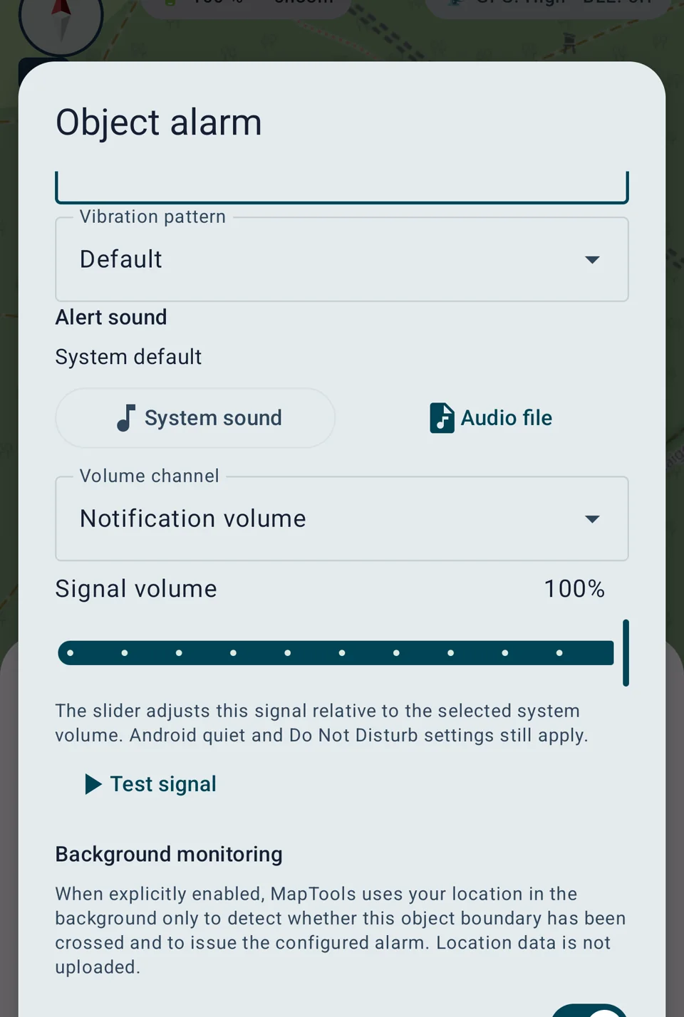
Audible and haptic output can be adapted to the environment and task. MapTools does not silently change the device system volume.
Choose a system tone or readable local audio file, a vibration pattern and relative volume within the appropriate audio channel.
Both choices are available in the compact selector and can be tested before saving.
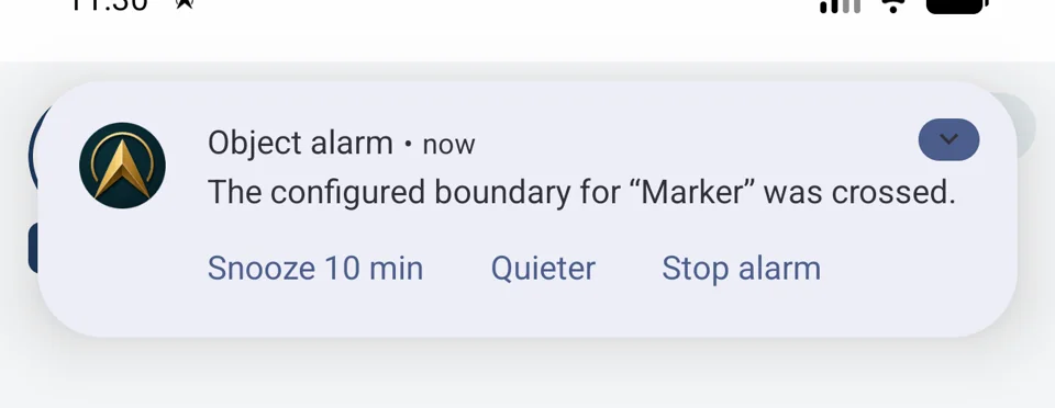
A triggered alarm can be snoozed for ten minutes, changed to quieter signalling or stopped completely.
The bell in the object browser shows only objects with active alarms. Text, category and visibility filters continue to apply as well.
Data and portability
Alarm definitions and device settings are kept separate so that importing or restoring a project cannot unexpectedly start background monitoring.
The alarm definition attached to an object can remain in .asmaps and app backups. Object IDs are remapped safely during project import.
Background opt-in, selected audio URI and snooze state remain local device settings and are not included in portable projects or backups.
MapTools processes location for the enabled alarm and does not send alarm locations to a MapTools-operated server.
Foreground location, notifications and optional background location are explained and requested separately in the actual alarm workflow.
Free can have one active object alarm. Pro supports up to 50 active object alarms. Android and device limitations apply to both editions.
Technical background
MapTools does not run two competing geofencing systems at the same time. The appropriate path takes over according to the app state.
The app evaluates its existing location stream. This supports markers, circles, areas and full route corridors with reported accuracy, hysteresis and time-based confirmation.
For approved markers and circles, MapTools registers a circular system geofence through Google Play services. Android can monitor it efficiently and wake the local receiver after a boundary transition.
The alarm definition remains in MapTools on the device. MapTools does not upload alarm locations to its own server. VTM only renders the map, and Google Maps is not the geofence engine. Optional Google Location Accuracy follows device settings.
System geofences batch location checks and avoid a permanently running MapTools GPS stream. This saves battery but is not second-accurate. Reception, radius, Doze and manufacturer rules can affect timing and accuracy.
After a device restart, MapTools registers approved system geofences again. After Android Force stop, they stay inactive until MapTools is opened. Without Google Play services, only visible-app monitoring is available.
Enable and use
Monitoring is deliberately configured per object. Background access is optional and is explained and requested only in the alarm workflow.
MapTools evaluates markers, circles, areas and route corridors itself, preserving the actual object geometry.
Android monitors only explicitly enabled markers and circles as circular system geofences. Areas and routes are no longer evaluated in this state.
A continuously running MapTools GPS service would consume more battery. Google Play also states that, from 26 August 2026, geofencing is no longer an allowed location foreground-service use case and directs apps to the Geofencing API.
Rules remain on the device and do not require a MapTools server. Android batches location checks to save power, so reception, Doze and manufacturer policies can delay an alert.
Detailed guides
The alert shows the condition, distance or boundary violation and GPS accuracy before you choose the next action.
Show the object on the map, open settings, snooze for 5, 10, 30 or 60 minutes, change the signal, acknowledge the current alert or stop monitoring.
Closing the alert ends only the current signal. Monitoring remains active and can trigger again after the position first returns to the permitted side. Notification shortcuts provide 10-minute snooze, Quieter and Stop.