
Maps and aerial imagery in 3D
Explore terrain using your enabled elevation data, maps and aerial imagery. Switch from an overview to a virtual viewpoint and look at the landscape from any direction.
- Nearby areas progressively receive finer imagery. Visible resolution depends on source data, viewing angle, distance and device.
- Pan, rotate and tilt with gestures. In free exploration, switch the joystick between looking around (View) and moving (Move).
- Enable Sun and Moon in the sky to show the sky at the virtual camera position. It uses the selected shadow time or the current time.
The view requires Vulkan 1.1 and a suitable graphics driver. Google maps are not transferred to this 3D view. Missing imagery may produce a neutral surface; movement is limited outside elevation coverage. Data is not included; access, fees and licences depend on the provider. A virtual view does not replace an on-site assessment.
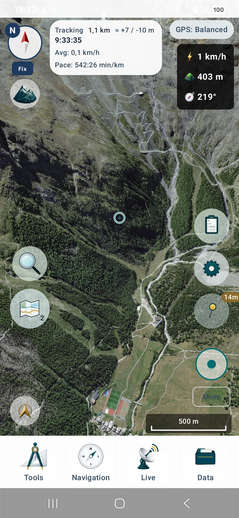
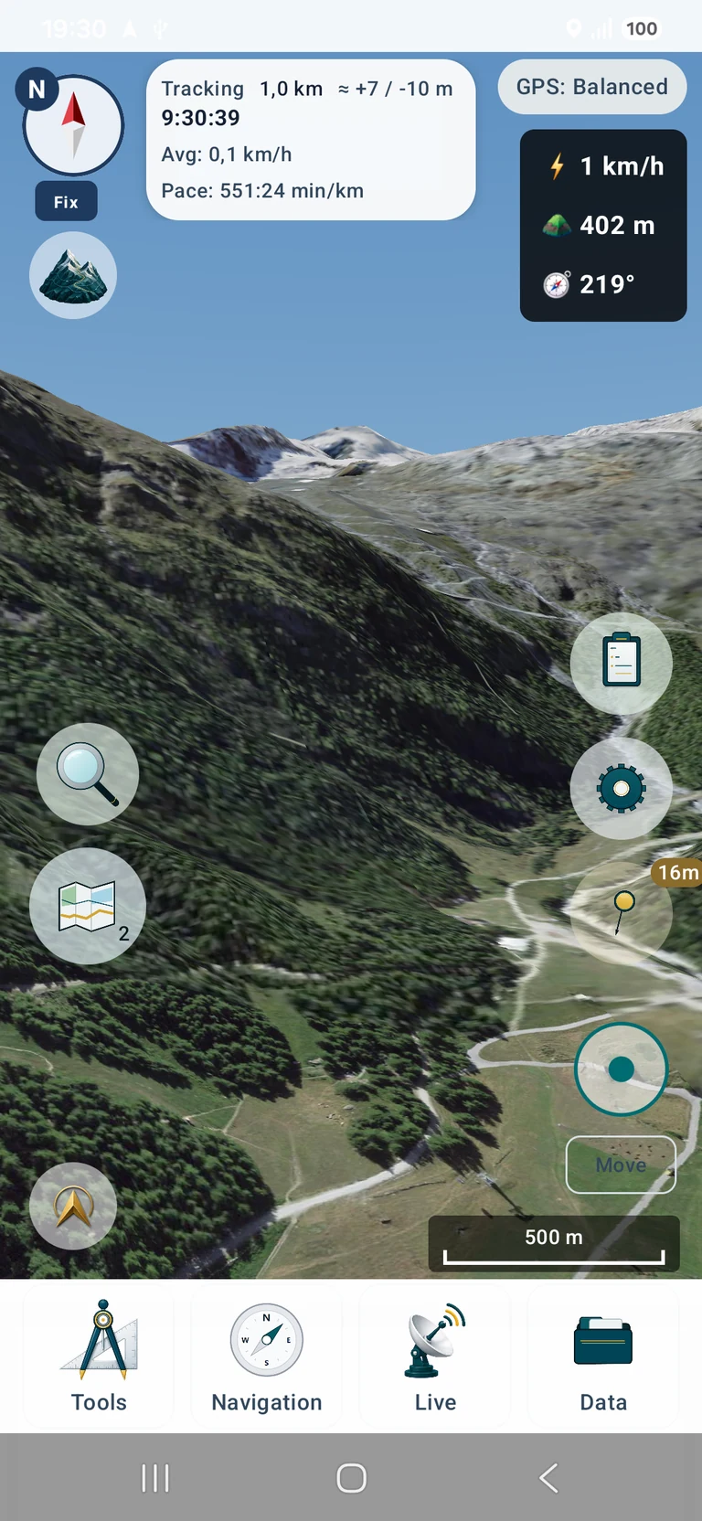
Original app screenshots with an English interface. Tap to open the larger image.
Data shown in the screenshots: SWISSIMAGE © swisstopo · DTM Sonny (CC BY 4.0) · 3D rendering by MapTools