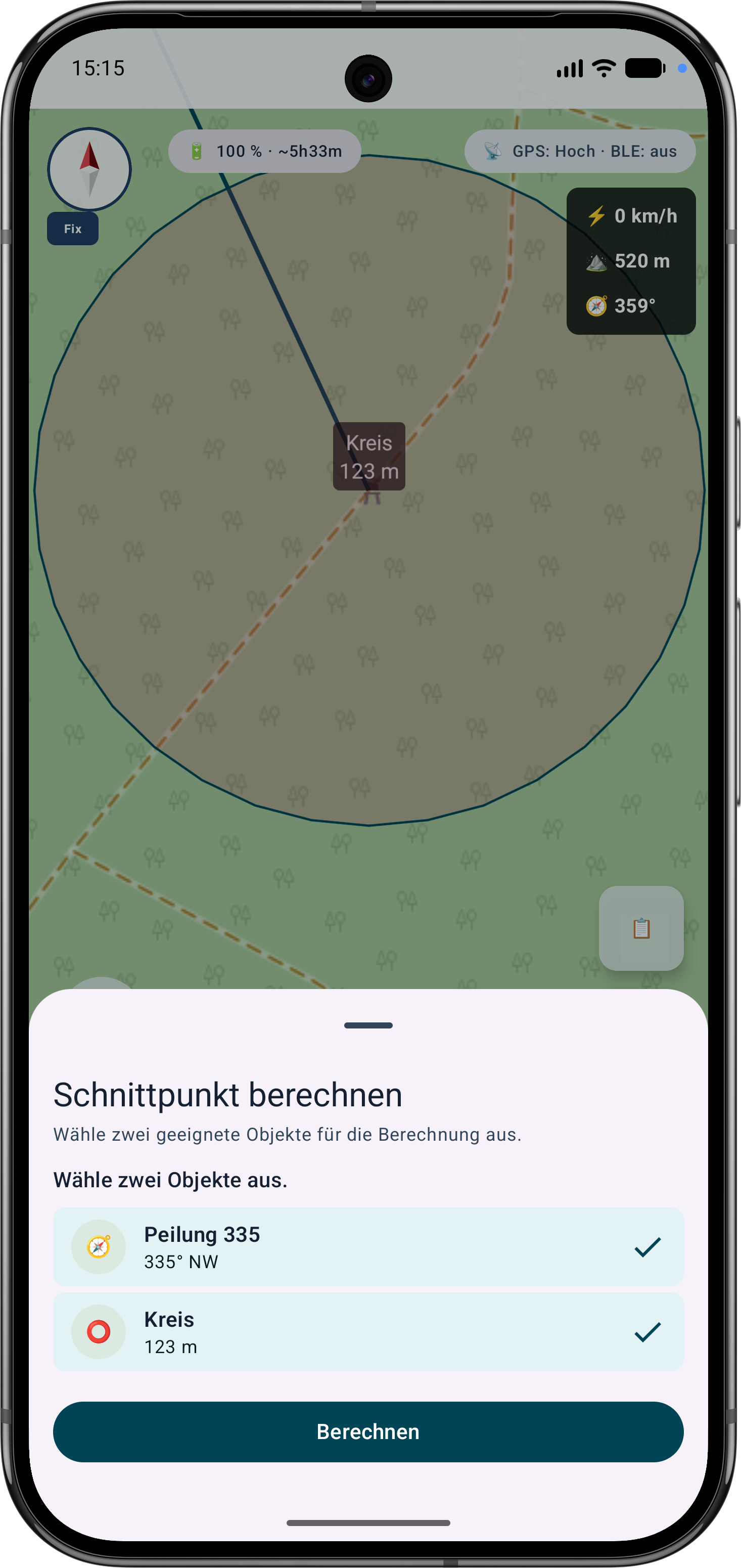
Guided cross bearing for distance work
The app guides the selection of suitable bearings, circles or measurement objects, calculates intersections and can save the result as a marker.
Praxe
Kombinujte pro orientaci azimuty, kruhy, vzdálenosti a značky.
Postup
Podle těchto kroků dokončíte postup přímo v mapě.
New Precision Features
The current tools support more guided measurement and correction workflows so existing objects do not need to be recreated.
The app guides the selection of suitable bearings, circles or measurement objects, calculates intersections and can save the result as a marker.
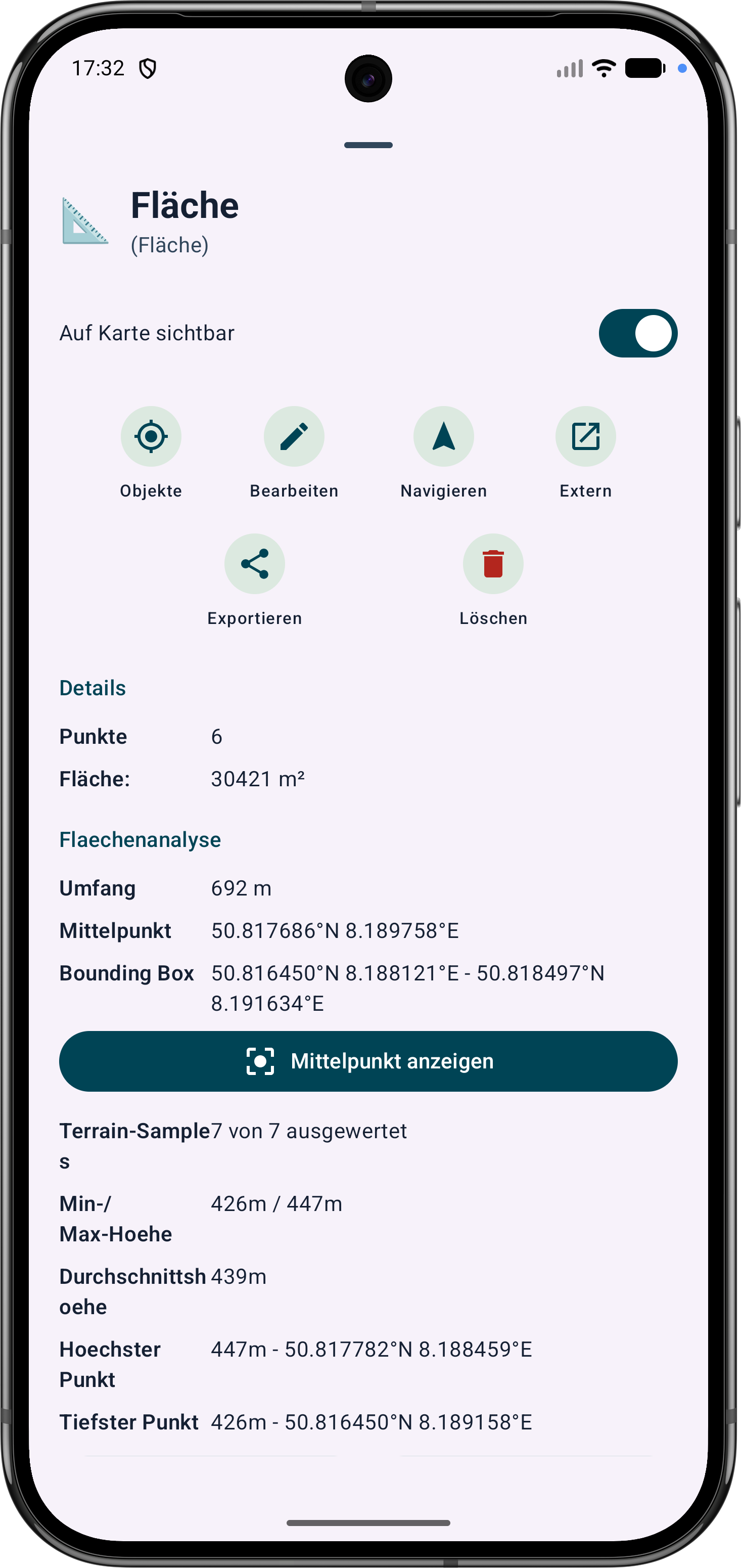
Polygon areas can be refined through their vertices. Side lengths, interior angles and distances help correct boundaries in the field.
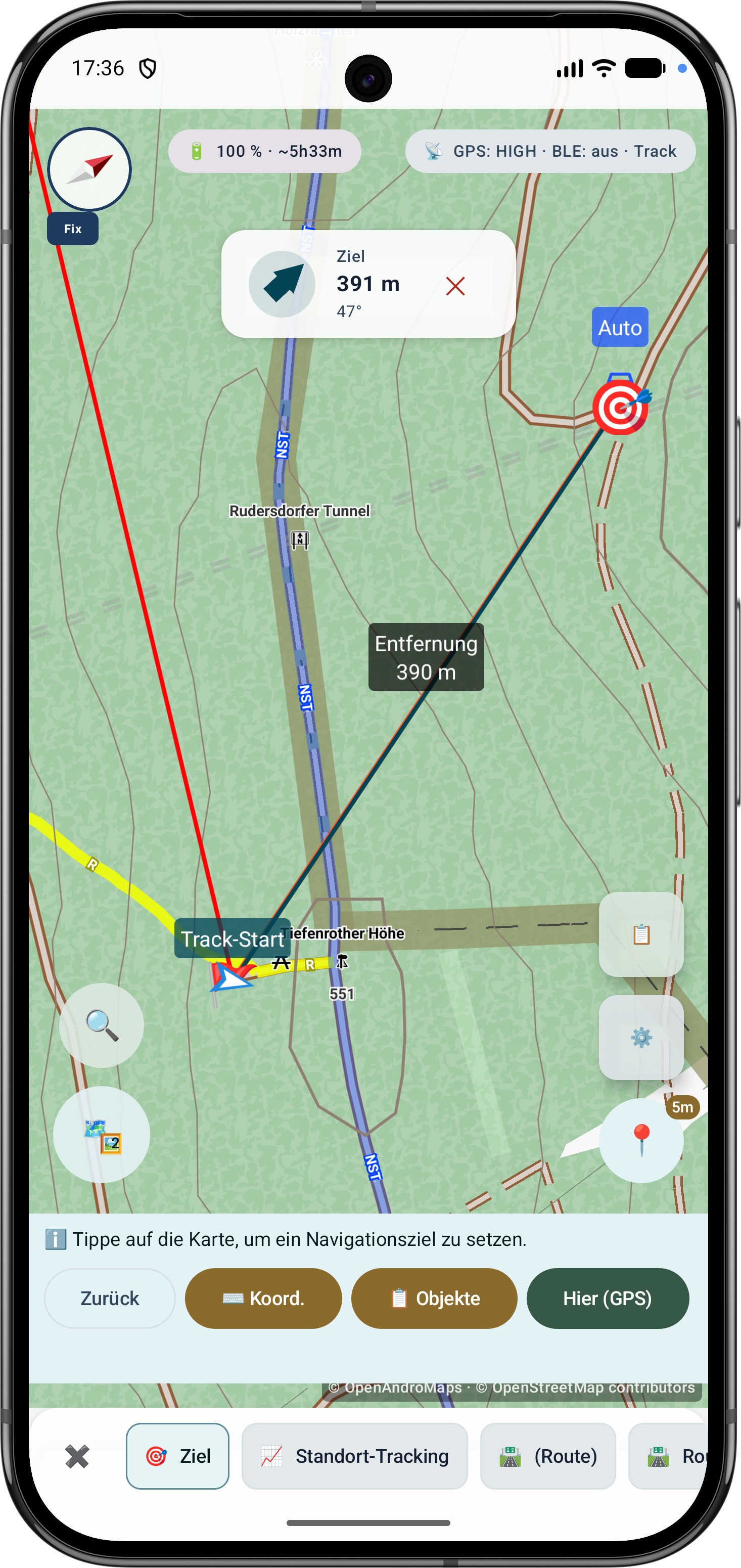
Route points and segments can be adjusted later. Bearing, distances and direction angles remain visible and understandable on the map.