מפות ושכבות
- מפות מקוונות ולא מקוונות
- Mapsforge, MBTiles ו-GeoPackage
- שכבות רסטר מ-GeoTIFF, KML או KMZ
- נראות שכבות ופרופילי מפה
תכונות
מפות, נתונים לא מקוונים, שטח, פרויקטים, ניווט וכלים חיים באפליקציית Android אחת.
סקירה
השתמש בכלי הליבה לעבודת מפות, נתונים גאוגרפיים, התמצאות ותיעוד שטח.
פרטים
ראה למה כל כלי מועיל ואילו נתונים או תכונות מכשיר הוא עשוי לדרוש.
| תכונה | מטרה | הקשר |
|---|---|---|
| טווח ראייה | מחשב אזורים נראים מנקודה בעזרת נתוני גובה זמינים. | דורש נתוני שטח מתאימים; התוצאה תלויה ברזולוציה ובכיסוי. |
| הצללה וקווי גובה | מקל על קריאת צורות השטח ומשלים פרופילי גובה וגבהי נקודות. | השתמש ב-HGT, DEM GeoTIFF, ASC או DTED. |
| ייבוא חכם | משייך קבצים ליעדים מתאימים: פרויקט, מפה, שטח, שכבת רסטר, שכבה, POI, מסלול או עקבה. | במכלים כגון ZIP או GeoPackage, התוכן הוא שקובע. |
| פרטי נקודה | נקודות מפה יכולות לספק הקשר לכבישים, POI, שטח, קואורדינטות ושכבות מיובאות. | רמת הפירוט תלויה במפה, בתגיות ובנתונים המיובאים. |
| Remote ID | קולט אותות Remote ID המשודרים לציבור ויכול לייצא היסטוריות. | הקליטה תלויה באזור, במכשיר, בסביבת הרדיו ובהרשאות. |
| קבוצות BLE | מיקומי קבוצות מקומיים ומצב בקרבת מקום ללא שרת בבעלות האפליקציה. | דורש הרשאות Bluetooth/Nearby מתאימות. |
| גיבוי ושחזור | שומר תוכן אפליקציה נבחר כקובץ .asmaps.bak ומשחזר אותו באופן מכוון. | גיבויים יכולים לכלול פרויקטים, הגדרות, פרופילים, POI, קבוצות ונתונים מקומיים; הצפנה אופציונלית זמינה. |
| AR/LiveView | מציג יעדים, אזימוטים, POI, פסגות, עקבות או רשתות חיפוש בתצוגת המצלמה. | איכות החיישנים ותאימות המכשיר מכריעות. |
GeoPackage
GeoPackage מיועד עדיין למפות, מכלי אריחים ושכבות ישויות. עבור תכונות שטח השתמש ב-HGT, DEM GeoTIFF, ASC או DTED.
New Precision Features
The current tools support more guided measurement and correction workflows so existing objects do not need to be recreated.
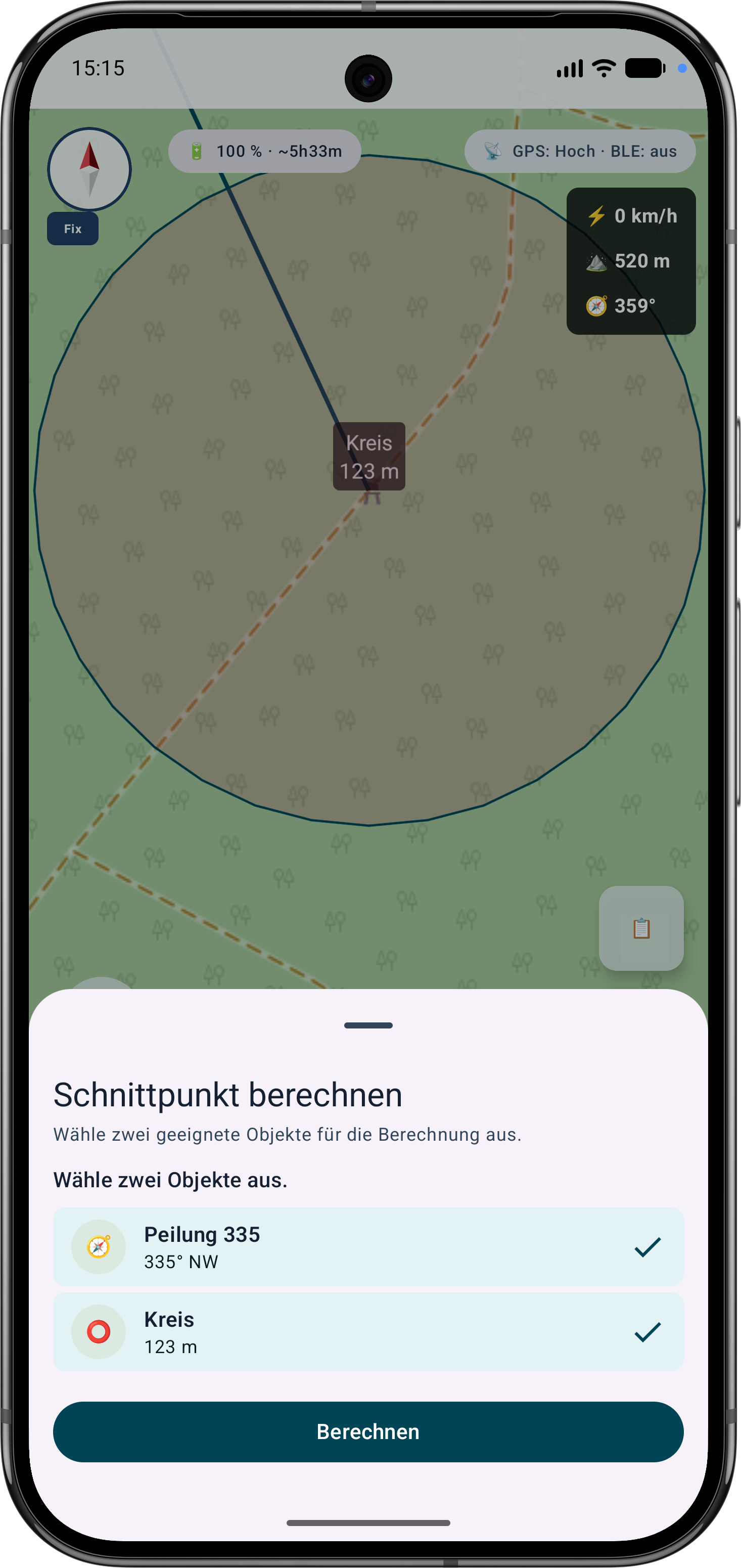
The app guides the selection of suitable bearings, circles or measurement objects, calculates intersections and can save the result as a marker.
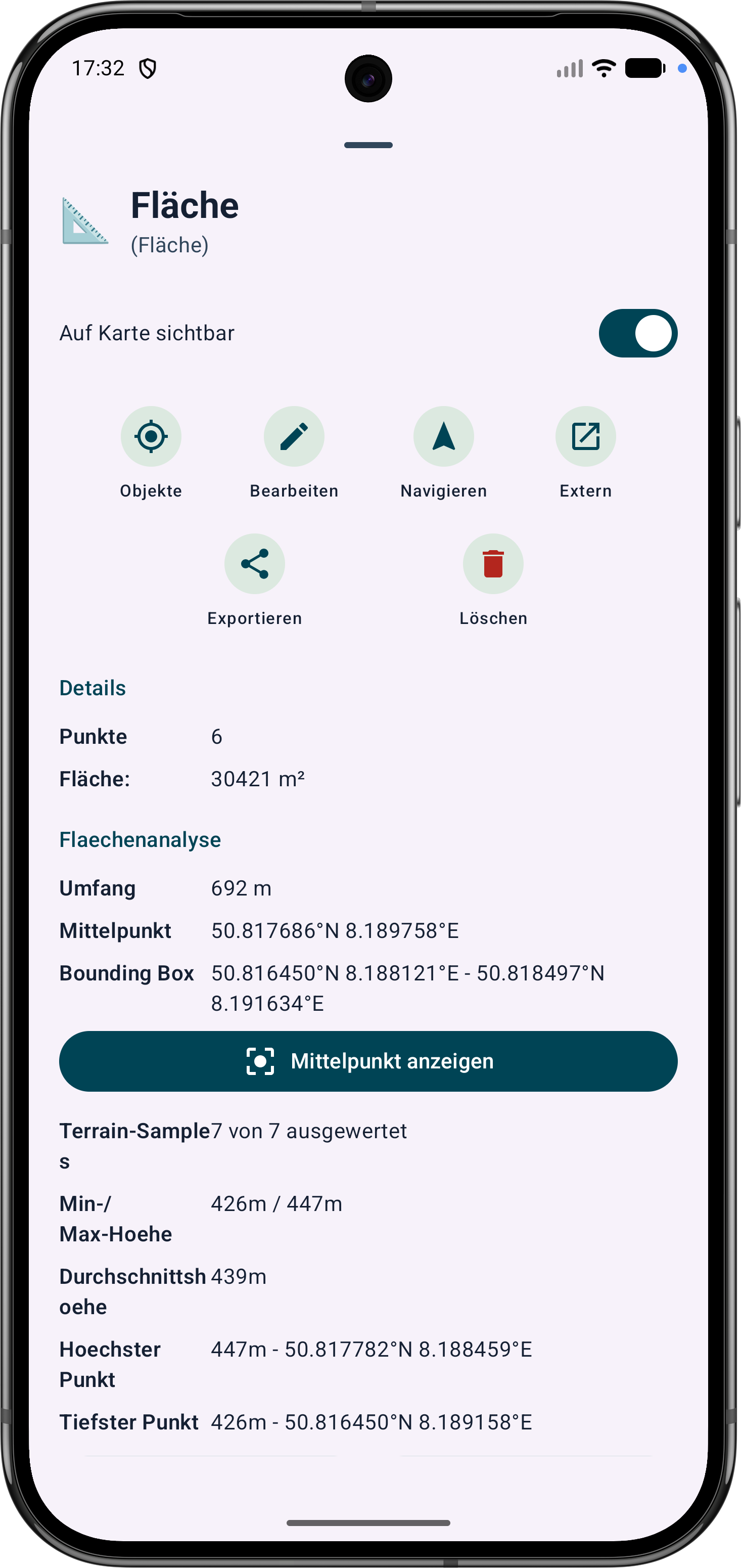
Polygon areas can be refined through their vertices. Side lengths, interior angles and distances help correct boundaries in the field.
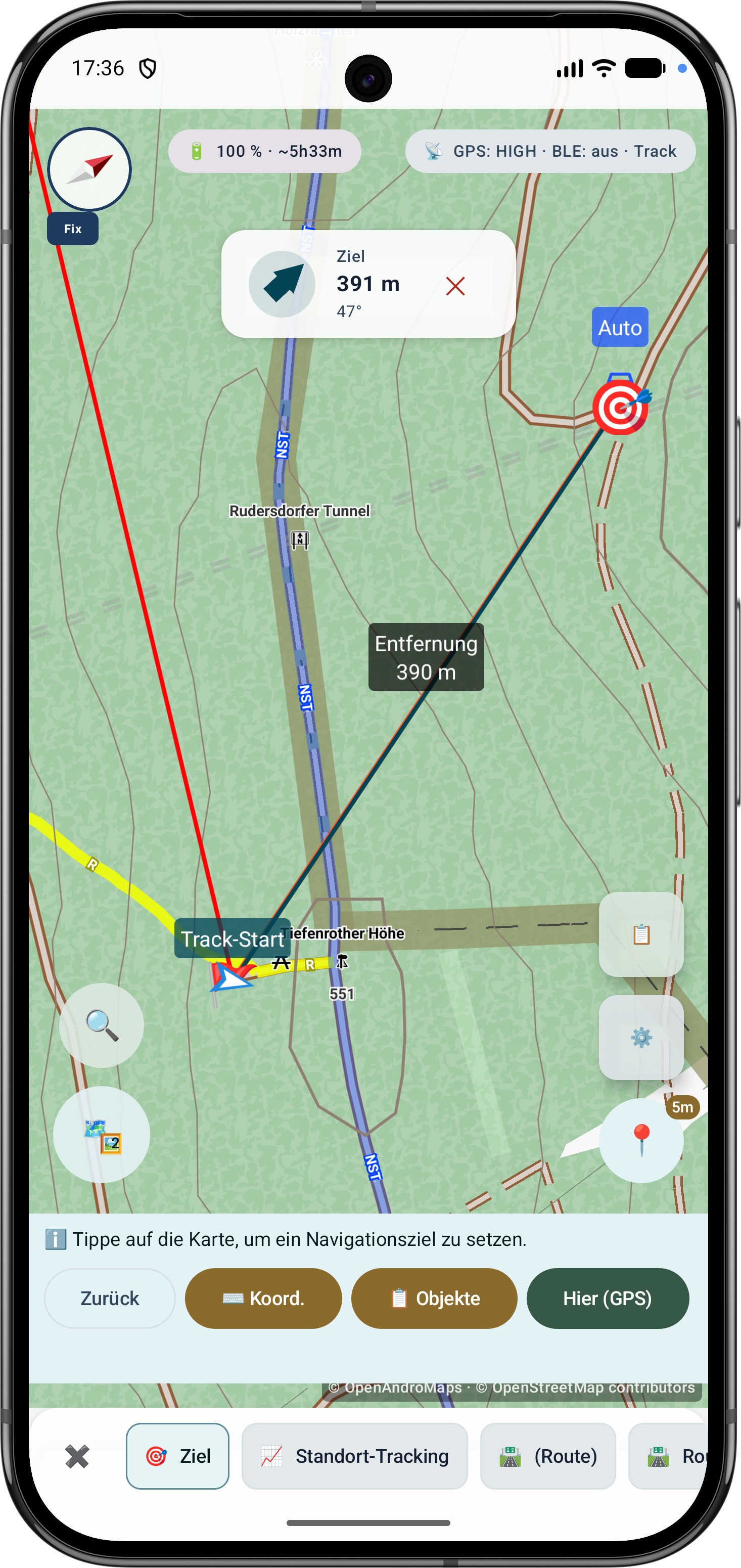
Route points and segments can be adjusted later. Bearing, distances and direction angles remain visible and understandable on the map.
Current Scope
These capabilities are especially relevant in the current app version and are grouped here.
Bearings, circles and measurement objects can be combined in a guided flow to determine intersections and distances.
Polygon areas can be refined later through their vertices while side lengths, interior angles and distances stay visible.
Route points and segments can be adjusted later with bearing, distances and direction angles.
Sensor status, true/magnetic north, tilt mode and correction for map, LiveView and AR are grouped in a dedicated view.
Drone reception shows BLE, Wi-Fi NAN, Wi-Fi Beacon, operator/system data, diagnostics and optional export where device and signal source support it.